Arizona Attractions
Every attraction in the database, ranked. 48 of 724 carry an official visitor count; the rest are ranked on public interest and significance, and say so.
724 attractions


#2 · National Recreation Area
Glen Canyon National Recreation Area
4,725,610 recreation visits in 2024 across the wider recreation area.Score 79.2 · medium confidence
#3 · Landmark
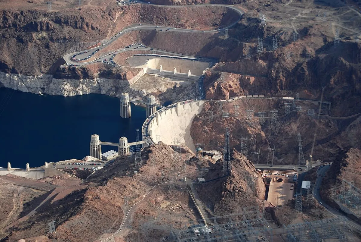
Hoover Dam
Straddling the Colorado River between Nevada and Arizona, this was the world's largest dam when completed in 1935, and instrumental in generating power and providing irrigation via Lake Mead, which was created behind the dam.Score 78.2 · medium confidence
#4 · Natural Landmark
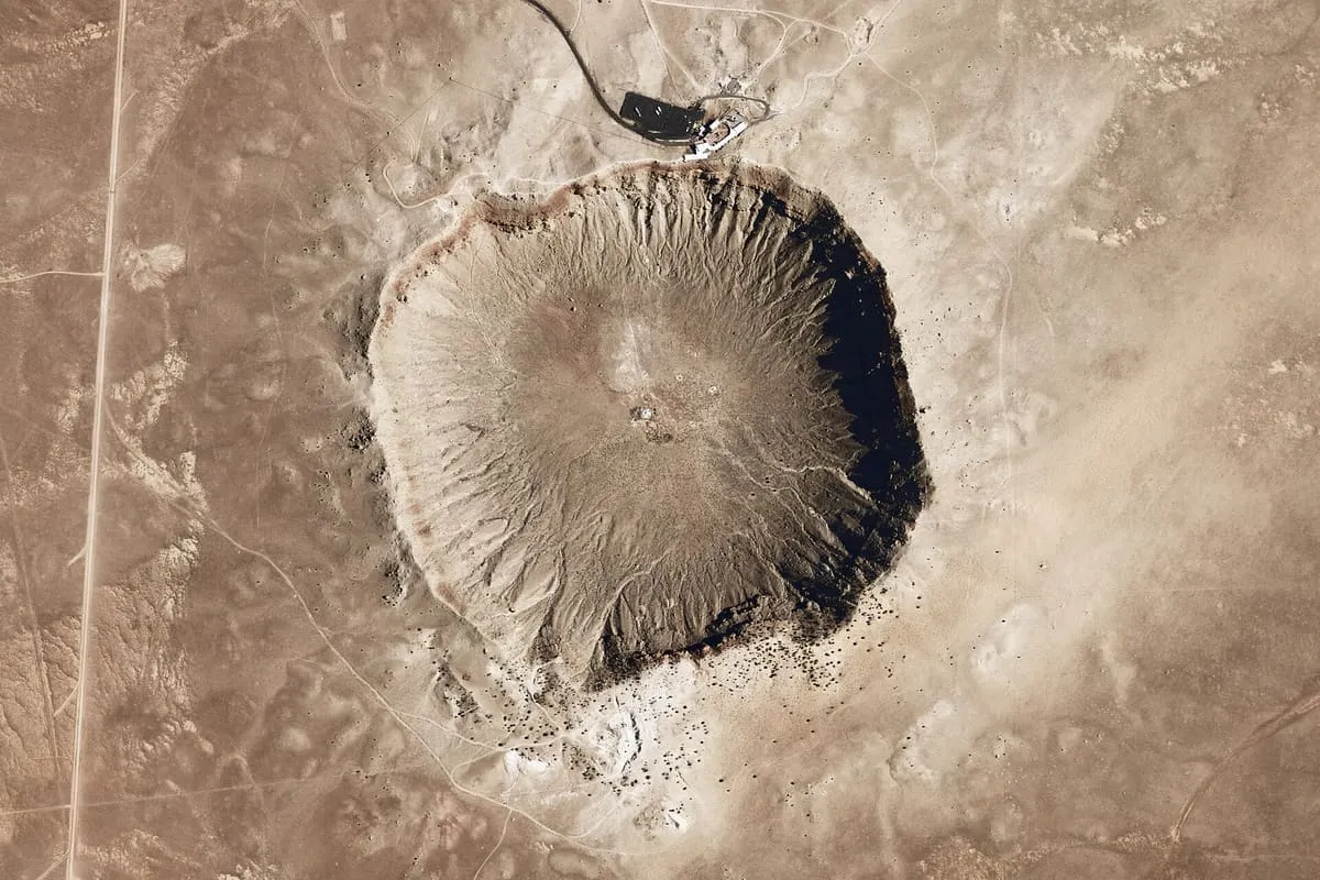
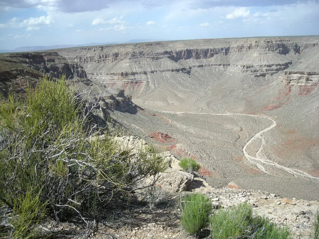
Meteor Crater
A bowl nearly a mile across left by an iron meteorite roughly 50,000 years ago, and the first crater on Earth proven to be of impact origin. Privately owned.Score 76.1 · medium confidence
#5 · National Park
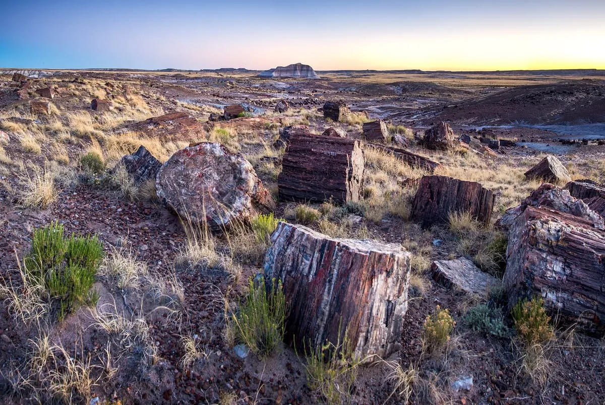
Petrified Forest National Park
559,254 recreation visits in 2024.Score 75.8 · high confidence
#6 · National Park
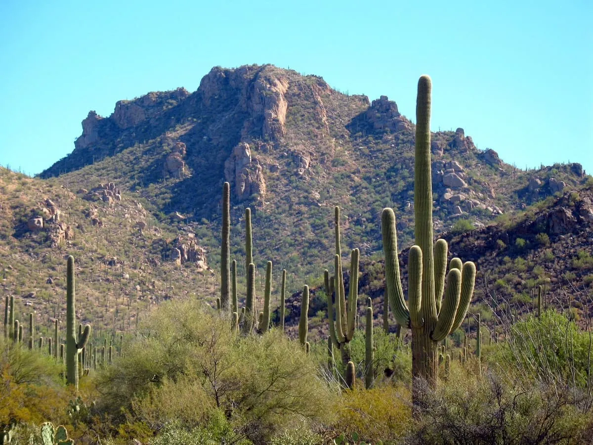
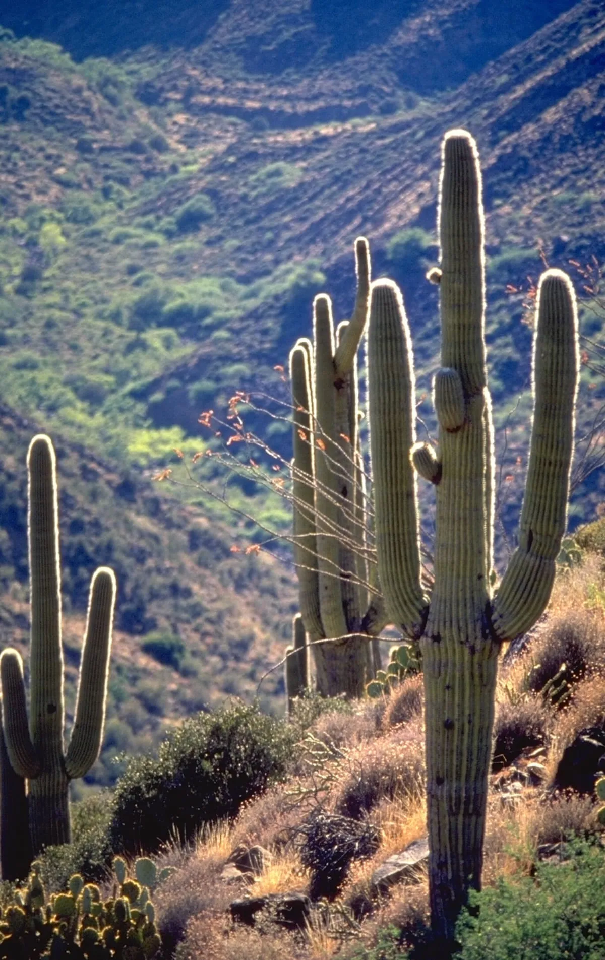
Saguaro National Park
946,369 recreation visits in 2024.Score 75.5 · high confidence
#7 · Historic Site
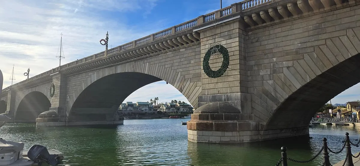
London Bridge
The 1831 London bridge, bought in 1968, dismantled and shipped block by block from England to be rebuilt in Arizona, where it now carries traffic over a channel of the Colorado River.Score 73.3 · medium confidence
#8 · Natural Landmark
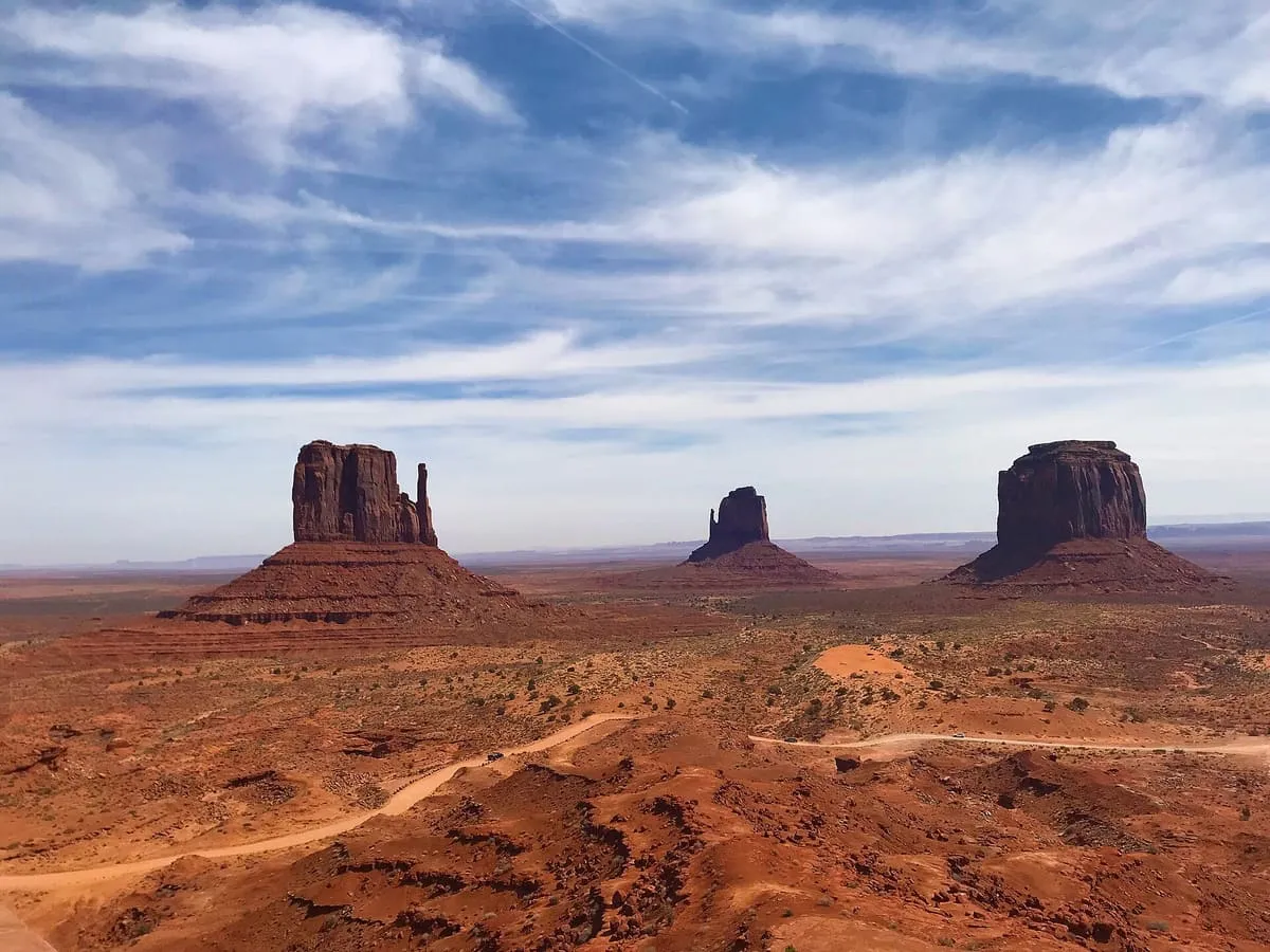
Monument Valley
Sandstone buttes rising up to 1,000 feet from the valley floor, within a Navajo Tribal Park on the Arizona-Utah line, familiar from decades of Western films.Score 72.0 · medium confidence
#9 · Natural Landmark
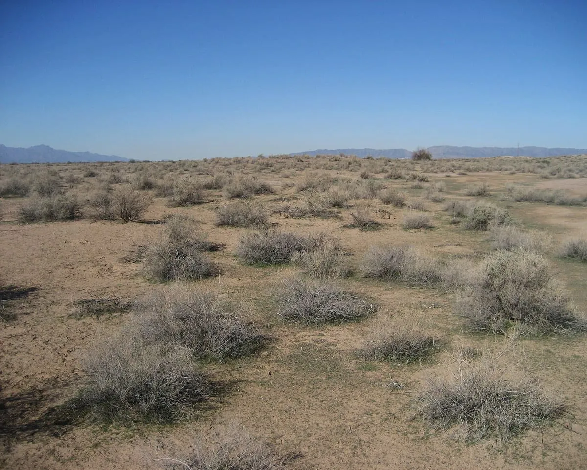
Sonoran Desert
The Sonoran Desert (Spanish: Desierto de Sonora) is a hot desert and ecoregion in North America that covers parts of the northwestern Mexican states of Sonora, Baja California, and Baja California Sur, as well as part of the Southwestern United States (in Arizona and California). It has an area of 260,000 square kilometers (100,000 sq mi). In phytogeography, the Sonoran Desert is within the Sonoran floristic province of the Madrean region of southwestern North America, part of the Holarctic realm of the northern Western Hemisphere.Score 72.0 · medium confidence
#10 · Canyon
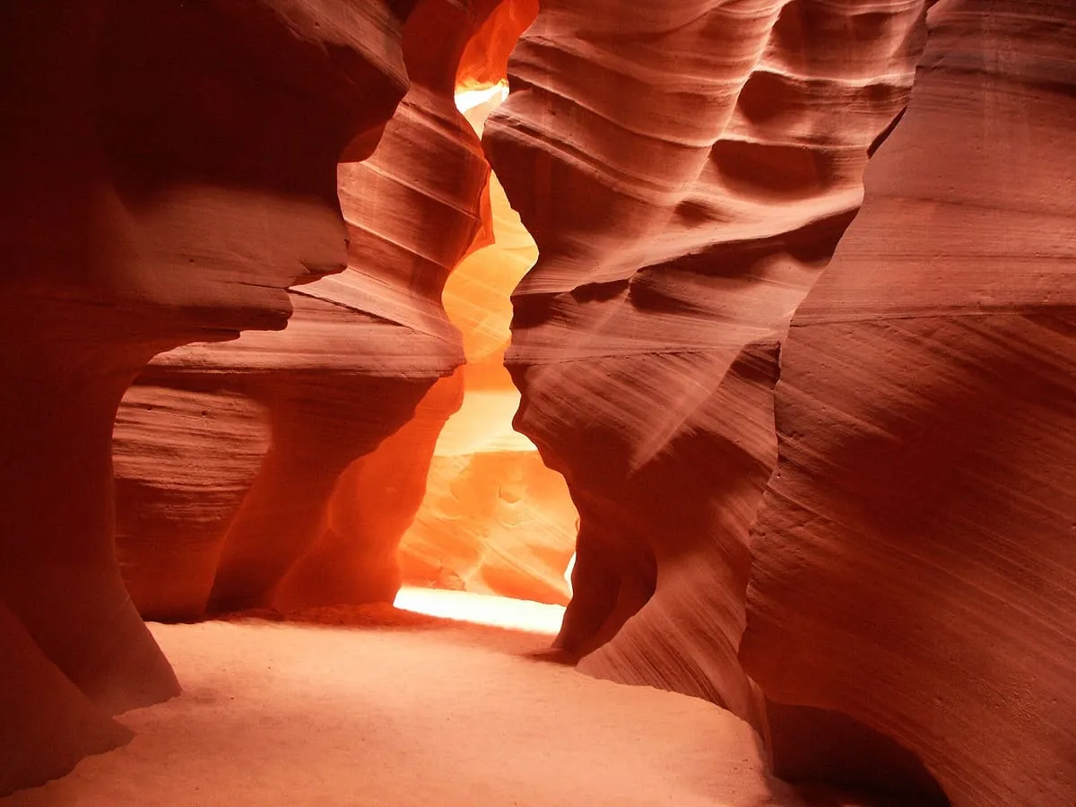
Antelope Canyon
A pair of slot canyons on Navajo Nation land, carved by flash flooding into corridors of banded sandstone. Access is only with an authorised Navajo guide.Score 70.7 · medium confidence
#11 · Historic Site
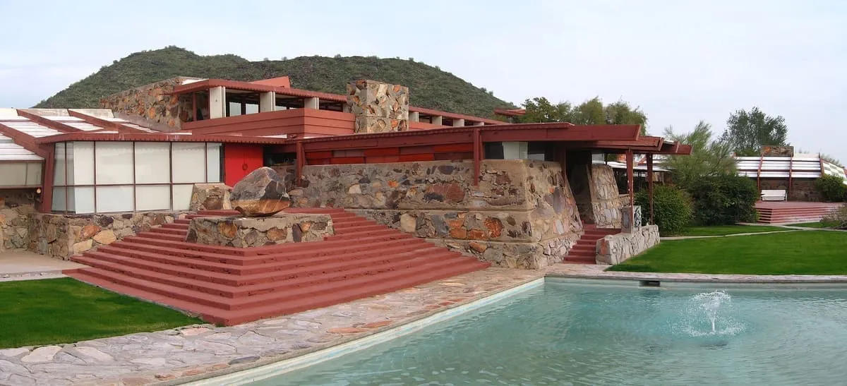
Taliesin West
Frank Lloyd Wright's winter home and studio, built from 1937 out of local desert rock and still the home of his architecture school and foundation.Score 69.7 · medium confidence
#12 · Natural Landmark
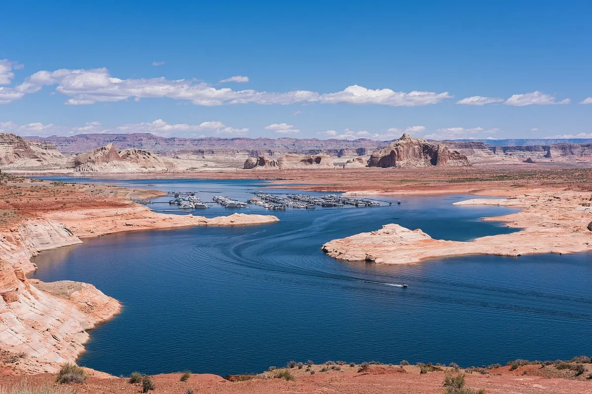
Lake Powell
Lake Powell is a reservoir on the Colorado River in Utah and Arizona, United States. It is a major vacation destination visited by approximately two million people every year. It holds 24,322,000 acre-feet (3.0001×10¹⁰ m3) of water when full, second in the United States to only the downstream reservoir of Lake Mead – though Lake Mead has fallen below Lake Powell in size several times during the 21st century in terms of volume of water, depth and surface area.Score 68.3 · medium confidence
#13 · Historic Site
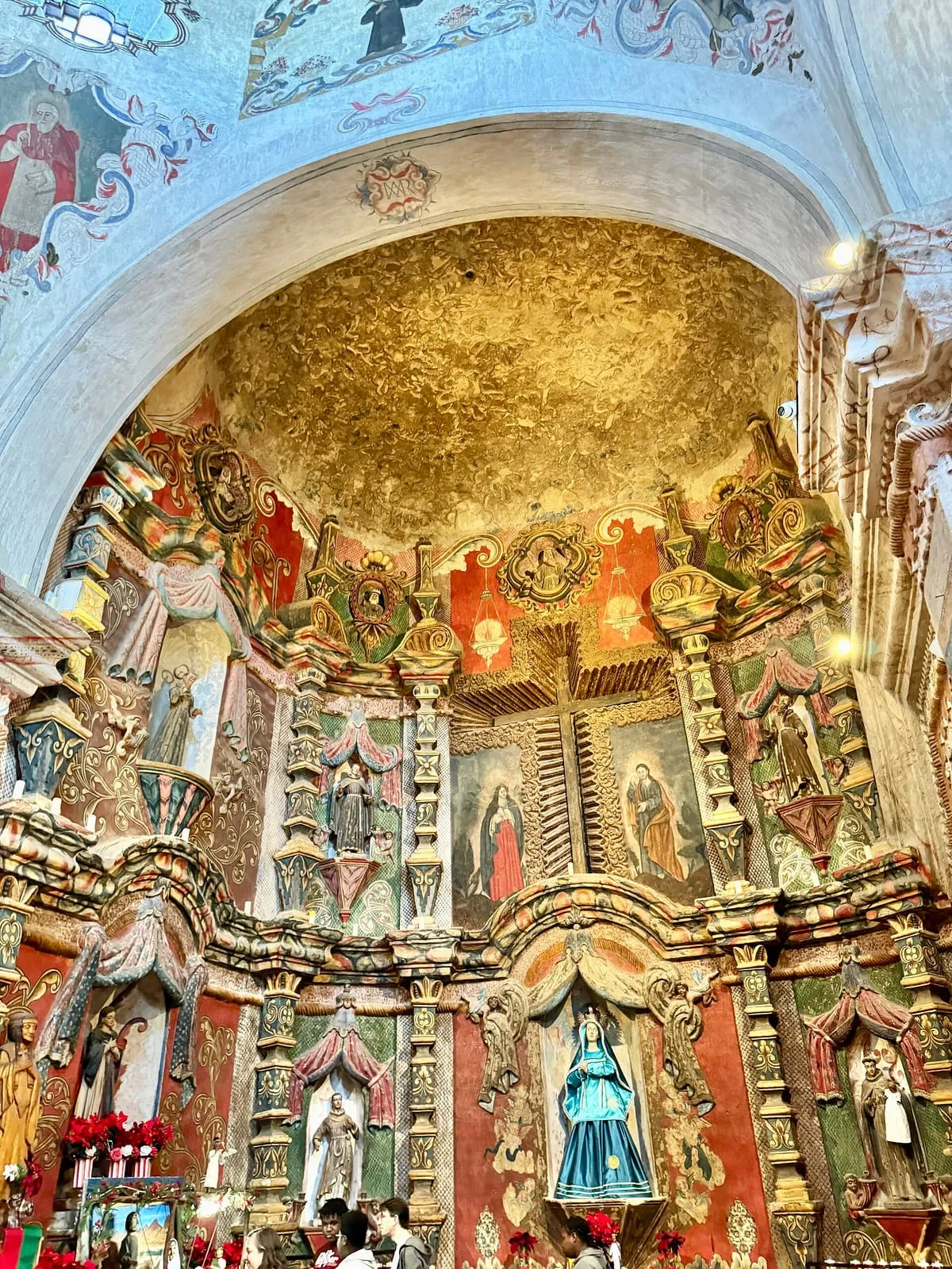
Mission San Xavier del Bac
A Spanish colonial mission completed in 1797 on the Tohono O'odham Nation, widely considered the finest Spanish colonial architecture in the United States and still an active parish church.Score 67.5 · medium confidence
#14 · National Monument
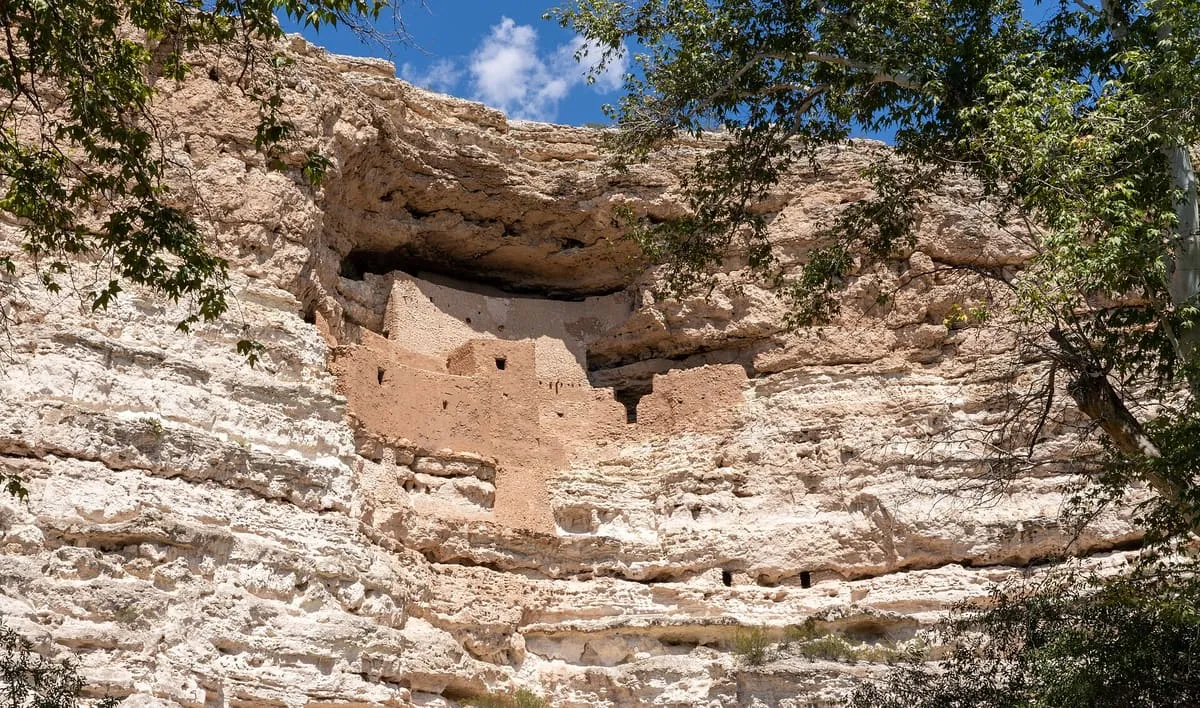
Montezuma Castle National Monument
379,967 recreation visits in 2024.Score 66.6 · high confidence
#15 · National Monument
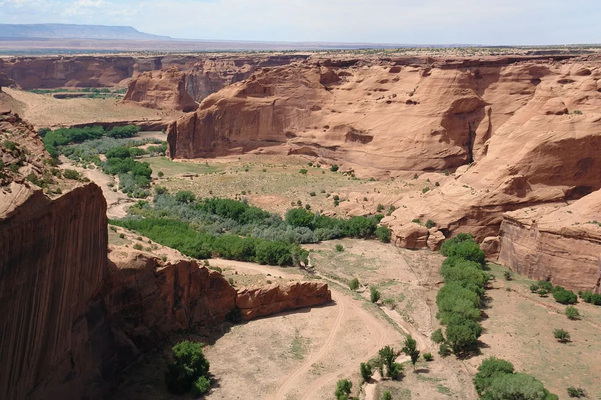
Canyon de Chelly National Monument
387,433 recreation visits in 2024.Score 66.2 · high confidence
#16 · Landmark
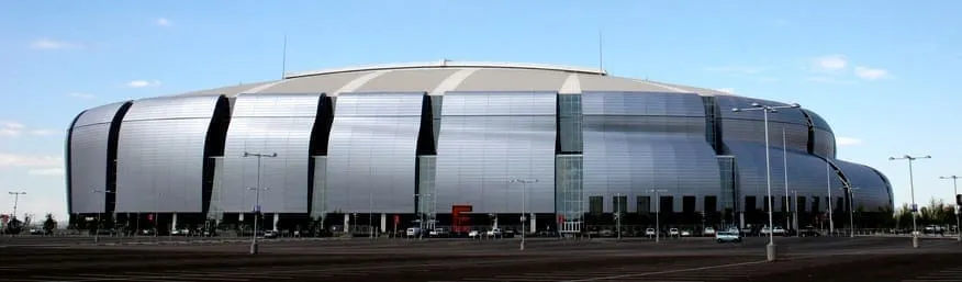
State Farm Stadium
State Farm Stadium is a retractable roof stadium in Glendale, Arizona, U.S., a suburb west of Phoenix. It is the home of the Arizona Cardinals of the National Football League (NFL) and the annual Fiesta Bowl. Opened in 2006, the venue replaced Sun Devil Stadium in Tempe as the home of the Cardinals, and is adjacent to Desert Diamond Arena, former home of the Arizona Coyotes of the National Hockey League.Score 65.0 · medium confidence
#17 · Natural Landmark
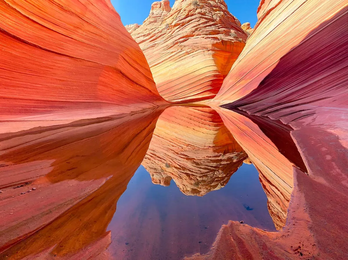
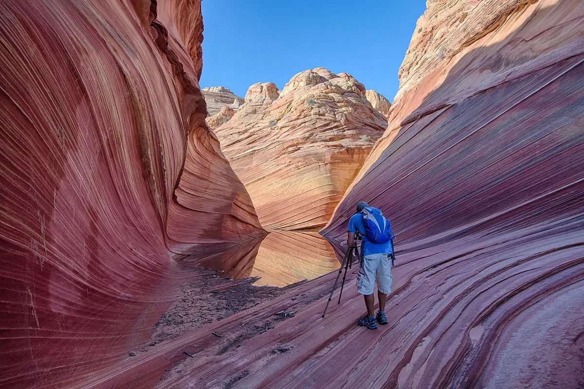
The Wave
The Wave is a sandstone rock formation located in Arizona, US, near its northern border with Utah. The formation is situated on the slopes of the Coyote Buttes in the Paria Canyon-Vermilion Cliffs Wilderness of the Colorado Plateau. The area is administered by the Bureau of Land Management (BLM) at the Grand Staircase–Escalante National Monument visitor center in Kanab, Utah.Score 64.9 · medium confidence
#18 · National Monument
Vermilion Cliffs National Monument
The famous "wave" is here. Only twenty people per day are permitted to visit: ten by online application months in advance, and ten by lottery at the Grand Staircase-Escalante Visitor Center here in Kanab. If you can't get the permit, don't worry, the national monument includes other beautiful scenery too.Score 64.9 · medium confidence
#19 · Waterfall
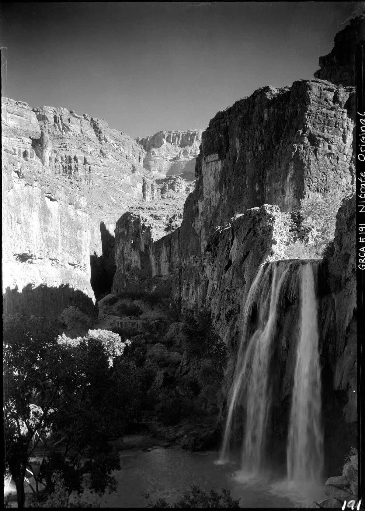
Havasu Falls
Blue-green travertine falls on the Havasupai Reservation, reached only by a ten-mile hike, helicopter or horseback. Visiting requires a reservation obtained well in advance.Score 64.8 · medium confidence
#20 · Natural Landmark
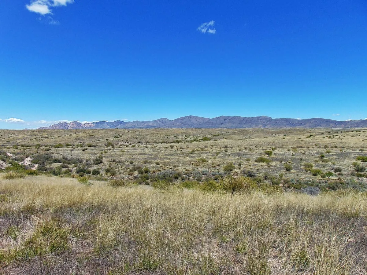
San Pedro Valley
The San Pedro Valley starts 10 miles (16 km) south of the United States–Mexico border and extends 140 miles (230 km) north through Arizona. The San Pedro River flows from the state of Sonora, Mexico, through Cochise, Pima, Graham, and Pinal Counties to Winkelman, Arizona.Score 64.2 · medium confidence
#21 · Natural Landmark
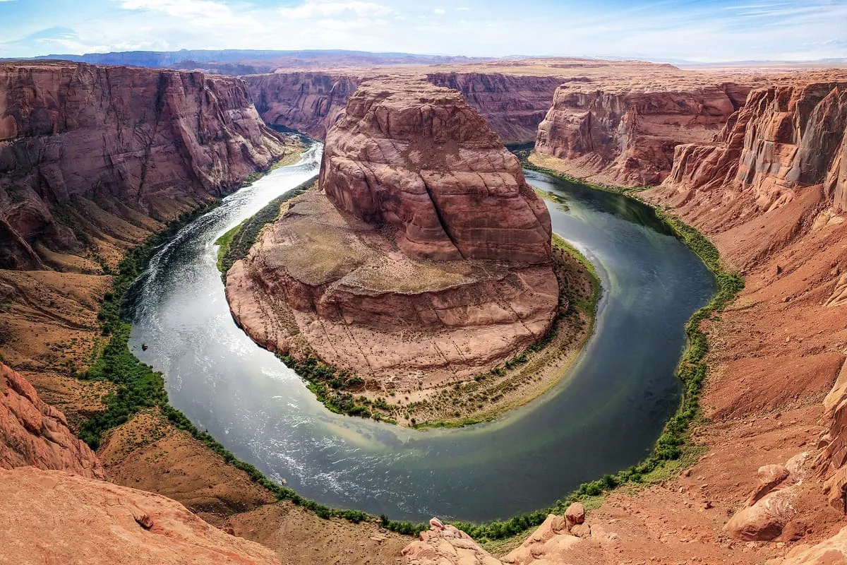
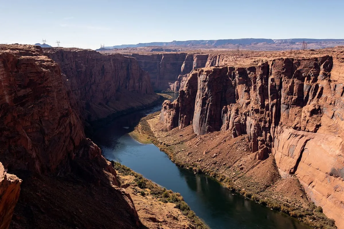
Horseshoe Bend
A meander of the Colorado River enclosing a sandstone butte, seen from an unfenced rim 1,000 feet above the water, a mile and a half round trip from the car park.Score 64.1 · medium confidence
#22 · Natural Landmark
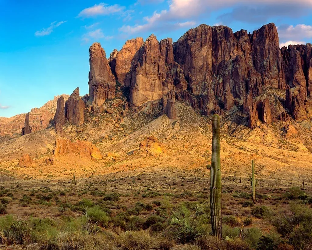
Superstition Mountains
The Superstition Mountains (Yavapai: Wi:kchsawa) is a range of mountains in Arizona located to the east of the Phoenix metropolitan area. They are anchored by Superstition Mountain, a large mountain that is a popular recreation destination for residents of the Phoenix, Arizona, area. They are roughly bounded by U.S.Score 63.6 · medium confidence
#23 · Historic Site
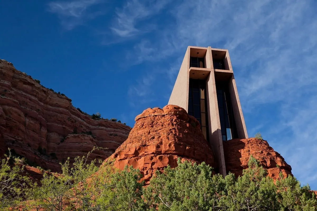
Chapel of the Holy Cross
This unique chapel built into the rock offers great views.Score 63.4 · medium confidence
#24 · Landmark
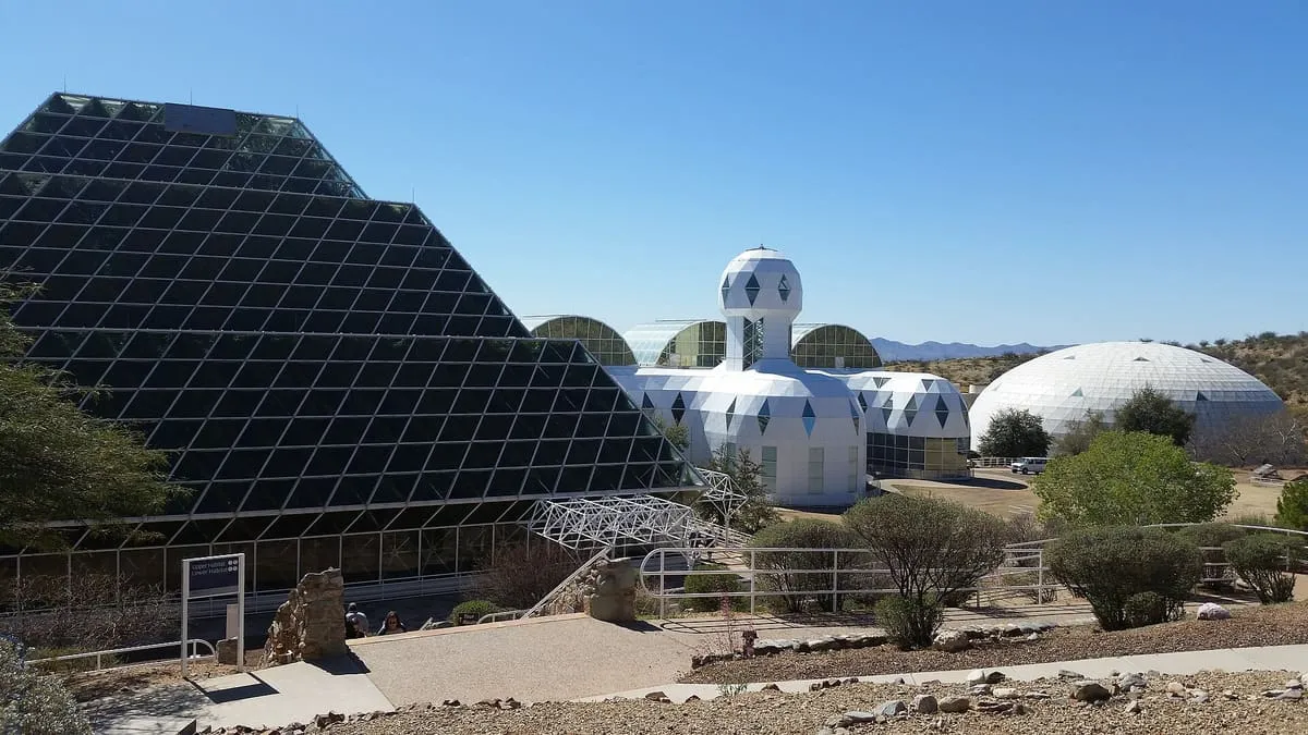
Biosphere 2
This unique facility was designed as an artificially closed complete ecology, and was the setting for research on human interaction with natural systems. The site is now owned and maintained by the University of Arizona, which conducts tours for the public.Score 63.2 · medium confidence
#25 · Natural Landmark
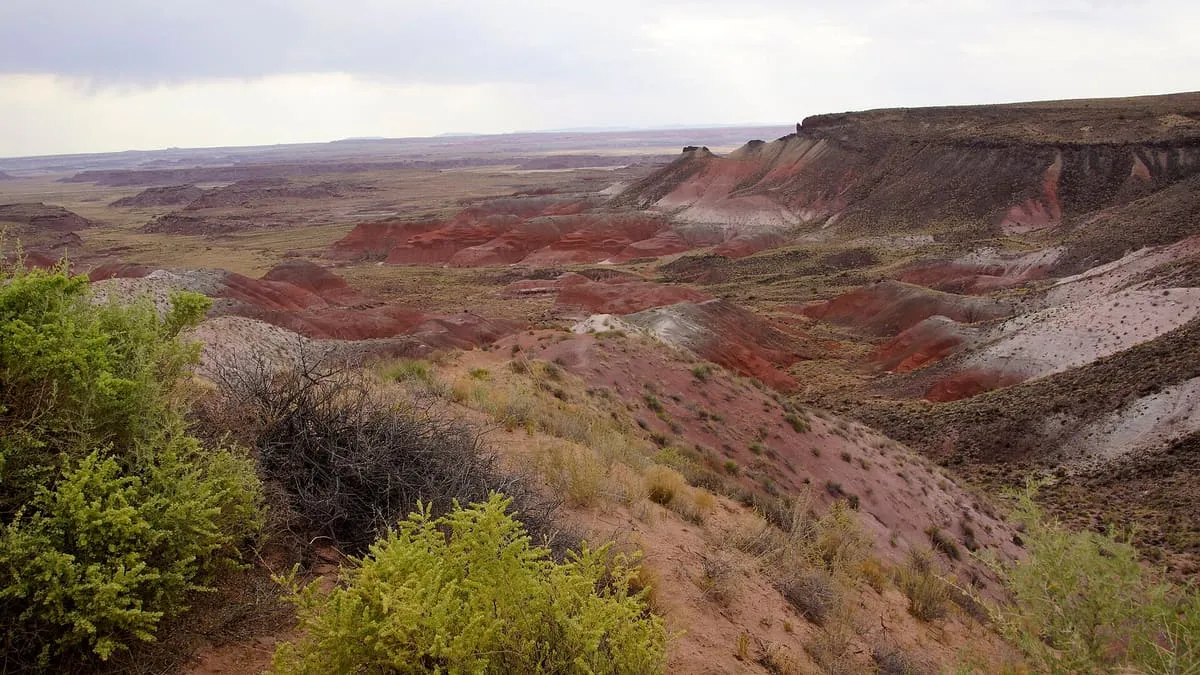
Painted Desert
The Painted Desert is a United States desert of badlands in the Four Corners area, running from near the east end of Grand Canyon National Park and southeast into Petrified Forest National Park. It is most easily accessed from the north portion of Petrified Forest National Park. The Painted Desert is known for its brilliant and varied colors: these include the more common red rock, but also shades of lavender.Score 61.7 · medium confidence
#26 · Historic Site
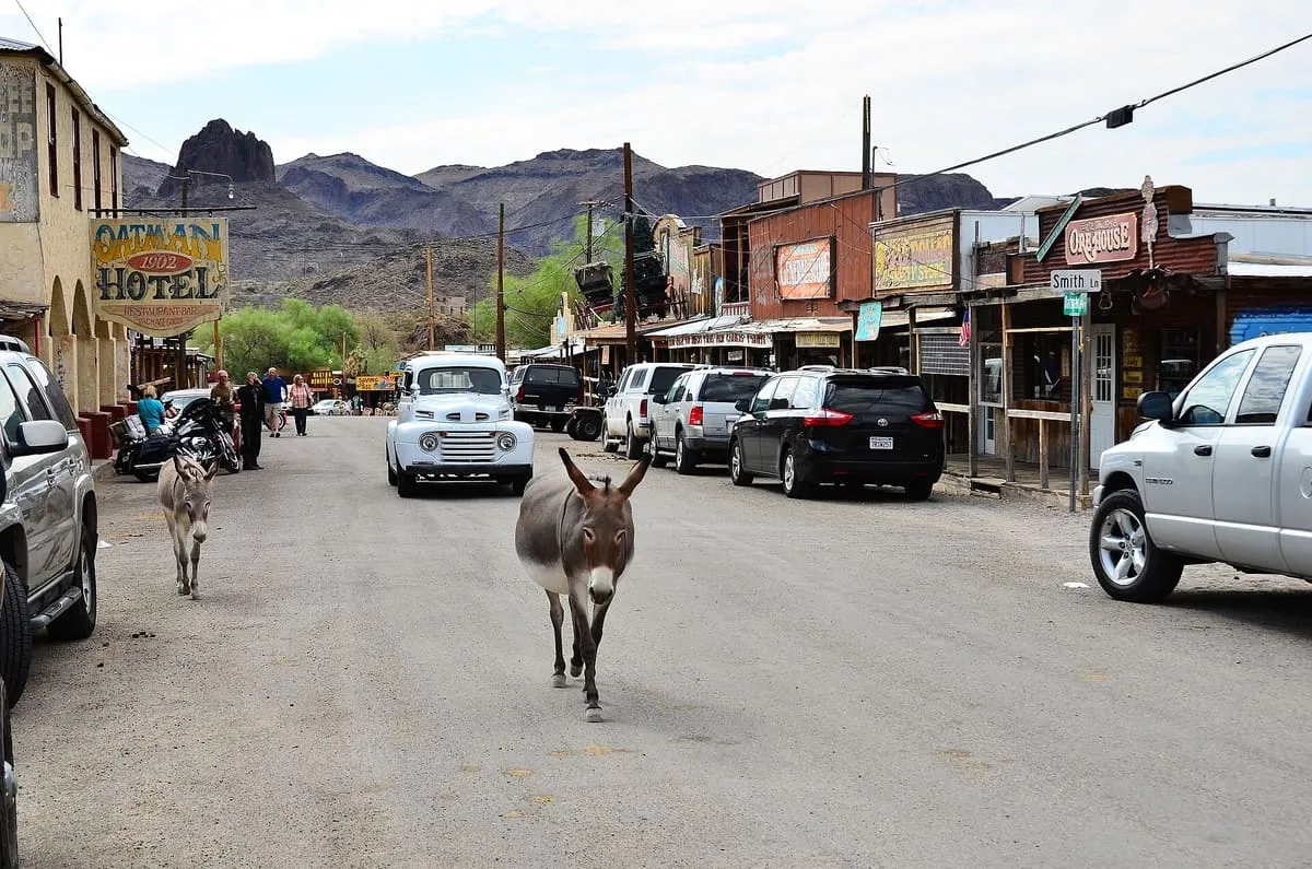
Oatman
Oatman is a census-designated place (CDP) in the Black Mountains of Mohave County, Arizona, United States, at an elevation of 2,710 feet (830 m). In 1915, it began as a small mining camp when two prospectors struck US$10 million (equivalent to $181 million in 2025) in gold, though the vicinity had already been settled for several years. Oatman's population grew to more than 3,500 in one year.Score 61.6 · medium confidence
#27 · Museum
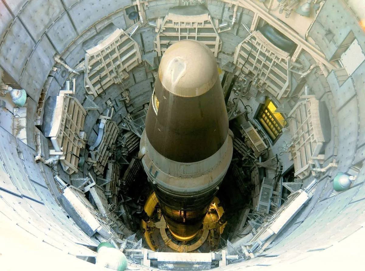
Titan Missile Museum
The only Titan II intercontinental ballistic missile complex left intact and open to the public, preserved as it was when it stood on alert. Tours descend into the silo and the launch control centre; a training missile remains in the shaft.Score 61.3 · medium confidence
#28 · Observatory
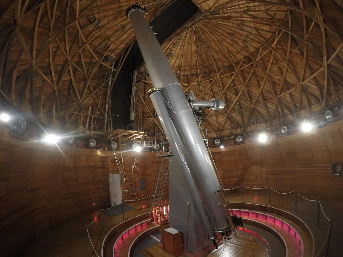
Lowell Observatory
The observatory where Pluto was discovered in 1930 and where the first evidence of an expanding universe was recorded. Open to the public for daytime tours and night viewing.Score 61.0 · medium confidence
#29 · Landmark
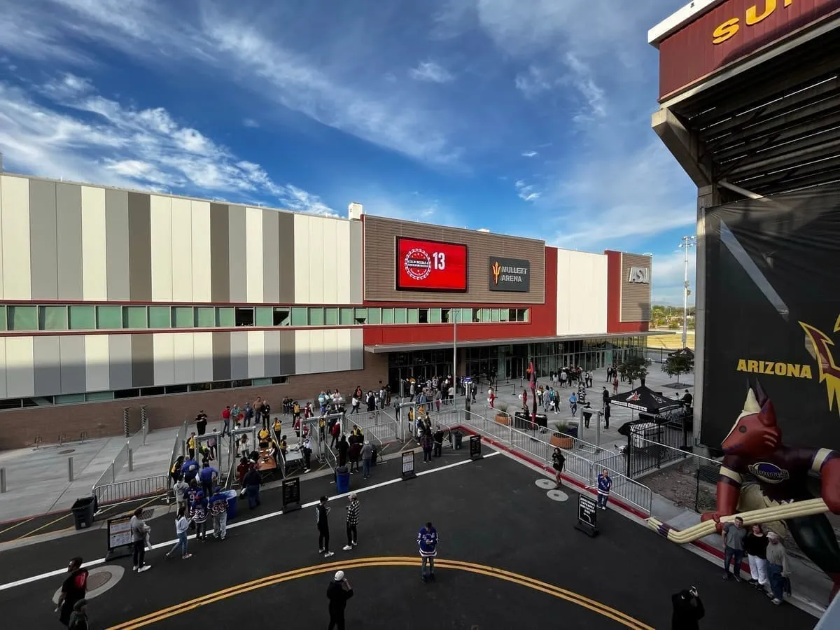
Mullett Arena
Mullett Arena (originally ASU Multi-Purpose Arena) is an indoor multipurpose arena at Arizona State University in Tempe, Arizona. The 5,000-seat arena is the home of the men's ice hockey, women's ice hockey, women's volleyball, and men's wrestling teams as well as the NBA G League's Valley Suns. It served as a temporary venue for the National Hockey League's Arizona Coyotes from 2022 to 2024, with seating capacity for NHL games capped at 4,600.Score 60.4 · medium confidence
#30 · Landmark
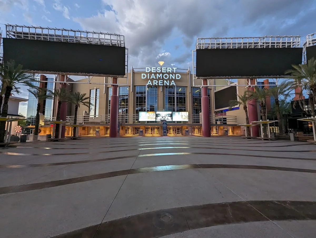
Desert Diamond Arena
Desert Diamond Arena (originally Glendale Arena and formerly Jobing.com Arena and Gila River Arena) is an indoor entertainment arena located in Glendale, Arizona, which anchors the 223-acre, $1 billion Westgate Entertainment District. Located about 12.5 miles (20.1 km) northwest of downtown Phoenix, the arena was built east of Arizona Loop 101 (Agua Fria Freeway) and on the north side of West Maryland Avenue at a cost of $220 million. The arena is owned by the City of Glendale and managed by ASM Global.Score 60.3 · medium confidence
#31 · Natural Landmark
Mogollon Rim
The Mogollon Rim () is a topographical and geological feature cutting across the northern half of the U.S. state of Arizona. It extends approximately 200 miles (320 km), starting in northern Yavapai County and running eastward, ending near the border with New Mexico.Score 60.0 · medium confidence
#32 · National Monument
Agua Fria National Monument
Agua Fria National Monument is in the U.S. state of Arizona, approximately 40 miles (64 km) north of downtown Phoenix, Arizona. Created by Presidential proclamation on January 11, 2000, the 72,344-acre (113 sq mi; 293 km2) monument is managed by the Bureau of Land Management, an agency within the U.S.Score 59.8 · medium confidence
#33 · National Monument
Hohokam Pima National Monument
The Hohokam Pima National Monument is an ancient Hohokam village within the Gila River Indian Community, near present-day Sacaton, Arizona. The monument features the archaeological site Snaketown 30 miles (48 km) southeast of Phoenix, Arizona, designated a National Historic Landmark in 1964. The area was further protected by declaring it a national monument in 1972, and was listed on the National Register of Historic Places in 1974.Score 59.5 · medium confidence
#34 · Natural Landmark
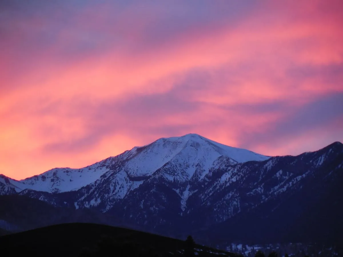
San Francisco Peaks
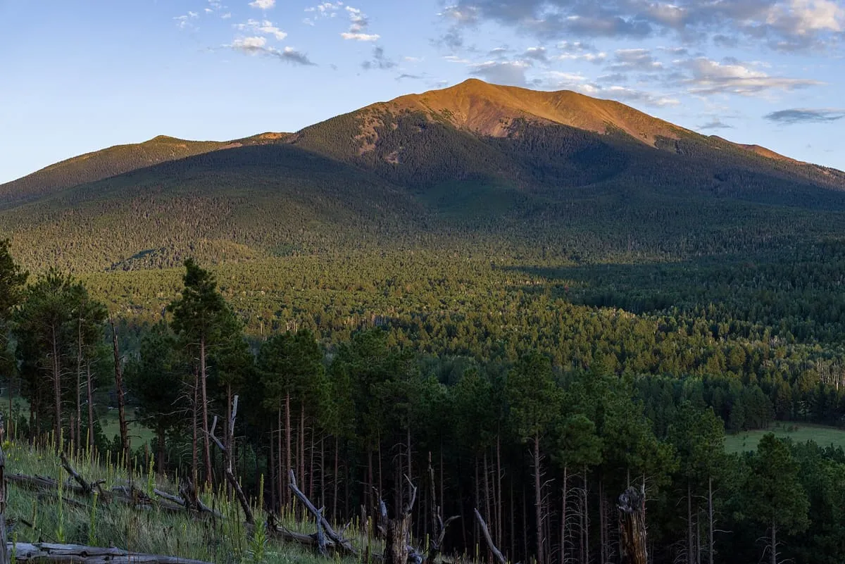
Managed by the Coconino National Forest, the San Francisco Peaks northwest of Flagstaff offer a number of hiking trails for all skill levels, as well as opportunities for mountain biking, rock climbing, camping, and skiing. The range is crowned by the 12,637-ft Humphreys Peak, and is held sacred by the Havasupai, Navajo, Hopi, and Zuni tribes.Score 59.4 · medium confidence
#35 · Landmark
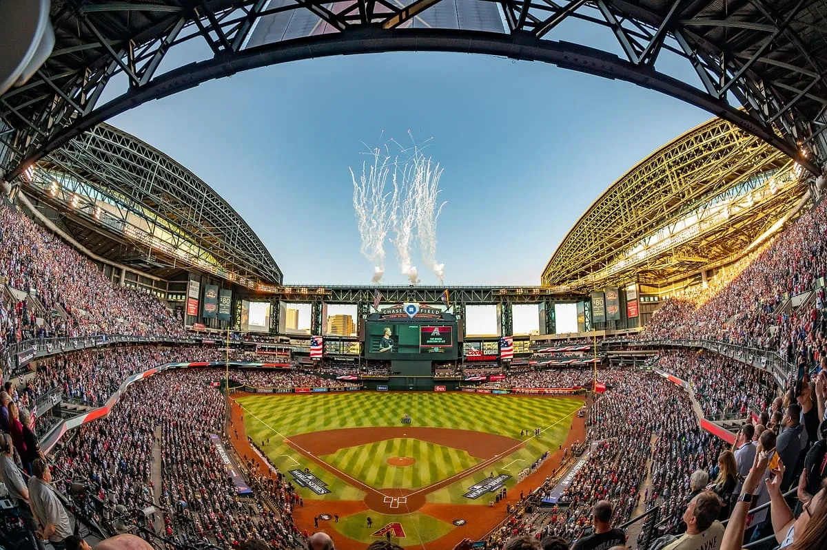
Chase Field
Chase Field, formerly Bank One Ballpark, is a retractable roof stadium in downtown Phoenix, Arizona, United States. It is the ballpark of Major League Baseball's Arizona Diamondbacks. It opened in 1998, the year the Diamondbacks debuted as an expansion team.Score 59.0 · medium confidence
#36 · National Monument
Baaj Nwaavjo I'tah Kukveni – Ancestral Footprints of the Grand Canyon National Monument
Baaj Nwaavjo I'tah Kukveni – Ancestral Footprints of the Grand Canyon National Monument is a United States national monument that protects over 900,000 acres (3,600 km2) surrounding the Grand Canyon in northern Arizona. President Joe Biden established it as a monument under the authority of the Antiquities Act on August 8, 2023, to be managed by the United States Forest Service within Kaibab National Forest and the Bureau of Land Management as part of the National Conservation Lands.Score 58.9 · medium confidence
#37 · Natural Landmark
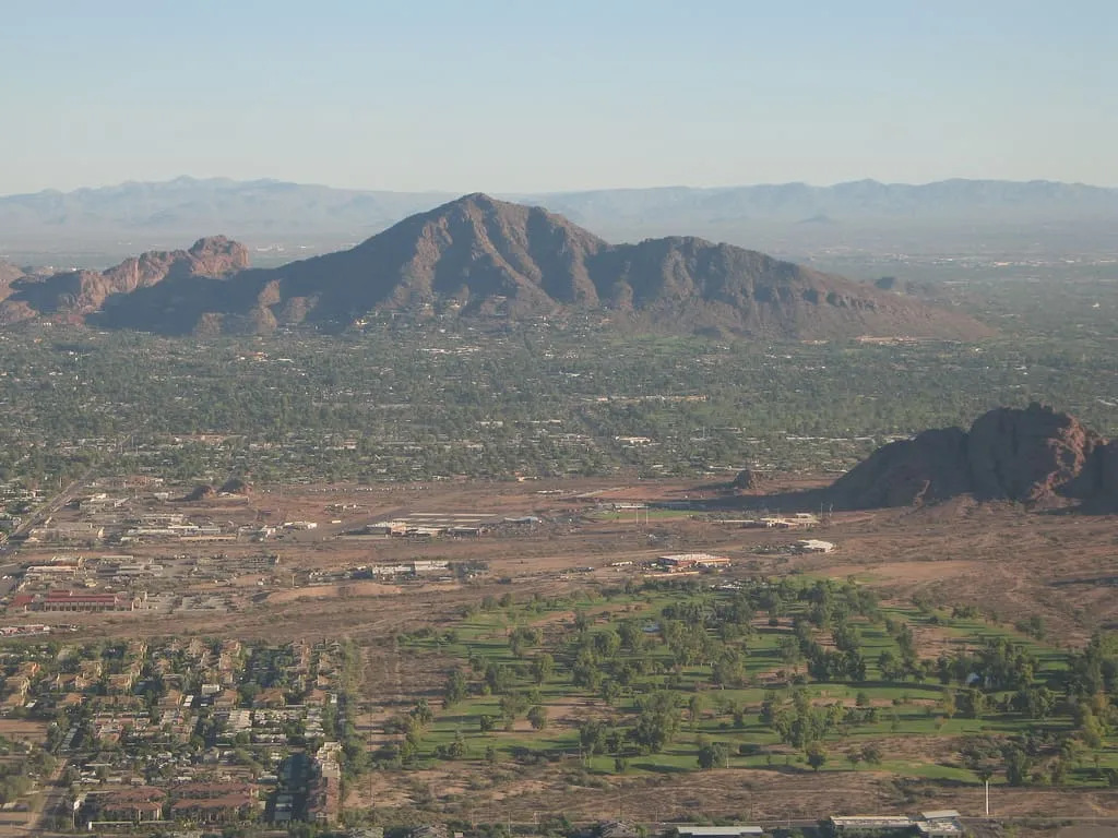
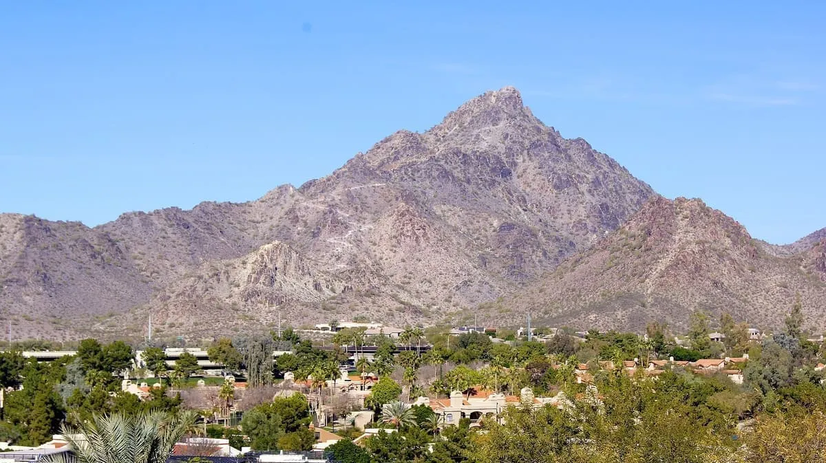
Camelback Mountain
Camelback Mountain, in Phoenix, Arizona.Score 58.7 · medium confidence#38 · Museum
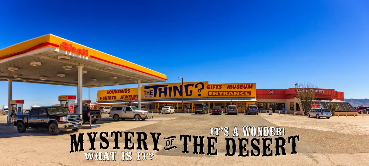
The Thing?
The Thing (a.k.a. The Thing Museum) is an Arizona roadside attraction extensively advertised by signs along Interstate 10 between El Paso, Texas, and Tucson, Arizona. The object, supposedly a mummified mother and child, is believed to have been made by exhibit creator Homer Tate for sideshows.Score 58.7 · medium confidence
#39 · Natural Landmark
Kaibab National Forest
Kaibab National Forest (, KY-bab) borders both the north and south rims of the Grand Canyon, in north-central Arizona, United States. Its 1.6 million acres (650,000 ha) is divided into three sections: the North Kaibab Ranger District (offices in Fredonia), the Tusayan Ranger District (offices in the Grand Canyon), and the Williams Ranger District (offices in Williams). It is managed by the United States Forest Service.Score 58.6 · medium confidence
#40 · Historic Site
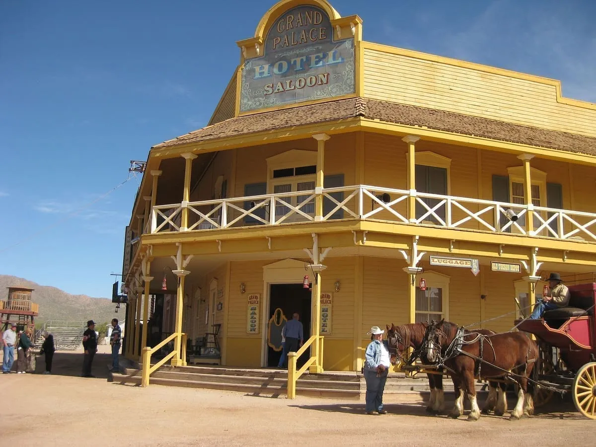
Old Tucson Studios
Ever notice that Hollywood's Old West, the backdrop for the gun-slinging and cryptic comments of Hollywood's Western icons – Wayne, Eastwood, Douglas and Newman – has much in common with the Wild West of today's Tombstone and Geronimo? They've all been filmed at the Old Tucson Studios, which were built in 1939 for the making of the William Holden film Arizona.Score 58.6 · medium confidence
#41 · Landmark
Four Corners Monument
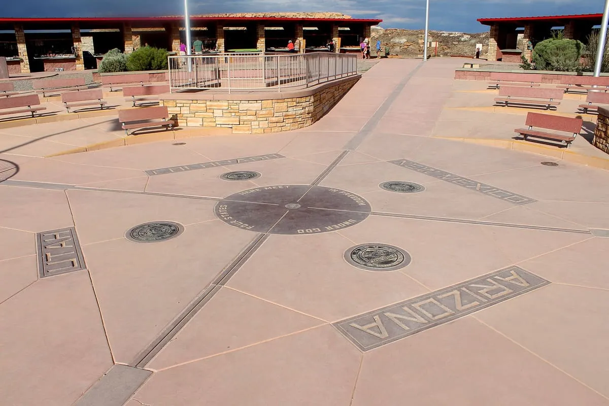
The Four Corners Monument marks the quadripoint in the Southwestern United States where the states of Arizona, Colorado, New Mexico, and Utah meet. It is the only point in the United States shared by four states, leading to the area being named the Four Corners region. The monument also marks the boundary between two sovereign Native American governments, the Navajo Nation, which maintains the monument as a tourist attraction, and the Ute Mountain Ute Tribe Reservation.Score 58.1 · medium confidence
#42 · Natural Landmark
Lake Pleasant Regional Park
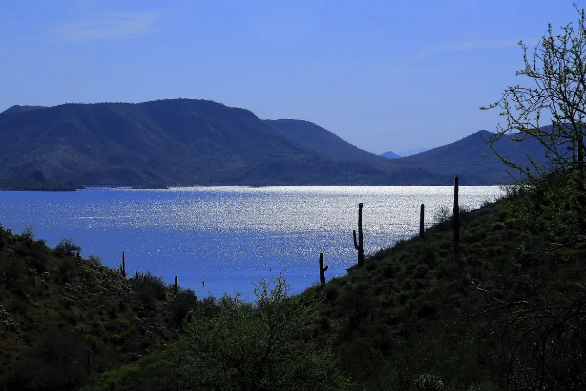
Lake Pleasant Regional Park is a large outdoors recreation area straddling the Maricopa and Yavapai county border northwest of Phoenix, Arizona. The park is located within the municipal boundaries of Peoria, Arizona, and serves as a major recreation hub for the northwest Phoenix metropolitan area. It is operated by the Maricopa County Parks and Recreation Department.Score 57.2 · medium confidence
#43 · Natural Landmark
Roden Crater
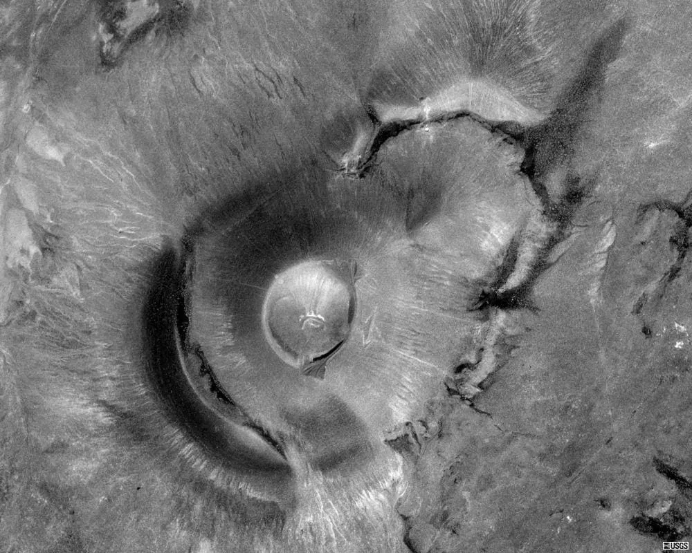
Roden Crater is a cinder cone type of volcanic cone from an extinct volcano, with a remaining interior volcanic crater. It is located approximately 50 miles northeast of the city of Flagstaff in northern Arizona, United States.Score 57.2 · medium confidence
#44 · National Monument
Wupatki National Monument
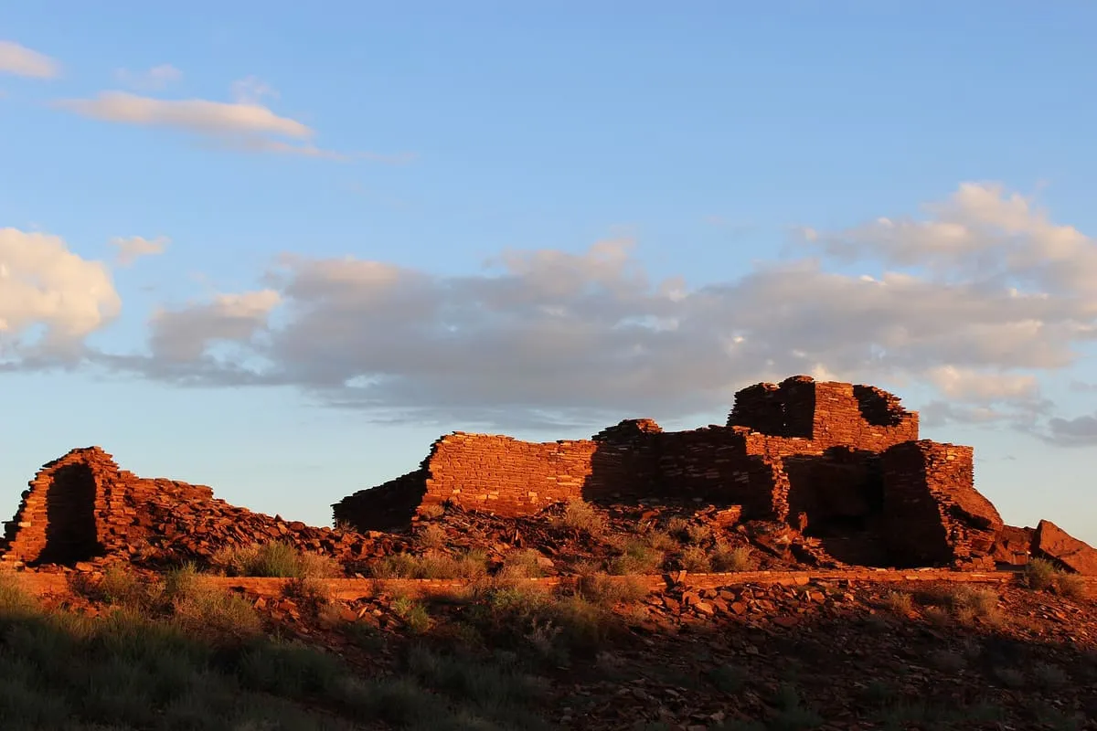
220,205 recreation visits in 2024.Score 56.9 · high confidence
#45 · Natural Landmark
Mount Graham
Mount Graham (called in Nnee biyati' (Western Apache) Dził Nchaa Sí'an – 'Big Seated Mountain') is a mountain in Graham County, Arizona, United States, approximately 70 miles (110 km) northeast of Tucson. The mountain reaches 10,720 feet (3,267 m) in height. It is the highest elevation in Graham County, Coronado National Forest and the Pinaleño Mountains.Score 56.4 · medium confidence
#46 · Natural Landmark
Piestewa Peak
In the middle of Phoenix lies Phoenix Mountains Park. The park offers a strenuous one- to two-hour hike to the top of Piestewa Peak, offering fantastic 360° views of the city and its surrounding environment. There are several alternative hiking trails (trail 304, 202, 8A) besides the very popular peak trail. The other well-known mountain in the area (Camelback Mountain being the most well known).Score 56.4 · medium confidence
#47 · Canyon
Glen Canyon
Glen Canyon is a natural canyon carved by a 169.6-mile (272.9 km) length of the Colorado River, mostly in southeastern and south-central Utah, in the United States. Glen Canyon starts where Narrow Canyon ends, at the confluence of the Colorado River and the Dirty Devil River. A small part of the lower end of Glen Canyon extends into northern Arizona and terminates at Lee's Ferry, near the Vermilion Cliffs.Score 56.3 · medium confidence
#48 · Historic Site
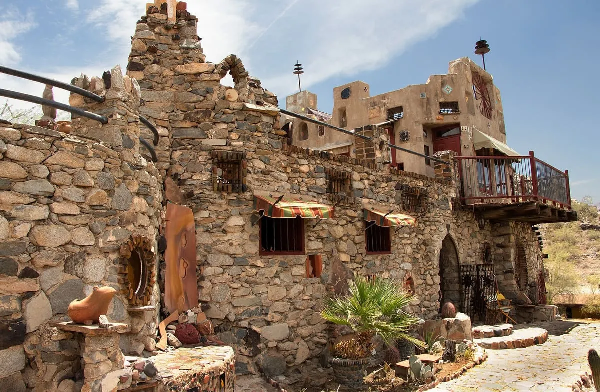
Mystery Castle
Mystery Castle is located in the city of Phoenix, Arizona, in the foothills of South Mountain Park. It was built in the 1930s by Boyce Luther Gulley for his daughter Mary Lou Gulley. After learning he had tuberculosis, Gulley moved from Seattle to the Phoenix area and began building the house from found or inexpensive materials.Score 56.2 · medium confidence
#49 · Museum
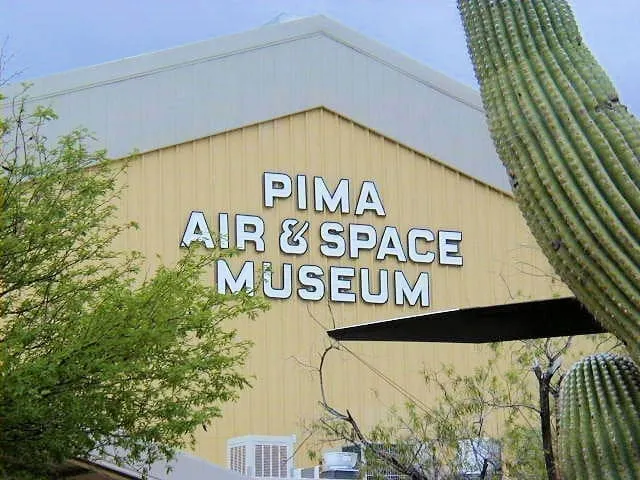
Pima Air & Space Museum
One of the largest aerospace museums in the world, holding around 400 aircraft across 80 acres. It sits beside the Air Force boneyard at Davis-Monthan, and runs bus tours into it. Independently operated, not a government facility.Score 56.0 · medium confidence
#50 · Historic Site
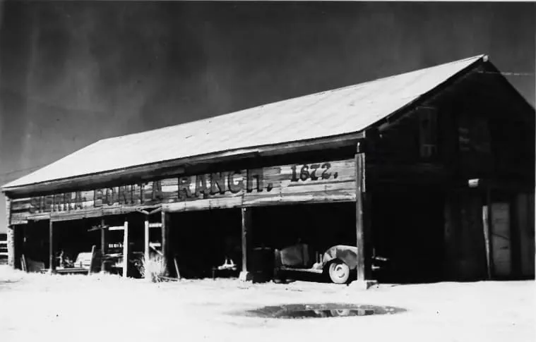
Sierra Bonita Ranch
The Sierra Bonita Ranch, founded in 1872 by Henry C. Hooker, is one of the oldest cattle ranches in the United States and the ranch buildings have been designated a National Historic Landmark. It was the first permanent American cattle ranch in Arizona.Score 55.4 · medium confidence
#51 · Historic Site
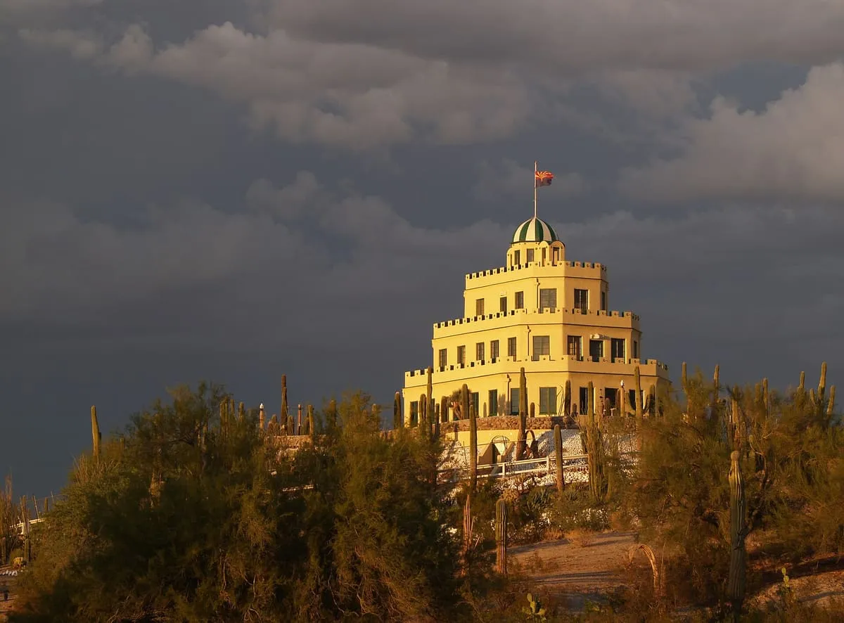
Tovrea Castle
Tovrea Castle is a historic structure and landmark, which is particularly visible to drivers on Arizona State Route 202. It was intended as a centerpiece for a resort, but was used as a private residence for the Tovrea family, who owned the Phoenix Stockyards which once were adjacent to the property.Score 55.4 · medium confidence
#52 · Observatory
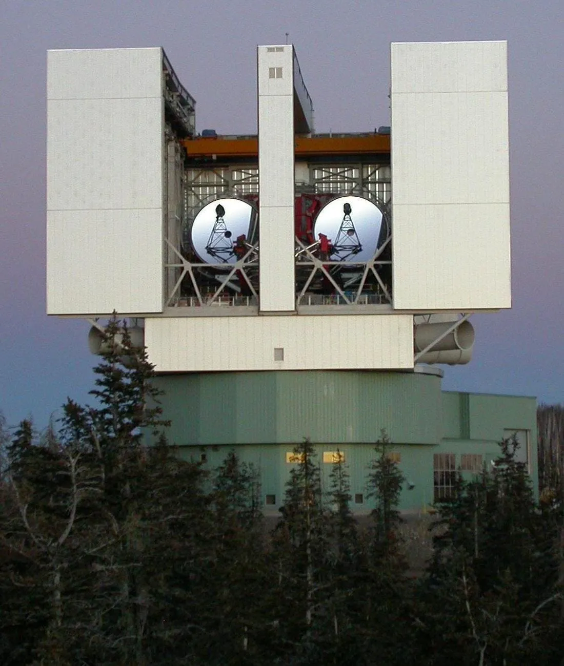
Large Binocular Telescope
The Large Binocular Telescope (LBT) is an optical telescope for astronomy located on 10,700-foot (3,300 m) Mount Graham, in the Pinaleno Mountains of southeastern Arizona, United States. It is a part of the Mount Graham International Observatory. When using both 8.4 m (330 inch) wide mirrors, with centres 14.4 m apart, the LBT has the same light-gathering ability as an 11.8 m (464 inch) wide single circular telescope and the resolution of a 22.8 m (897 inch) wide one.Score 55.3 · medium confidence

#54 · Natural Landmark
Tonto National Forest
The surrounding Tonto National Forest offers a range of opportunities for hiking, mountain biking, and rock climbing. Maps, books, and trail information are available from the Globe Ranger Station.Score 55.3 · medium confidence
#55 · Natural Landmark
White Mountains
The White Mountains of Arizona are a mountain range and mountainous region in the eastern part of the state, near the border with New Mexico; they are a continuation from the west of the Arizona transition zone–Mogollon Rim, with the Rim ending in western New Mexico. The White Mountains are a part of the Colorado Plateau high country of Northeast Arizona, the Navajo Nation, with the rest of the Plateau in eastern Utah, northwest New Mexico, and southwestern Colorado. Nearby communities include Show Low, Pinetop-Lakeside, Greer, St.Score 55.3 · medium confidence
#56 · Historic Site
Wrigley Mansion
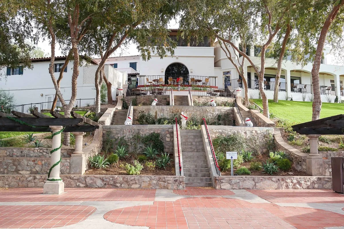
Take a tour of the amazing architecture and grounds of this historic mansion built by the famous chewing gum magnate.Score 55.3 · medium confidence
#57 · Natural Landmark
Coconino National Forest
The Coconino National Forest is a 1.856-million acre (751,000 ha) United States National Forest located in northern Arizona in the vicinity of Flagstaff, with elevations ranging from 2,600 ft (800 m) to the highest point in Arizona at 12,633 ft (3,851 m) (Humphrey's Peak). Originally established in 1898 as the "San Francisco Mountains National Forest Reserve", the area was designated a U.S. National Forest by Pres.Score 55.1 · medium confidence
#58 · Natural Landmark
Cheops Pyramid
Cheops Pyramid is a 5,401-foot-elevation (1,646-meter) summit located in the Grand Canyon, in Coconino County of Arizona, US.Score 55.0 · medium confidence
#59 · Historic Site
Contention City
Contention City or Contention is a ghost mining town in Cochise County in the southeastern part of the U.S. state of Arizona. It was occupied from the early 1880s through the late 1880s in what was then known as the Arizona Territory.Score 55.0 · medium confidence
#60 · Natural Landmark
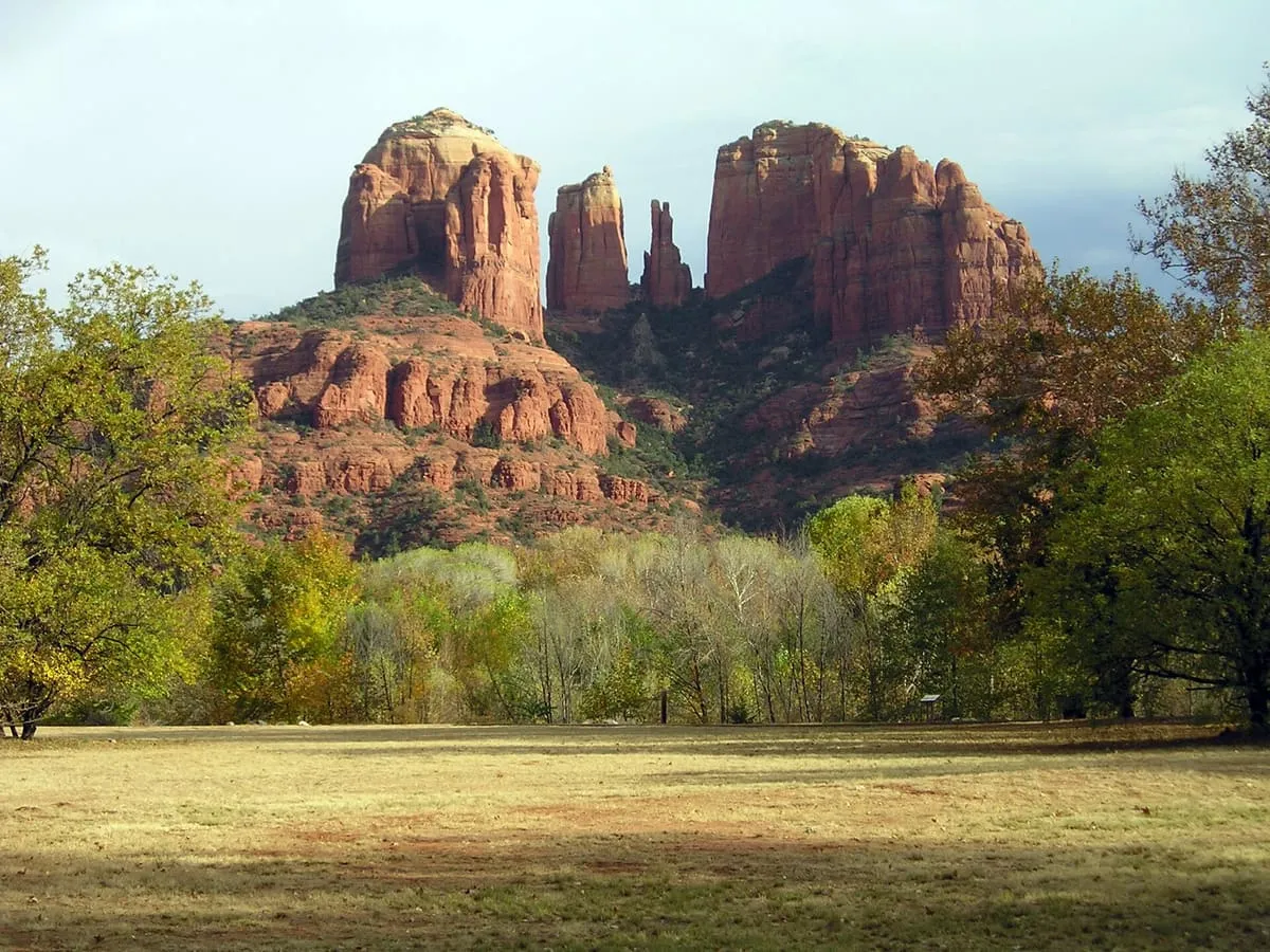
Cathedral Rock
One of the most recognised and most photographed of Sedona's red rock formations, with a short but steep scramble to the saddle between its spires.Score 54.7 · medium confidence
#61 · National Monument
Walnut Canyon National Monument
187,205 recreation visits in 2024.Score 54.7 · high confidence
#62 · Natural Landmark
Montezuma Well
Montezuma Well (Yavapai: ʼHakthkyayva), a detached unit of Montezuma Castle National Monument, is a natural limestone sinkhole near the town of Lake Montezuma, Arizona, through which some 1,500,000 US gallons (5,700,000 L; 1,200,000 imp gal) of water emerge each day from an underground spring. It is located about 11 miles (18 km) northeast of Montezuma Castle. The "well" measures 386 feet (118 m) in diameter from rim to rim and contains a near-constant volume of spring water even in times of severe drought.Score 54.5 · medium confidence
#63 · Landmark
Mountain America Stadium
Mountain America Stadium is an outdoor college football stadium in Tempe, Arizona, located on the campus of Arizona State University (ASU). It is the home of the Arizona State Sun Devils football team of the Big 12 Conference. The stadium opened in 1958.Score 54.5 · medium confidence
#64 · Landmark
Colin Grand Canyon Skywalk
The Grand Canyon Skywalk is a horseshoe-shaped cantilever bridge with a glass walkway at Eagle Point in Arizona near the Colorado River, on the edge of a side canyon in the Grand Canyon West area of the main canyon. It opened as a tourist attraction in 2007, located outside the boundaries of the Grand Canyon National Park. USGS topographic maps indicate the Skywalk's elevation as 4,770 ft (1,450 m) above sea level.Score 54.4 · medium confidence
#65 · Historic Site
Navajo Nation Council Chamber
Navajo Nation Council Chamber (Navajo: Béésh bąąh dah si'ání) is the center of government for the Navajo Nation. The landmark building, in Window Rock, Arizona, is significant for its association with the 1930s New Deal, and its change in federal policy for relations with Native Americans, as established in the Indian Reorganization Act. With its red sandstone façade and overall rustic architectural style, the chamber was designed to harmonize with its spectacular natural surroundings.Score 54.4 · medium confidence
#66 · National Monument
Ironwood Forest National Monument
Established as a National Monument in 2000, the monument is managed by the Bureau of Land Management (BLM) for multiple uses, including ranching and recreational use. It is noted for significant concentrations of Ironwood trees, and for over 200 pre-Columbian archeological sites.Score 54.3 · medium confidence
#67 · Canyon
Oak Creek Canyon
Oak Creek Canyon is a river gorge located in northern Arizona between the cities of Flagstaff and Sedona. The canyon is often described as a smaller cousin of the Grand Canyon because of its scenic beauty. State Route 89A enters the canyon on its north end via a series of hairpin turns before traversing the bottom of the canyon for about 13 miles (21 km) until the highway enters the town of Sedona.Score 54.2 · medium confidence
#68 · National Monument
Casa Grande Ruins National Monument
104,429 recreation visits in 2024.Score 54.1 · high confidence
#69 · Landmark
Standin' on the Corner Park
Standin' on the Corner Park is a public park in Winslow, Arizona, opened in 1999, commemorating the song "Take It Easy" which was written by Jackson Browne and Glenn Frey and most famously recorded by Frey's band, the Eagles. The song includes the verse "Well, I'm a-standin' on a corner in Winslow, Arizona, and such a fine sight to see.Score 54.1 · medium confidence
#70 · Natural Landmark
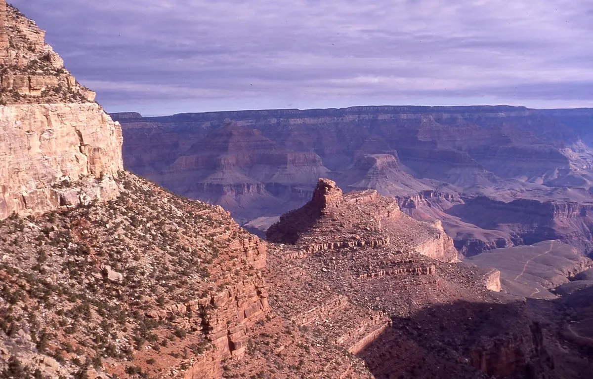
Bright Angel Trail
The park's most popular trail is the Bright Angel trail which starts near the Bright Angel Lodge. This trail traverses a seemingly unending series of switchbacks down the canyon wall before leveling out somewhat around the oasis of Indian Gardens.Score 53.8 · medium confidence
#71 · Natural Landmark
Chuska Mountains
The Chuska Mountains (Navajo: Chʼóshgai) are an elongate range on the southwest Colorado Plateau and within the Navajo Nation whose highest elevations approach 10,000 feet. The range is about 80 by 15 km (50 by 10 miles). It trends north-northwest and is crossed by the state line between Arizona and New Mexico.Score 53.8 · medium confidence
#72 · National Monument
Organ Pipe Cactus National Monument
182,612 recreation visits in 2024.Score 53.4 · high confidence
#73 · Landmark
Phoenix Raceway
Phoenix Raceway is a 1 mi (1.6 km) dogleg oval track in Avondale, Arizona, United States. The track has held a variety of events since its opening in 1964, including NASCAR, IndyCar, and CART races. It has a seating capacity of 42,000 as of 2019.Score 53.4 · medium confidence
#74 · National Monument
Sonoran Desert National Monument
Sonoran Desert National Monument is south of Goodyear and Buckeye and east of Gila Bend, Arizona. Created by Presidential proclamation on January 17, 2001, the 496,400 acres (200,886 ha) monument is managed by the U.S. Bureau of Land Management as part of the National Landscape Conservation System.Score 53.3 · medium confidence
#75 · Natural Landmark
Coyote Buttes
Coyote Buttes is a section of the Paria Canyon-Vermilion Cliffs Wilderness managed by the Bureau of Land Management (BLM). It spans extreme south-central Utah and north-central Arizona, south of US 89 halfway between Kanab, Utah and Page, Arizona. It is divided into two areas: Coyote Buttes North and Coyote Buttes South.Score 53.1 · medium confidence
#76 · Historic Site
Gila River War Relocation Center
The Gila River War Relocation Center was an American concentration camp in Arizona, one of several built by the War Relocation Authority (WRA) during the Second World War for the incarceration of Japanese Americans from the West Coast of the United States. It was located within the Gila River Indian Reservation (over their objections) near the town of Sacaton, about 30 mi (48.3 km) southeast of Phoenix. With a peak population of 13,348, it became the fourth-largest city in the state, operating from May 1942 to November 16, 1945.Score 53.1 · medium confidence
#77 · Natural Landmark
Theodore Roosevelt Lake
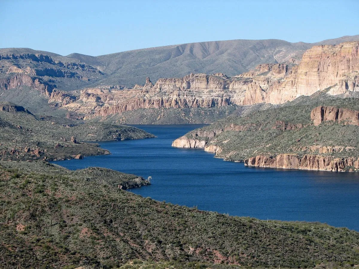
Theodore Roosevelt Lake (usually called Roosevelt Lake, sometimes Lake Roosevelt) is a large reservoir formed by Theodore Roosevelt Dam on the Salt River in Arizona as part of the Salt River Project (SRP). Located roughly 80 miles (130 km) northeast of Phoenix in the Salt River Valley, Theodore Roosevelt is the largest lake or reservoir located entirely within the state of Arizona (Lake Mead and Lake Powell are larger but are both located partially within the bordering states of Nevada and Utah respectively).Score 53.1 · medium confidence
#78 · Observatory
Kitt Peak National Observatory
The largest collection of optical telescopes in the world, on Tohono O'odham land at 6,880 feet, hosting more than twenty telescopes operated by different institutions.Score 53.0 · medium confidence
#79 · Historic Site
Phoenix Indian School
The Phoenix Indian School, or Phoenix Indian High School in its later years, was a Bureau of Indian Affairs-operated school in Encanto Village, in the heart of Phoenix, Arizona. It served lower grades also from 1891 to 1935, and then served as a high school thereafter. It opened in 1891 and closed in 1990 on the orders of the federal government.Score 53.0 · medium confidence
#80 · Natural Landmark
Chiricahua Mountains
The Chiricahuas is a mountain range in southeastern Arizona and part of the Basin and Range province of the western and southwestern United States and northwestern Mexico. The range lies primarily within the Coronado National Forest. Chiricahua Peak, the highest point in the range, rises 9,759 feet (2,975 m) above sea level, about 6,000 feet (1,800 m) above the surrounding valleys.Score 52.9 · medium confidence
#81 · Historic Site
Yuma Crossing
Yuma Crossing is a site in Arizona and California that is significant for its association with transportation and communication across the Colorado River. It connected New Spain and Las Californias in the Spanish Colonial period in and also during the Western expansion of the United States. Features of the Arizona side include the Yuma Quartermaster Depot and Yuma Territorial Prison.Score 52.7 · medium confidence
#82 · Historic Site
Boothill Graveyard
Boothill Graveyard is a small graveyard of at least 250 interments located in Tombstone, Cochise County, Arizona. Also known as the "Old City Cemetery", the graveyard was used after 1883 only to bury outlaws and a few others. It had a separate Jewish cemetery, which is nearby.Score 52.6 · medium confidence
#83 · Natural Landmark
West and East Mitten Buttes
The West and East Mitten Buttes (also known as the Mittens) are two buttes in the Monument Valley Navajo Tribal Park in northeast Navajo County, Arizona. When viewed from the south, the buttes appear to be two giant mittens with their thumbs facing inwards. The Mittens are about 0.6 mi (0.97 km) from the Arizona–Utah state line and West Mitten Butte is 1.1 mi (1.8 km) northeast of the park headquarters.Score 52.6 · medium confidence
#84 · Natural Landmark
Lees Ferry
Lees Ferry, in Vermilion Cliffs National Monument, Arizona.Score 52.5 · medium confidence
#85 · Natural Landmark
Papago Park
Papago Park () is a municipal park of the cities of Phoenix and Tempe, Arizona, United States. It has been designated as a Phoenix Point of Pride. It includes Hunt's Tomb, which is listed on the National Register of Historic Places.Score 52.3 · medium confidence
#86 · Historic Site
Pueblo Grande Ruin and Irrigation Sites
S'edav Va'aki (pronounced /ˈsɛʔ.dɑv ˈvɑʔ.ɑ.ki/) (formerly known as Pueblo Grande) is a pre-Columbian archaeological site and National Historic Landmark located in Phoenix, Arizona. It includes a prehistoric platform mound and irrigation canals. The City of Phoenix manages these resources through the adjacent S'edav Va'aki Museum.Score 52.3 · medium confidence
#87 · Natural Landmark
Vishnu Temple
Vishnu Temple is a 7,533-foot-elevation (2,296-meter) summit located in the Grand Canyon, in Coconino County of Arizona, US.Score 52.3 · medium confidence
#88 · Historic Site
Desert View Watchtower
Desert View Watchtower, also known as the Indian Watchtower at Desert View, is a 70-foot (21 m)-high stone building located on the South Rim of the Grand Canyon within Grand Canyon National Park in Arizona, United States. The tower is located at Desert View, more than 20 miles (32 km) to the east of the main developed area at Grand Canyon Village, toward the east entrance to the park.Score 52.2 · medium confidence

#90 · Natural Landmark
Santa Rita Mountains
The Santa Rita Mountains (O'odham: To:wa Kuswo Doʼag), located about 40 miles (60 km) southeast of Tucson, Arizona, extend 26 miles (42 km) from north to south, then trending southeast. They merge again southeastwards into the Patagonia Mountains, trending northwest by southeast. The highest point in the range, and the highest point in the Tucson area, is Mount Wrightson, with an elevation of 9,453 feet (2,881 m), The range contains Madera Canyon, one of the world's premier birding areas.Score 51.8 · medium confidence
#91 · Historic Site
Pinal City
Pinal or Pinal City is a ghost town in Pinal County in the U.S. state of Arizona. The town was populated from the 1870s into the 1890s, in what was then the Arizona Territory.Score 51.7 · medium confidence
#92 · Natural Landmark
Dragoon Mountains
The Dragoon Mountains is a range of mountains located in Cochise County, Arizona. The range is about 25 mi (40 km) long, running on an axis extending south-south east through Willcox. The name originates from the 3rd U.S.Score 51.6 · medium confidence
#93 · Historic Site
Fort Bowie
Fort Bowie was a 19th-century outpost of the United States Army located in southeastern Arizona near the present day town of Willcox, Arizona. The remaining buildings and site are now protected as Fort Bowie National Historic Site. Fort Bowie was established by the California Volunteers in 1862, after a series of engagements between the California Column and the Chiricahua Apaches.Score 51.6 · medium confidence
#94 · Natural Landmark
Coronado National Forest
The Coronado National Forest is a United States National Forest that includes an area of about 1.78 million acres (7,200 km2) spread throughout mountain ranges in southeastern Arizona and southwestern New Mexico. It is located in parts of Cochise, Graham, Santa Cruz, Pima, and Pinal Counties in Arizona, and Hidalgo County in New Mexico.Score 51.5 · medium confidence
#95 · Natural Landmark
Santa Catalina Mountains
The Santa Catalina Mountains, commonly referred to as the Catalina Mountains or the Catalinas, are north and northeast of Tucson, Arizona, United States, on Tucson's north perimeter. The mountain range is the most prominent in the Tucson area, near Catalina Foothills, an unincorporated community, with the highest average elevation. The highest point in the Catalinas is Mount Lemmon at an elevation of 9,157 feet (2,791 m) above sea level and receives 18 inches (460 mm) of precipitation annually.Score 51.5 · medium confidence
#96 · Natural Landmark
South Kaibab Trail
Slightly steeper than the Bright Angel trail, this trail starts from Yaki Point and follows a ridgeline into the canyon. Because the trail follows a ridge the views are spectacular and wide-open, but the amazing scenery comes at a cost: there is almost no shade to protect hikers from the sun, and the lack of natural water sources means that there is less plant and animal life.Score 51.4 · medium confidence
#97 · Museum
Bird Cage Theatre
The Bird Cage Theatre was a theater in Tombstone, Arizona, United States. It operated intermittently from December 1881 to 1894. When the silver mines closed, the theatre was also closed in 1892.Score 51.3 · medium confidence
#98 · Natural Landmark
Isis Temple
Isis Temple is a prominence in the Grand Canyon, Arizona, Southwestern United States. It is located below the North Rim and adjacent to the Granite Gorge along the Colorado River. The Trinity Creek and canyon flow due south at its west border; its north, and northeast border/flank is formed by Phantom Creek (Phantom Ranch, about 2,460 ft (750 m)) and canyon, a west tributary of Bright Angel Creek; the creeks intersect about 3 mi (4.8 km) southeast, and 1.0 mi (1.6 km) north of Granite Gorge.Score 51.3 · medium confidence#99 · Historic Site
Lehner Mammoth-Kill Site
The Lehner Mammoth-Kill Site is in southern Arizona (Cochise County) on the west bank of the San Pedro River 1.5 miles southwest of the town of Hereford. It is significant for its association with evidence that mammoths were killed here by Paleo-Indians 11,000 to 12,000 years before present. The Lehner Mammoth-Kill Site was declared a National Historic Landmark in 1967.Score 51.3 · medium confidence
#100 · Historic Site
St. Mary's Basilica
The Basilica of the Immaculate Conception of the Blessed Virgin Mary, also known as St. Mary's Basilica, is a Roman Catholic basilica located in Phoenix, Arizona. It was previously known as St.Score 51.2 · medium confidence
#101 · Natural Landmark
Superstition Mountain
Superstition Mountain (Yavapai: Wi:kchsawa, O'odham: Gakoḍk) is a prominent mountain and regional landmark located in the Phoenix metropolitan area of Arizona, immediately east of Apache Junction and north of Gold Canyon. It anchors the west end of the Superstition Mountains (within the federally designated Superstition Wilderness Area) and is a popular outdoor recreation destination, home to numerous trails for hiking and horseback riding. The legend of the Lost Dutchman's Gold Mine centers around the mountain.Score 51.2 · medium confidence
#102 · Natural Landmark
Fossil Creek
Fossil Creek (Yavapai: Hakhavsuwa or Vialnyucha) is a perennial stream accessed by a forest road near the community of Camp Verde in the U.S. state of Arizona. Access is from Forest Road 708 off Arizona State Route 260 east of Camp Verde.Score 51.0 · medium confidence
#103 · Natural Landmark
Willcox Playa
The Willcox Playa is a large endorheic dry lake or sink (playa) adjacent to Willcox, Arizona in Cochise County, in the southeast corner of the state. It is part of the Sonoran Desert ecoregion and is the remnant of a Pleistocene era pluvial Lake Cochise. The playa itself is roughly 8 miles (13 km) wide by 10 miles (16 km) long, with an area of approximately 40 square miles (100 km2).Score 51.0 · medium confidence
#104 · Historic Site
Awatovi Ruins
The Awatovi Ruins, spelled Awat'ovi in recent literature, are an archaeological site on the Hopi Reservation in northeastern Arizona, United States. The site contains the ruins of a pueblo estimated to be 500 years old, as well as those of a 17th-century Spanish mission. It was visited in the 16th century by members of Francisco Vázquez de Coronado's exploratory expedition.Score 50.8 · medium confidence
#105 · Landmark
Chevelon Creek Bridge
Chevelon Creek Bridge is a historic road bridge located about 12 miles (19 km) southeast of Winslow, in Navajo County, eastern Arizona, United States. It is a steel Warren Pony truss bridge over Chevelon Creek, built on the first permanent road connecting Holbrook, the seat of Navajo County, and Winslow. When built, the road was regionally important in northern Arizona as well as being a segment of an early national highway at the time automobile traffic was growing and national roads were first being formed.Score 50.7 · medium confidence
#106 · Natural Landmark
Tempe Town Lake
Tempe Town Lake, in Tempe, Arizona.Score 50.7 · medium confidence#107 · Landmark
Caduceus Cellars
Caduceus Cellars is a winery in Jerome, Arizona, United States. It is owned by Maynard James Keenan, who is best known as the vocalist for Grammy Award-winning rock band Tool. While the winery is named after the caduceus, an ancient symbol for commerce and staff of the Greek god Hermes, the vineyard is named Merkin Vineyards, after a pubic wig (merkin).Score 50.5 · medium confidence
#108 · Natural Landmark
Canyon Lake
Canyon Lake is one of four reservoirs that were formed by the damming of the Salt River in the U.S. state of Arizona as part of the Salt River Project. It was formed by the Mormon Flat Dam, which was completed in 1925 after two years of construction.Score 50.5 · medium confidence
#109 · Natural Landmark
Four Peaks
Four Peaks (Yavapai: Wi:khoba) is a prominent landmark on the eastern skyline of Phoenix. Part of the Mazatzal Mountains, it is located in the Four Peaks Wilderness in the Tonto National Forest, 40 miles (64 km) east-northeast of Phoenix. In winter, Four Peaks offers much of the Phoenix metro area a view of snow-covered peaks.Score 50.5 · medium confidence
#110 · Historic Site
Kinishba Ruins
Kinishba Ruins is a 600-room Mogollon great house archaeological site in eastern Arizona and is administered by the White Mountain Apache Tribe. It is located on the present-day Fort Apache Indian Reservation, near the Apache community of Canyon Day. As it demonstrates a combination of both Mogollon and Ancestral Puebloan cultural traits, archaeologists consider it part of the historical lineage of both the Hopi and Zuni cultures.Score 50.5 · medium confidence
#111 · Natural Landmark
Mummy Mountain (Arizona)
Mummy Mountain is a mountain situated in Paradise Valley, Arizona, United States. The slopes of the mountain incorporate primarily suburban residential development while the upper summit areas are conservation sites. Camelback Inn has been located on the southern slope since 1936.Score 50.5 · medium confidence

#113 · Historic Site
Gammage Memorial Auditorium
A theater designed by Frank Lloyd Wright that hosts international talent, Broadway shows, and local entertainment. One of his last architectural pieces, it was designed for Baghdad before being built in the equally arid Valley of the Sun.Score 50.4 · medium confidence
#114 · Waterfall
Grand Falls
Grand Falls is a natural waterfall system located 30 miles (48.3 kilometers) northeast of Flagstaff, Arizona in the Painted Desert on the Navajo Nation. It is also called Chocolate Falls because of the color. It dumps snow melt or seasonal rain into the gorge of the Little Colorado River below.Score 50.1 · medium confidence
#115 · Natural Landmark
Lake Mohave
Lake Mohave is a reservoir on the Colorado River between the Hoover Dam and Davis Dam in Cottonwood Valley defining the border between Nevada and Arizona in the United States. This 67-mile (108 km) stretch of the Colorado River flows past Boulder City, Nelson, Searchlight, Cottonwood Cove, Cal-Nev-Ari, and Laughlin to the west in Nevada and Willow Beach and Bullhead City to the east in Arizona. A maximum width of 4 miles (6.4 km) wide and an elevation of 647 feet (197 m), Lake Mohave encompasses 28,260 acres (114.4 km2) of water.Score 50.1 · medium confidence#116 · Museum
Poozeum
The Poozeum is a museum in Williams, Arizona, United States, dedicated to coprolites (fossilized feces). It was founded in 2014 as a website and resource center by George Frandsen, who owns the world's largest collection of coprolites. Pieces from Frandsen's collection served as a traveling exhibition before the Poozeum opened its physical location in 2024.Score 50.1 · medium confidence
#117 · Museum
Rosson House
Rosson House, at 113 North 6th Street at the corner of Monroe Street in Downtown Phoenix, Arizona, is a historic house museum in Heritage Square. It was built between 1894 and 1895 in the Stick-Eastlake - Queen Anne Style of Victorian architecture and was designed by San Francisco architect A. P.Score 50.1 · medium confidence
#118 · Historic Site
Hunt's Tomb
Hunt's Tomb is a tomb in the shape of a small white pyramid behind a fence at the top of a hill within Papago Park, Phoenix, Arizona, United States. George W. P.Score 50.0 · medium confidence
#119 · Historic Site
Anthem Veterans Memorial
Monument honoring members of the US Armed Forces, with five pillars representing the five branches of the US military. The community hosts ceremonies each year on Memorial Day (late May) and Veterans Day (November 11th).Score 49.9 · medium confidence
#120 · Historic Site
Charleston
Charleston is a ghost town in Cochise County in the southeastern part of the U.S. state of Arizona. It was occupied from the late-1870s through the late-1880s, and was located in what was then known as the Arizona Territory.Score 49.9 · medium confidence#121 · Historic Site
Poston War Relocation Center
The Poston Internment Camp, located in Yuma County (now in La Paz County) in southwestern Arizona, was the largest (in terms of area) of the 10 American concentration camps operated by the War Relocation Authority during World War II. The site was composed of three separate camps arranged in a chain from north to south, three miles from each other. Internees named the camps Roasten, Toastin, and Dustin, based on their desert locations.Score 49.9 · medium confidence
#122 · Natural Landmark
Arizona Trail
The Arizona National Scenic Trail (AZT) is a National Scenic Trail from Mexico to Utah that traverses the whole north–south length of the U.S. state of Arizona. The trail begins at the Coronado National Memorial near the US–Mexico border and moves north through parts of the Huachuca, Santa Rita, and Rincon Mountains.Score 49.8 · medium confidence
#123 · Historic Site
Tombstone Historic District
Tombstone Historic District is a historic district in Tombstone, Arizona that is significant for its association with the struggle between lawlessness and civility in frontier towns of the wild west, and for its history as a boom-and-bust mining center. Located within the historic district is the legendary O.K. Corral associated with the famous Gunfight at the O.K.Score 49.8 · medium confidence
#124 · National Monument
Chiricahua National Monument
71,390 recreation visits in 2024.Score 49.7 · high confidence
#125 · Landmark
Grand Canyon Railway
Round-trip train ride of 65 miles, taking approximately 2 hr 15 min each way. Leaves Williams at 9:30AM; passengers are at the South Rim of the Grand Canyon from about 11:45AM until the train begins its return trip at 3:30PM, arriving in Williams at 5:45PM. In Nov and Dec, all scheduled times are one hour earlier.Score 49.7 · medium confidence
#126 · Historic Site
Painted Desert Inn
Painted Desert Inn is a historic complex in Petrified Forest National Park, in Apache County, eastern Arizona. It is located off Interstate 40 and near the original alignment of historic U.S. Route 66, overlooking the Painted Desert.Score 49.7 · medium confidence
#127 · Natural Landmark
Saguaro Lake
Saguaro Lake is the fourth reservoir on the Salt River, formed by the Stewart Mountain Dam in the U.S. state of Arizona. The lake is off State Route 87, about halfway between Phoenix and the ghost town of Sunflower.Score 49.6 · medium confidence
#128 · Canyon
Virgin River Gorge
Worth a short drive into Utah. Beware of dangerous curves and, at times, low visibility, but when conditions are clear, the drive is amazing. Take Interstate 15 north through a small sliver of Arizona, then into Utah for more of nature's wonder.Score 49.6 · medium confidence
#129 · Natural Landmark
Black Mesa
Black Mesa (also called Big Mountain) is an upland mountainous mesa of Arizona, north-trending in Navajo County, west and southeast-trending in Apache County. In Navajo it is called Dziłíjiin ('Black Mountain') and during Mexican rule of Arizona it was called Mesa de las Vacas (Spanish for 'mesa of the cows'). It derives its dark appearance from its pinyon-juniper and mixed conifer woodlands.Score 49.5 · medium confidence
#130 · Natural Landmark
Bell Rock
Bell Rock is a butte just north of the Village of Oak Creek, Arizona, United States, south of Sedona in Yavapai County. With an elevation at its summit of 4,919 feet (1,499 m), it is just west of Courthouse Butte. Its panoramic views make it a popular landmark and tourist attraction.Score 49.4 · medium confidence
#131 · Natural Landmark
Verde Valley
The Verde Valley (Yavapai: Matkʼamvaha; Spanish: Valle Verde) is a valley in central Arizona in the United States. The Verde River runs through it. The Verde River is one of Arizona's last free-flowing river systems.Score 49.4 · medium confidence#132 · Natural Landmark
Devil's Kitchen Sinkhole
The Devil's Kitchen Sinkhole is a sinkhole near Sedona, Arizona on the Soldier Pass Trail in the Coconino National Forest. Formed in the late 1880s, it is one of the at least seven sinkholes surrounding the city. The sinkhole is about 660 ft (200 m) deep but leads to a cave that adds 180 ft (55 m), for a total of 840 ft (260 m).Score 49.3 · medium confidence
#133 · Zoo or Aquarium
Phoenix Zoo
A non-profit zoo in Papago Park, among the largest privately held zoos in the country, known for its part in saving the Arabian oryx from extinction.Score 49.3 · medium confidence
#134 · Natural Landmark
Sentinel Peak
Sentinel Peak is a 2,897 ft (900 m) peak in the Tucson Mountains southwest of downtown Tucson, Arizona, United States. The valley's first inhabitants grew crops at the mountain's base, along the Santa Cruz River. The name "Tucson" is derived from the O'odham Cuk Ṣon ([tʃʊk ʂɔːn]), meaning "the base [of the mountain] is black".Score 49.3 · medium confidence
#135 · Natural Landmark
Apache-Sitgreaves National Forests
The Apache–Sitgreaves National Forests is a 2.76-million-acre (11,169 km2) United States national forest which runs along the Mogollon Rim and the White Mountains in east-central Arizona and into the U.S. state of New Mexico. Formerly two forests, it is currently managed as one unit by USDA Forest Service from the Forest Supervisors Office in Springerville, Arizona.Score 49.2 · medium confidence
#136 · Historic Site
Hi Jolly Monument
A tribute to camel driver Hadji Ali, enlisted in an unsuccessful 19th-century attempt by the US Army to use camels in the southwest.Score 49.1 · medium confidence
#137 · Natural Landmark
Kaibab Plateau
The Kaibab Plateau is a plateau almost entirely in Coconino County, Arizona (but extending slightly north into Kane County, Utah) in the Southwestern United States. The high plain is also known as the Buckskin Mountain, Buckskin Plateau, and Kaibab Mountain.Score 49.1 · medium confidence
#138 · Natural Landmark
Patagonia Mountains
The Patagonia Mountains are a 15-mile-long (24 km) mountain range within the Coronado National Forest, and in Santa Cruz County, Arizona, United States.Score 49.1 · medium confidence
#139 · Natural Landmark
Tempe Butte
Tempe Butte (O'odham: ʼOidbaḍ Doʼag) is the official name of an andesite butte of volcanic origin, located partially on Arizona State University's Tempe campus in Tempe, Arizona. It is often referred to by locals as A Mountain, after the 60-foot-tall (18 m) gold-painted letter 'A' near the top. Another name for the area, used by the City of Tempe, is Hayden Butte.Score 49.1 · medium confidence
#140 · Natural Landmark
Vermilion Cliffs
Straddling around the park's boundaries, these impressive red-colored sandstone cliffs can be seen from quite a distance.Score 49.1 · medium confidence#141 · Natural Landmark
Hole-in-the-Rock (Papago Park)
Hole-in-the-Rock is a natural geological formation in Papago Park, a municipal park of Phoenix and Tempe, Arizona.Score 49.0 · medium confidence#142 · Historic Site
Pearce
Pearce, Arizona, and Sunsites, Arizona, are adjacent unincorporated communities in the Sulphur Springs Valley of Cochise County, Arizona, United States. The two communities are often referred to as Pearce–Sunsites, Pearce/Sunsites, or Pearce Sunsites. Pearce is located between the Cochise Stronghold, Chiricahua National Monument, and the winter Sandhill Crane refuge of Whitewater Draw making it popular for birders, history buffs, hikers, and climbers alike.Score 49.0 · medium confidence
#143 · Natural Landmark
Mount Baldy
Mount Baldy (Western Apache: Dził Łigai White Mountain) is an extinct stratovolcano in eastern Arizona in the United States. With a summit elevation of 11,409 feet (3,477 m), the peak of Mount Baldy rises above the tree line and is left largely bare of vegetation, lending the mountain its current name. The Mount Baldy Wilderness occupies the eastern slope of the mountain and is managed by the Apache-Sitgreaves National Forest.Score 48.9 · medium confidence
#144 · Natural Landmark
Yuma Desert
The Yuma Desert is a lower-elevation section of the Sonoran Desert in the southwestern United States and the northwest of Mexico. It lies in the Salton basin. The desert contains areas of sparse vegetation and has notable areas of sand dunes.Score 48.8 · medium confidence
#145 · Historic Site
Buckhorn Baths Motel
The Buckhorn Baths Motel at 5900 East Main Street at the corner of North Recker Road in Mesa, Arizona was a small mineral hot springs resort which offered a bathhouse as well as both cottages and motel rooms for overnight stays. Beginning in 1936 as a gas station and store, Ted and Alice Sliger developed the property into a resort complex which opened in 1939 and was virtually complete as of 1947. It continued to operate until 1999, when the bathhouse closed, although the motel and "Wildlife Museum" continued until 2004.Score 48.7 · medium confidence
#146 · Natural Landmark
Shiva Temple
Shiva Temple is a 7,646-foot-elevation (2,331-meter) summit located in the Grand Canyon, in Coconino County of Arizona, US. It is situated six miles north of Hopi Point overlook of the canyon's South Rim, about 2.5 miles southwest of North Rim's Tiyo Point, and two miles northwest of Isis Temple, where it towers 5,200 feet (1,600 meters) above the Colorado River. Shiva Temple is named for Shiva, the Hindu deity, destroyer of the universe.Score 48.7 · medium confidence
#147 · Historic Site
Mesa Arizona Temple
This unique, historic building opened in 1927. Its 20-acre lot features beautiful gardens and sitting spaces. It is the largest temple built by The Church of Jesus Christ of Latter-day Saints outside of Utah. The public is welcome to walk through the gardens. A must see at night when the exterior is illuminated.Score 48.6 · medium confidence
#148 · Observatory
Mount Graham International Observatory
Operated by the University of Arizona in the Pinaleño Mountains west of Safford, this observatory offers periodic tours for the public. Reservations required, preferably two or more weeks in advance. Tours depart from the Discovery Park Campus.Score 48.6 · medium confidence
#149 · Museum
Musical Instrument Museum
A collection of more than 8,000 instruments from every country in the world, presented with recordings that play as visitors approach each display.Score 48.5 · medium confidence
#150 · Historic Site
Santa Claus
Santa Claus (also known as Santa Claus Acres) is an uninhabited desert place in Mohave County, Arizona, United States. Originating in 1937, Santa Claus lies approximately 14 miles (23 km) northwest of Kingman, Arizona, along U.S. Route 93 between mile markers 57 and 58, immediately north of Hermit Drive and just south of both Grasshopper Junction, Arizona, and the Junk Art of Chloride, a group of metal statues in Chloride, Arizona, that include a flamingo made out of a motorcycle gas tank.Score 48.5 · medium confidence
#151 · Canyon
Canyon Diablo
Canyon Diablo, previously named "Cañon Diablo", is a canyon that winds through the Colorado Plateau approximately 30 miles (48 km) east of Flagstaff in northern Arizona. It is an example of an incised meander, a river bend carved into the plateau by erosion, creating a gorge. Portions of the canyon experience an ephemeral stream and act as a tributary to the Little Colorado River.Score 48.4 · medium confidence
#152 · National Historic Site
Coronado National Memorial
164,426 recreation visits in 2024.Score 48.4 · high confidence
#153 · Historic Site
Paradise
Paradise is a small ghost town located in Cochise County in the U.S. state of Arizona. The town was settled in 1901 in what was then the Arizona Territory.Score 48.4 · medium confidence
#154 · Natural Landmark
Weaver's Needle
Weavers Needle is a 1,000-foot-high (300 m) column of rock that forms a distinctive peak visible for many miles around. Located in the Superstition Mountains east of Phoenix, Arizona, Weavers Needle was created when a thick layer of tuff (fused volcanic ash)—a volcanic plug—was heavily eroded, creating the spire as an erosional remnant with a summit elevation of 4,555 feet (1,388 m). It is set in a desert landscape of cactus and mesquite bush, with large Saguaro cacti particularly prominent.Score 48.4 · medium confidence
#155 · Natural Landmark
Tucson Mountains
The Tucson Mountains (O'odham: Cuk Doʼag) are a minor mountain range west of Tucson, Arizona, United States. The Tucson Mountains, including Wasson Peak, are one of four notable mountain ranges surrounding the Tucson Basin. The Santa Catalina Mountains lie to the northeast, the Rincon Mountains are to the east of Tucson, and the Santa Rita Mountains lie to the south.Score 48.3 · medium confidence
#156 · National Monument
Tuzigoot National Monument
108,283 recreation visits in 2024.Score 48.3 · high confidence#157 · Historic Site
Vulture City
Vulture City is a ghost town situated at the site of the defunct Vulture Mine in Maricopa County, Arizona, United States.Score 48.3 · medium confidence
#158 · Landmark
Arizona Veterans Memorial Coliseum
Arizona Veterans Memorial Coliseum, also called the Madhouse Coliseum or Phoenix Memorial Coliseum, is a 14,870-seat multi-purpose indoor arena in Phoenix, Arizona, United States, located at the Arizona State Fairgrounds. It hosted the Phoenix Suns of the National Basketball Association from 1968 to 1992, as well as indoor soccer, professional roller hockey, multiple professional minor league ice hockey teams, and roller derby.Score 48.2 · medium confidence
#159 · Historic Site
Fort Whipple
Fort Whipple is a former United States (U.S.) Army post that was temporarily established at Del Rio Springs, north of present-day Chino Valley, Arizona, and later relocated to a permanent site near present-day Prescott, Arizona.Score 48.1 · medium confidence
#160 · National Monument
Navajo National Monument
58,442 recreation visits in 2024.Score 48.1 · high confidence
#161 · Natural Landmark
Huachuca Mountains
The Huachuca Mountains are part of the Sierra Vista Ranger District of the Coronado National Forest in Cochise County in southeastern Arizona, approximately 70 miles (110 km) south-southeast of Tucson and southwest of the city of Sierra Vista. Included in this area is the highest peak in the Huachucas, Miller Peak, and the region of the Huachucas known as Canelo Hills in eastern Santa Cruz County. The mountains range in elevation from 3,934 feet (1,199 m) at the base to 9,466 feet (2,885 m) at the top of Miller Peak.Score 48.0 · medium confidence
#162 · Natural Landmark
Bartlett Lake
Bartlett Lake is a reservoir that was formed by the damming of the Verde River in the U.S. state of Arizona. It is downstream and to the south of Horseshoe Reservoir.Score 47.9 · medium confidence

#164 · Natural Landmark
Mount Elden
This area is managed by the Coconino National Forest, and is an excellent starting point for exploring the area with numerous trails running up and alongside most faces of the mountain. One of the most popular trails is Elden Lookout Trail, which scales all 2800 ft (855m) from base to summit, and has access to the lookout tower at the top which looks down on the entire city.Score 47.9 · medium confidence

#166 · Historic Site
St. Anthony's Greek Orthodox Monastery (Florence, Arizona)
St. Anthony's Greek Orthodox Monastery is a Greek Orthodox monastery in the Sonoran Desert outside Florence, Arizona, United States. It was established in 1995 in the name of Saint Anthony the Great and is the largest Orthodox monastic complex in the Western Hemisphere.Score 47.8 · medium confidence

#168 · Natural Landmark
Owl Rock
Owl Rock is a 6,547-foot (1,996 m) elevation sandstone summit located south of Monument Valley, in northeast Arizona. It is situated 7 miles (11 km) north of Kayenta on Navajo Nation land, and can be seen from Highway 163 perched on the east edge of Tyende Mesa, where it towers 1,000 feet (300 meters) above the surrounding terrain. Its nearest higher neighbor is Agathla Peak, 1.4 miles (2.3 km) to the east-northeast, on the opposite side of this highway.Score 47.6 · medium confidence
#169 · Historic Site
Ruby
Ruby is a ghost town in Santa Cruz County, Arizona, United States. It is situated near the base of Montana Peak in the Pajarita Wilderness, roughly 25 miles west of Rio Rico, and 7 miles north of the Mexico–United States border. Originally named Montana Camp, the town was founded in 1877 as a mining camp.Score 47.6 · medium confidence
#170 · Natural Landmark
S P Crater
S P Crater is a cinder cone volcano in the San Francisco volcanic field, 25 miles (40 km) north of Flagstaff, Arizona, United States. It is surrounded by several other cinder cones which are older and more eroded. It is a striking feature on the local landscape, with a well-defined lava flow that extends for 4.3 miles (7 km) to the north.Score 47.6 · medium confidence
#171 · Canyon
Texas Canyon
Named after pioneer settlers from Texas whose family still operates a nearby ranch, the pass is between the Dragoon Mountains in the south and the Little Dragoon Mountains in the north. The entire area is marked by huge granite boulders which can be easily appreciated from the I-10 rest stop. To explore further, take Exit 318 and turn south and head toward the Amerind Foundation (listed above).Score 47.6 · medium confidence
#172 · Natural Landmark
El Camino Del Diablo
El Camino del Diablo (Spanish, meaning "The Devil's Path"), also known as El Camino del Muerto, Sonora Trail, Sonoyta-Yuma Trail, Yuma-Caborca Trail, and Old Yuma Trail, is a historic 250-mile (400 km) road that passes through some of the most remote and inhospitable terrain of the Sonoran Desert in Pima County and Yuma County, Arizona. The name refers to the harsh, unforgiving conditions on the trail. In use for thousands of years, El Camino del Diablo began as a series of footpaths used by desert-dwelling Native Americans.Score 47.4 · medium confidence
#173 · Historic Site
San Bernardino Ranch
San Bernardino Ranch is a historic ranch house in the southern San Bernardino Valley near the San Bernardino National Wildlife Refuge in extreme southeast Cochise County, Arizona, United States. It is significant for its association with the beginning of cattle ranching in southern Arizona and northern Mexico. The ranchland and valley are part of the headwaters region of the Yaqui River.Score 47.4 · medium confidence
#174 · Landmark
Camelback Ranch
Camelback Ranch–Glendale is a baseball complex located in Phoenix, Arizona, and owned by the city of Glendale. It is operated by Camelback Spring Training LLC. It is the spring training home of the Los Angeles Dodgers and Chicago White Sox.Score 47.3 · medium confidence
#175 · Historic Site
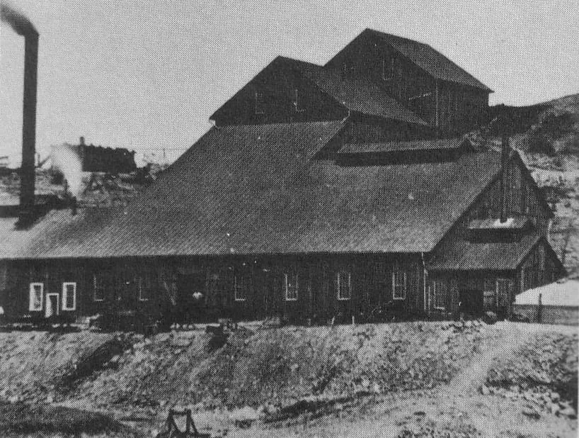
Copper Queen Mine
Visitors can take a guided tour of the old mine, which ceased operation in 1975.Score 47.3 · medium confidence
#176 · Natural Landmark
Grand Canyon Caverns
The largest dry cavern in the United States. The Regular Tour is a 45-minute, 3/4 mile (1 km) walking tour. A 25 minute Short Tour is available. The Explorers Tour is an off-trail caving tour of groups of 2-6 persons. The caverns are a constant 56ºF (13ºC) even during the heat of summer so a sweater or jacket is recommended.Score 47.3 · medium confidence
#177 · Natural Landmark
Kendrick Peak
Kendrick Peak or Kendrick Mountain is one of the highest peaks in the San Francisco volcanic field north of the city of Flagstaff in the U.S. state of Arizona and is located on the Coconino Plateau in Coconino County. Kendrick Peak rises to a height of 10,425 feet (3,178 m), which makes it the 11th or 12th tallest summit (depending on the source) in Arizona.Score 47.2 · medium confidence
#178 · Natural Landmark
Agathla Peak
Agathla Peak or Agathlan (Navajo: Aghaałą́, Spanish: El Capitan) is a peak south of Monument Valley, Arizona, which rises over 1,500 feet (460 meters) above the surrounding terrain. It is 7 miles (11 km) north of Kayenta and is visible from U.S. Route 163.Score 47.0 · medium confidence
#179 · Natural Landmark
Totem Pole
The Totem Pole is a pillar or rock spire found in Monument Valley. It is a highly eroded remnant of a butte. Deserts at the end of the Permian period, 260 million years ago, formed the De Chelly and Wingate Sandstones that make up the buttes, totems, and mesas in Monument Valley.Score 47.0 · medium confidence#180 · Natural Landmark
Hunts Mesa
This mesa marks the southern end of Monument Valley. It is in Southern Monument Valley, the extremely remote part of the valley that even the local Navajo people avoid.Score 46.9 · medium confidence
#181 · Canyon
Black Canyon of the Colorado
The Black Canyon of the Colorado is the canyon on the Colorado River where Hoover Dam was built. The canyon is located on the Colorado River at the state line between Nevada and Arizona. The western wall of the gorge is in the El Dorado Mountains, and the eastern wall is in the Black Mountains of Arizona.Score 46.8 · medium confidence
#182 · Natural Landmark
Baboquivari Peak Wilderness
This remote wilderness area is on the eastern side of the Baboquivari Mountain Range 50 mi (80 km) southwest of Tucson, and is administered by the Bureau of Land Management. It is notable for the spectacular Baboquivari Peak which is sacred to the Tohono O’odham people, and is clearly visible from nearby Kitt Peak National Observatory (see listing above).Score 46.7 · medium confidence
#183 · Botanical Garden
Desert Botanical Garden
Fifty-five acres in Papago Park holding one of the world's most significant collections of desert plants, including a large collection of agave and cactus species.Score 46.7 · medium confidence
#184 · Historic Site
Grand Canyon Village Historic District
Grand Canyon Village is a census-designated place (CDP) located on the South Rim of the Grand Canyon, in Coconino County, Arizona, United States. Its population was 2,004 at the 2010 Census. Located in Grand Canyon National Park, it is wholly focused on accommodating tourists visiting the canyon.Score 46.7 · medium confidence#185 · Natural Landmark
Iron Springs (Cochise County, Arizona)
Iron Springs is the historical name of a natural spring in the Whetstone Mountains of southeastern Arizona. It is famous for being the site of a confrontation between Wyatt Earp and William "Curly Bill" Brocius on March 24, 1882, which resulted in Brocius' death. The site was then known as Iron Springs, but on later maps the designation is Mescal Springs.Score 46.7 · medium confidence
#186 · Historic Site
Murray Springs Clovis Site
One of the oldest archeological sites in North America, used by nomadic hunters 12,000-13,000 years ago to pursue large game, including woolly mammoth. The site is managed as part of the San Pedro Riparian National Conservation Area, and has several trails, including a .3-mile long interpretative trail with exhibits and shade.Score 46.7 · medium confidence
#187 · Natural Landmark
Apache Pass
Apache Pass, also known by its earlier Spanish name Puerto del Dado ("Pass of the Die"), is a historic mountain pass in the U.S. state of Arizona between the Dos Cabezas Mountains and Chiricahua Mountains at an elevation of 5,110 feet (1,560 m). It is approximately 20 miles (32 km) east-southeast of Willcox, Arizona, in Cochise County.Score 46.6 · medium confidence
#188 · Natural Landmark
Big Lake
Big Lake is a reservoir in Arizona's White Mountains', with attractive size, recreational activities, and visitor amenities. As with most trout waters in Arizona, catch rates are best in spring, during late April and May after the winter ice thaws. Fishing gets even better later in the summer and into fall until the lake freezes over again in late November.Score 46.6 · medium confidence
#189 · Natural Landmark
Mount Wrightson
Mount Wrightson (O'odham: Ce:wi Duag) is a 9,456-foot (2,882 m) peak in the Santa Rita Mountains within the Coronado National Forest, in southern Arizona, United States. It was renamed from its original O'odham name: Ce:wi Duag for William Wrightson, a miner and entrepreneur in the region killed by Apaches in the 1865 Battle of Fort Buchanan.Score 46.6 · medium confidence
#190 · Natural Landmark
South Mountain Park
South Mountain Park and Preserve is the largest municipal park in the United States. With more than 16,000 acres, it has 51 miles of trails for horseback riding, hiking and mountain biking. By driving up the scenic Summit Road to Dobbins Lookout, you will be treated to spectacular views of metropolitan Phoenix area.Score 46.6 · medium confidence
#192 · Historic Site
Delgadillo's Snow Cap Drive-In
Delgadillo's Snow Cap Drive-In is a historic eatery and roadside attraction located along Route 66 in Seligman, Arizona USA. The drive-in was built in 1953 by local resident Juan Delgadillo (1916–2004). Delgadillo was working on an extremely limited budget, so he built the restaurant mostly from scrap lumber obtained from the nearby Santa Fe Railway yard.Score 46.4 · medium confidence
#193 · Historic Site
Orpheum Theatre
Be sure to take a walk around this amazing piece of historic architecture set in downtown Phoenix. Built in 1929 in the Spanish Baroque style, this building feature intricate murals and moldings.Score 46.4 · medium confidence#194 · Natural Landmark
Wotans Throne
Wotans Throne is a 7,721-foot-elevation (2,353-meter) summit located in the Grand Canyon, in Coconino County, Arizona, US. It is situated one mile immediately southwest of the Cape Royal overlook on the canyon's North Rim, 1.7 miles west-southwest of Freya Castle, two miles west-northwest of Vishnu Temple, and five miles east of Zoroaster Temple. It rises 5,200 feet (1,600 meters) above the Colorado River.Score 46.4 · medium confidence
#195 · Canyon
Sabino Canyon
A spectacular desert canyon cut into the south side of the Santa Catalina Mountains, this area is justifiably popular with both locals and visitors and is the starting point for a number of hiking trails.Score 46.3 · medium confidence
#196 · Natural Landmark
Watson Lake
Watson Lake is one of two reservoirs at the Granite Dells, in Prescott, Arizona, that was formed in the early 1900s when the Chino Valley Irrigation District built a dam on Granite Creek. The City of Prescott bought the reservoir and surrounding land in 1997 to preserve it as recreational land. Local rockclimbers use the granite cliffs above and adjacent to the lake for top-roping and lead climbing.Score 46.3 · medium confidence
#197 · Landmark
Wigwam Motel
The Wigwam Motels, also known as the "Wigwam Villages", is a motel chain in the United States built during the 1930s and 1940s. The rooms are built in the form of tipis, mistakenly referred to as wigwams. It originally had seven different locations: two locations in Kentucky and one each in Alabama, Florida, Arizona, Louisiana, and California.Score 46.3 · medium confidence
#198 · Natural Landmark
Bradshaw Mountains
The Bradshaw Mountains are a mountain range in central Arizona, United States, named for brothers Isaac and William D. Bradshaw after their deaths, having been formerly known in English as the Silver Mountain Range.Score 46.1 · medium confidence
#199 · Historic Site
Empire Ranch
A beautifully-situated historic ranch from the 1860s. The adobe ranch house is listed on the National Register of Historic Places, and the property is managed as part of the Las Cienegas National Conservation Area. The area offers good opportunities for a range of outdoor activities, including birding, hiking, and horseback riding.Score 46.0 · medium confidence#200 · Natural Landmark
Hawley Lake
Hawley Lake is an American 300-acre (120 ha) lake and place in east-central Arizona, in the White Mountain Apache Indian Reservation, and has an elevation of 8,200 feet (2,500 m). The lake is a remnant of Pliocene volcanism on the Mogollon Rim but it has been artificially extended as a reservoir for downstream irrigation plus trout and ice fishing (though a tribal licence is required to fish on the reservation). The camphost Bill Kee has been part of this recreation facility for nearly 25 years.Score 45.9 · medium confidence
#201 · Landmark
Sloan Park
Sloan Park is an American baseball park in Mesa, Arizona, that opened in 2014. Sloan Park is the spring training home of the Chicago Cubs, and serves as the home field of the Arizona League Cubs of the Arizona Complex League and the Mesa Solar Sox of the Arizona Fall League. Sloan Park was built and paid for by residents of the City of Mesa, approved by ballot measure.Score 45.9 · medium confidence#202 · Natural Landmark
Bat Cave mine
The Bat Cave mine was a bat guano mine in a natural cave located in the western Grand Canyon of Arizona at river mile 266, 800 feet (240 m) above Lake Mead.Score 45.8 · medium confidence
#203 · Natural Landmark
Hualapai Mountains
The Hualapai Mountains are a mountain range located in Mohave County, east of Kingman, Arizona. Rising up to 8,417 feet at its highest peak, the higher elevations of the Hualapai Mountains support Madrean Sky Island habitats, and are host to a plethora of unique flora and fauna in a wide range of microclimates, high above the surrounding Mojave Desert.Score 45.8 · medium confidence
#204 · Museum
Phoenix Art Museum
The largest art museum in the Southwest, holding around 20,000 works across American, Asian, European, Latin American and fashion design collections.Score 45.8 · medium confidence#205 · Natural Landmark
South Mountains
The South Mountains (O'odham: Muhaḍagĭ Doʼag, Yavapai: Wi:ki'tiyeda, Maricopa: Vii Kwxas), known locally as simply South Mountain, is a mountain range in central Arizona in south Phoenix, Arizona. The majority of the range is public land managed by the City of Phoenix as South Mountain Park, but a small portion extends into the Gila River Indian Community.Score 45.7 · medium confidence
#206 · Landmark
Arizona Snowbowl
Alpine skiing. One of only three ski resorts in the state of Arizona. Despite the surrounding desert, Flagstaff is a popular skiing destination for the Southwest due to the high elevation. Interestingly, the Snowbowl is one of the first ten ski resorts established in the United States.Score 45.6 · medium confidence
#207 · Museum
Heard Museum
A museum of American Indian art founded in 1929, known for its collaboration with Native artists and for a permanent exhibition on the American Indian boarding school era.Score 45.6 · medium confidence
#208 · Natural Landmark
Paria Canyon-Vermilion Cliffs Wilderness
The Paria Canyon-Vermilion Cliffs Wilderness is a 112,500 acres (455 km2) wilderness area located in northern Arizona and southern Utah, United States, within the arid Colorado Plateau region. The wilderness is composed of broad plateaus, tall escarpments, and deep canyons. The Paria River flows through the wilderness before joining the Colorado River at Lee's Ferry, Arizona.Score 45.6 · medium confidence
#209 · Historic Site
Guevavi Mission
La Misión de San Gabriel de Guevavi was founded by Jesuit missionary priests Eusebio Kino and Juan María de Salvatierra in 1691. Subsequent missionaries called it San Rafael and San Miguel, resulting in the common historical name of Mission Los Santos Ángeles de Guevavi (O'odham: Geʼe Wawhia Big Well/Spring). Located in what is now Arizona, near Tumacácori, the mission served as a district headquarters for the Jesuits.Score 45.5 · medium confidence
#210 · Natural Landmark
Mormon Lake
Mormon Lake is a shallow, intermittent lake located in northern Arizona in Pleasant Valley. With an average depth of only 10 ft (3.0 m), the surface area of the lake is extremely volatile and fluctuates seasonally. When full, the lake has a surface area of about 12 square miles (31 km2), making it the largest natural lake in Arizona.Score 45.5 · medium confidence#211 · Natural Landmark
Oak Flat
Oak Flat (Western Apache: Chíchʼil Bił Dagoteel, Navajo: Chéchʼil Bił Dahoteel) is a mesa in Pinal County about 40 miles (64 km) east of Phoenix in the Tonto National Forest. A high desert setting at 3,900 feet (1,200 m) elevation, the land is sacred to Native Americans from the San Carlos Apache Indian Reservation and many other Arizona tribes. This federally-managed area is listed on the National Register of Historic Places, and features a U.S.Score 45.5 · medium confidence
#212 · Natural Landmark
Woods Canyon Lake
Woods Canyon Lake is a small lake located in northern Arizona, United States, about 30 mi (48 km) east of the city of Payson. It is one in a series of small, canyon-bound lakes located on the Mogollon Rim, collectively referred to as the Rim Lakes. It is among the more developed and accessible of the Rim Lakes.Score 45.5 · medium confidence
#213 · Zoo or Aquarium
Arizona-Sonora Desert Museum
Part zoo, part botanical garden and part natural history museum, presenting the Sonoran Desert ecosystem largely outdoors along two miles of walking paths.Score 45.4 · medium confidence
#214 · Historic Site
McPhaul Suspension Bridge
The McPhaul Suspension Bridge, sometimes known as Yuma, Arizona's Bridge to Nowhere, is a suspension bridge that used to carry a section of Arizona Route 95 (AZ SR 95, which later became US 95). The bridge is listed on the National Register of Historic Places. The bridge, which was named for local Yuma resident Henry Harrison McPhaul, was built over the Gila River in 1929 and replaced in 1968 when it was deemed insufficient for modern transportation needs.Score 45.4 · medium confidence
#215 · Historic Site
Painted Rock Petroglyph Site
This archeological site contains hundreds of pre-Columbian petroglyphs and is managed by the Bureau of Land Management. Picnic tables and vaulted toilets available, primitive camping possible (no water). Most heavily visited from October to April; watch out for rattlesnakes.Score 45.4 · medium confidence
#216 · Landmark
Walkup Skydome
The J. Lawrence Walkup Skydome is an indoor multipurpose stadium located on the campus of Northern Arizona University (NAU) in Flagstaff, Arizona. It is primarily used as the home of the NAU Lumberjacks football and both men's and women's basketball teams of the Big Sky Conference.Score 45.4 · medium confidence
#217 · Natural Landmark
Mingus Mountain
Mingus Mountain (Yavapai: Hwa:lkyañaña) is a mountain located in the U.S. state of Arizona in the Black Hills mountain range. It is located within the Prescott National Forest traversed by State Route 89A approximately midway between Cottonwood and Prescott.Score 45.3 · medium confidence
#218 · Historic Site
Ocean To Ocean Bridge
The Ocean-to-Ocean Bridge is a through truss bridge spanning the Colorado River in Yuma, Arizona. Built in 1915, it was the first highway crossing of the lower Colorado and is the earliest example of a through truss bridge in Arizona. It is also the only example of a Pennsylvania truss within Arizona.Score 45.3 · medium confidence
#219 · Natural Landmark
Sierra Estrella
The Estrella Mountains or The Sierra Estrella (O'odham: Komaḍk, Maricopa: Vii Lyxa, Yavapai: Wi:kchasa) is a mountain range located southwest of Phoenix, Arizona. Much of the range falls within the Gila River Indian Reservation, but 14,400 acres (5,800 ha) of BLM land is protected as the Sierra Estrella Wilderness, and is also located near Goodyear, Arizona to the northwest.Score 45.3 · medium confidence
#220 · Landmark
Desert Sky Pavilion
Talking Stick Resort Amphitheatre (originally known as the Desert Sky Pavilion and most recently known as Ak-Chin Pavilion) is an amphitheater located in Phoenix, Arizona, which seats 8,106 under a pavilion roof and an additional 12,000 on a hillside behind the main stands. It officially opened on November 9, 1990 (Billy Joel was the venue's inaugural performer). The naming rights sponsor is Talking Stick Resort (the venue is not located on tribal land).Score 45.2 · medium confidence
#221 · Historic Site
El Tiradito
El Tiradito is the only shrine to a sinner in North America. In the 1880s, a young man had an affair with his mother-in-law. When caught in the act, his father-in-law shot him and he stumbled from bed and ran out of the house. He dropped dead on this spot, and because he had not confessed his sins, he could not be buried in the church yard.Score 45.2 · medium confidence
#222 · Landmark
Navajo Bridges
Navajo Bridge is the name of twin steel spandrel arch bridges that cross the Colorado River in the Grand Canyon National Park (near Lees Ferry) in northern Coconino County, Arizona, United States. The newer of the two spans carries vehicular traffic on U.S. Route 89A (US 89A) over Marble Canyon between Bitter Springs and Jacob Lake, allowing travel into a remote Arizona Strip region north of the Colorado River including the North Rim of Grand Canyon National Park.Score 45.2 · medium confidence
#223 · Historic Site
San Rafael Ranch
The San Rafael Ranch, formerly known as the Greene Ranch, is a historic cattle ranch located in the San Rafael Valley about a mile and a half north of Lochiel, Arizona, United States near the international border with Sonora, Mexico.Score 45.2 · medium confidence
#224 · Historic Site
Gilbert Arizona Temple
The Gilbert Arizona Temple is a temple of the Church of Jesus Christ of Latter-day Saints, located at 3301 South Greenfield Road, at the corner of East Pecos Road in Gilbert, Arizona. The intent to build the temple was announced on April 26, 2008, by church president Thomas S. Monson in a press release.Score 45.1 · medium confidence
#225 · Natural Landmark
Salt River Valley
The Salt River Valley is an extensive valley on the Salt River in central Arizona, which contains the Phoenix Metropolitan Area. Although this geographic term still identifies the area, the name "Valley of the Sun" popularly replaced the usage starting in the early 1930s for purposes of boosterism. A common dust for testing air filter efficiency was derived from top soil dust from the Salt River Valley, referred to as Arizona Dust.Score 45.1 · medium confidence
#226 · Historic Site
Bumble Bee
Bumble Bee is a ghost town in the Bradshaw Mountains of Yavapai County, Arizona, United States, named for nearby Bumble Bee Creek. The townsite area is commonly used by RV campers in winter.Score 45.0 · medium confidence
#227 · Historic Site
Hopi House
Hopi House is located on the South Rim of the Grand Canyon, within Grand Canyon National Park in the U.S. state of Arizona. Built in 1904 as concessioner facilities at the South Rim were being developed, it is the first of eight projects at the Grand Canyon that were designed by architect Mary Colter, along with Bright Angel Lodge, Hermit's Rest, Lookout Studio, Phantom Ranch, Desert View Watchtower, Colter Hall and Victor Hall, (the latter two being employee dormitories).Score 45.0 · medium confidence
#228 · Historic Site
Miracle Mile Historic District
The Miracle Mile Historic District, located on North Stone Avenue, Drachman Street, Oracle Road and Miracle Mile in Tucson, Arizona, United States, was listed as a historic district on the National Register of Historic Places in 2017.Score 45.0 · medium confidence
#229 · Natural Landmark
Rincon Mountains
The Rincon Mountains (O'odham: Cew Doʼag) are a significant mountain range east of Tucson, Pima County, Arizona, in the United States. The Rincon Mountains are one of five mountain ranges surrounding the Tucson valley. The other ranges include the most prominent, the Santa Catalina Mountains to the north, the Santa Rita Mountains to the south, the Tucson Mountains to the west, and the Tortolita Mountains to the northwest.Score 45.0 · medium confidence
#230 · Historic Site
Mesa Grande
Sce:dagĭ Mu:val Va’aki (formerly known as Mesa Grande Cultural Park), in Mesa, Arizona, preserves a group of Hohokam structures constructed during the Classic Period. The ruins were occupied between AD 1100 and 1400 (Pueblo II – Pueblo IV Era) and were a product of the Hohokam civilization that inhabited the Salt River Valley. There the Hohokam constructed an extensive system of water canals.Score 44.9 · medium confidence
#231 · Natural Landmark
Pinaleño Mountains
The Pinaleño Mountains (in Yavapai: Walkame—"pine mountains" or in Western Apache: Dził Nnilchí' Diyiléé—"pine-burdened mountain") are a remote mountain range in southeastern Arizona, near Safford (Ich'į' Nahiłtį́į́), Arizona. The mountains have over 7,000 feet (2,100 m) of vertical relief, more than any other range in the state. The mountains are surrounded by the Sonoran-Chihuahuan Desert.Score 44.9 · medium confidence#232 · Historic Site
Cosanti
The gallery and house of the architect Paolo Soleri.Score 44.8 · medium confidence
#233 · Natural Landmark
Merrick's Butte
Merrick Butte is a butte located in Monument Valley and is part of the Monument Valley Navajo Tribal Park, similar to its neighbors West and East Mitten Buttes just to the north. It was named after silver miner Jack Merrick, killed by Native Americans in 1880.Score 44.8 · medium confidence
#234 · Natural Landmark
Gila Valley
The Gila River Valley is a multi-sectioned valley of the Gila River, located primarily in Arizona. The Gila River forms in western New Mexico and flows west across southeastern, south-central, and southwestern Arizona; it changes directions as it progresses across the state, and defines specific areas and valleys. The central portion of the river flows through the southern Phoenix valley region (the Salt River Valley joins the Gila River Valley in this area), and the final sections in southwestern Arizona form smaller, irrigated valleys, such as Dome Valley, Mohawk Valley, and Hyder Valley.Score 44.7 · medium confidence
#235 · Landmark
Chase Tower
Chase Tower (formerly known as Valley Bank Center and Bank One Center) is a 40-story skyscraper at 201 North Central Avenue in Phoenix, Arizona. Opened in 1972, the building was designed by architects Welton Becket and Fred M. Guirey.Score 44.6 · medium confidence
#236 · Historic Site
Cochise
Cochise is an unincorporated community located in Cochise County, Arizona, United States. The city was created alongside the Southern Pacific Railroad in the 1880s. The city was primarily a stop for coal and water which were needed for trains at the time.Score 44.6 · medium confidence#237 · Landmark
Phoenix Rising Soccer Stadium
Phoenix Rising Soccer Stadium is a soccer-specific stadium in Phoenix, Arizona. It is the home of Phoenix Rising FC of the USL Championship. The stadium was completed on April 1, 2023.Score 44.6 · medium confidence
#238 · Natural Landmark
Rim Trail
A paved, generally flat trail along the South Rim. Viewpoints along this path have views just as good as Mather Point but with way less people. Some points along the trail go near parking lots and shuttle bus stops, so there are lots of options to do just a section of the route, which is a good choice for visitors who want something easier than the more serious trails listed below.Score 44.6 · medium confidence
#239 · Historic Site
Twin Arrows
Twin Arrows is a ghost town located in the central part of Arizona on U.S. Route 66 (US 66) in Coconino County between the city of Flagstaff and the town of Winslow.Score 44.6 · medium confidence
#240 · Natural Landmark
Whetstone Mountains
The Whetstone Mountains are a range of mountains in Cochise County, southeastern Arizona. The Opata called the mountains Babocomari, a name still attached to the nearby Babocomari River. The Spanish continued the name as Sierra del Babocomari.Score 44.6 · medium confidence
#241 · Natural Landmark
White Tank Mountains
The White Tank Mountains are a mountain range in Maricopa County, Arizona. The mountains are on the western periphery of the Phoenix metropolitan area, primarily flanked by the suburban cities of Buckeye to the southwest, and Surprise to the northeast. The mountain range is home to the White Tank Mountain Regional Park and is a regional recreation hub.Score 44.6 · medium confidence#242 · Historic Site
Camp Bouse
Camp Bouse was a secret camp of the US Army, Desert Training Center in Mohave County, Arizona. Camp Bouse is located 25 miles (40 km) from Bouse, Arizona, just north of Arizona State Route 72 and about 50 miles (80 km) north of Interstate 10.Score 44.5 · medium confidence#243 · Natural Landmark
Colossal Cave Mountain Park
A "dry" cave with 3½ miles of mapped passageways. The cave was used by pre-Columbian Native Americans, and rediscovered in 1879. Also on park grounds are a cowboy ranch museum, a butterfly garden, horseback trails, and picnic and camping facilities.Score 44.5 · medium confidence#244 · Natural Landmark
Mazatzal Mountains
The Mazatzal Mountains (MAH-zaht-ZAL, locally Ma-tuh-ZEL) are a mountain range in south central Arizona, about 30–45 miles northeast of the Phoenix metropolitan area. The origin of the name remains obscure but one possibility is that it is from the Nahuatl language meaning "place of the deer". The crest of the Mazatzals forms the county line between Maricopa County and Gila County.Score 44.4 · medium confidence
#245 · Historic Site
City of Mesa Cemetery
The City of Mesa Cemetery is a historic cemetery located at 1212 N. Center Street in the city of Mesa, Arizona. It is the final resting place of various notable early citizens of Mesa.Score 44.3 · medium confidence
#246 · Historic Site
Hackberry
Hackberry is an unincorporated community and census-designated place (CDP) in Mohave County, Arizona, United States. It is located on State Route 66 (former U.S. Route 66), 28 miles (45 km) northeast of Kingman.Score 44.3 · medium confidence
#247 · Natural Landmark
McDowell Mountains
The McDowell Mountain Range (Yavapai: Wi:kajasa) is located about twenty miles northeast of downtown Phoenix, Arizona, and may be seen from most places throughout the city. The range is composed of Miocene deposits left nearly five million years ago. The McDowells share borders with the cities of Fountain Hills, Scottsdale, and Maricopa County.Score 44.3 · medium confidence
#248 · Natural Landmark
North Kaibab Trail
This trail descends steeply from the North Kaibab Trailhead on the North Rim to Roaring Springs, the headwaters of Bright Angel Creek, where it flattens out for the long trek to the Colorado River. The upper stretch of the trail (from the trailhead to Cottonwood Campground) receives some shade, but the lower stretch to Bright Angel Campground becomes dangerously hot during the summer, and hiking…Score 44.3 · medium confidence
#249 · Historic Site
Cathedral of Saint Augustine
The Cathedral of Saint Augustine (Spanish: Catedral de San Agustín) is the cathedral and mother church of the Catholic Diocese of Tucson. It is located in Tucson, Arizona in the United States.Score 44.2 · medium confidence
#250 · Landmark
Phantom Ranch
Phantom Ranch is a lodge inside Grand Canyon National Park in Arizona. It sits at the bottom of Grand Canyon, on the east side of Bright Angel Creek, a little over half a mile north of the Creek's confluence with the Colorado River. Opened in 1922, Phantom Ranch is a member of Historic Hotels of America, the official program of the National Trust for Historic Preservation.Score 44.2 · medium confidence
#251 · Landmark
Arizona Federal Theatre
The Arizona Financial Theatre (formerly known as the Dodge Theatre, the Comerica Theatre and the Arizona Federal Theatre) is a multi-use theatre in Downtown Phoenix, Arizona. The venue seats 5,000 people.Score 44.1 · medium confidence
#252 · Historic Site
La Paz
La Paz (Yavapai: Wi:hela) was a short-lived early gold mining town along the Colorado River on the western border of current-day La Paz County, Arizona. The town grew quickly after gold was discovered nearby in 1862. La Paz, Spanish for peace, was chosen as the name in recognition of the feast day for Our Lady of Peace.Score 44.1 · medium confidence
#253 · Canyon
Madera Canyon
Madera Canyon is a canyon in the northwestern face of the Santa Rita Mountains, twenty-five miles southeast of Tucson, Arizona. As part of the Coronado National Forest, Madera Canyon has campsites, picnic areas, and miles of hiking trails. The canyon is also used as a resting place for migrating birds, and it is thus known as a premier birdwatching area.Score 44.1 · medium confidence
#254 · Natural Landmark
Chiricahua Peak
Chiricahua Peak is a 9,773-foot (2,979 m) peak located in the Chiricahua Mountains of southeastern Arizona, located about 35 miles (56 km) north of the United States–Mexico border. It is the highest summit in the Chiricahua Mountains and the highest point in Cochise County. As with the rest of the Chiricahua Mountains, the peak was formed as the result of a violent volcanic eruption about 27 million years ago.Score 44.0 · medium confidence

#256 · Historic Site
Agua Caliente
Agua Caliente in Maricopa County, Arizona on the border with Yuma County, is a place north of the Gila River near Hyder, Arizona. Named 'Santa Maria del Agua Caliente' in 1744 by Father Jacob Sedelmayer. In 1775, Father Francisco Garces used the current short form.Score 43.9 · medium confidence#257 · Natural Landmark
Tonto Basin
The Tonto Basin, also known as Pleasant Valley, covers the main drainage basin of Tonto Creek and its tributaries in central Arizona, at the southwest of the Mogollon Rim, the higher elevation transition zone across central and eastern Arizona. Although the word tonto means silly or foolish in Spanish, this place name is derived from the Apache word, Koun’nde, which means wild, rough people and refers to the indigenous Dilzhe’e Tonto Apache. Tonto Basin is mostly north-south trending and outflows into the Salt River at the extensive canyon reservoir called Theodore Roosevelt Lake.Score 43.8 · medium confidence
#258 · National Historic Site
Hubbell Trading Post National Historic Site
46,419 recreation visits in 2024.Score 43.7 · high confidence
#259 · Natural Landmark
Parker Canyon Lake
Parker Canyon Lake is located in southeastern Arizona, 28 miles (45 km) southwest of Sierra Vista around the Huachuca Mountains and about 5 miles (8.0 km) north of the border with Mexico. The lake is a reservoir formed by a dam in Parker Canyon in the south end of the Canelo Hills in southwestern Cochise County. Parker Canyon is a tributary to the Santa Cruz River in the San Rafael Valley.Score 43.7 · medium confidence
#260 · Historic Site
Fairbank
Fairbank is a ghost town in Cochise County, Arizona, next to the San Pedro River. First settled in 1881, Fairbank was the closest rail stop to nearby Tombstone, which made it an important location in the development of southeastern Arizona. The town was named for Chicago investor Nathaniel Kellogg Fairbank who partially financed the railroad, and was the founder of the Grand Central Mining Company, which had an interest in the silver mines in Tombstone.Score 43.6 · medium confidence#261 · Historic Site
Hermit's Rest
At the West end of Hermit Road, this gift shop and snack bar was designed by Mary Colter (the same person responsible for the Watchtower at Desert View) to resemble a Hermit's abode, and fit in harmoniously with the landscape. Constructed of a mix of stone and wood.Score 43.5 · medium confidence
#262 · Natural Landmark
Lynx Lake
Lynx Lake, Arizona, is a 55-acre (220,000 m2) reservoir located within Prescott National Forest, approximately 5 miles (8.0 km) east of Prescott, Arizona, in the Bradshaw Mountains. The lake is located at 5,530 feet (1,690 m) elevation and is stocked for fishing. It is one of the most popular recreation areas in central Arizona.Score 43.5 · medium confidence
#263 · Historic Site
Walnut Grove Dam
The Walnut Grove Dam was built north of Wickenburg, Arizona, United States, along the Hassayampa River. Its failure in 1890 killed over 100 people. Its construction from 1886 to 1888 was chiefly on the impetus of the Bates family, whose mismanagement of the project was considerable.Score 43.5 · medium confidence
#264 · Historic Site
Rialto Theatre
The Rialto Theatre is a performance theater and concert venue located on Congress Street in downtown Tucson, Pima County, southern Arizona. The cinema−theater and surrounding Rialto Building commercial block were listed on the National Register of Historic Places in 2003.Score 43.3 · medium confidence
#265 · Historic Site
Schieffelin Hall
Schieffelin Hall is a building from the American Old West in Tombstone, Arizona Territory, the largest standing adobe structure still existent in the United States southwest. There are other adobe structures, houses dating from 1000 in Taos and Santa Fe, New Mexico. It was built in 1881 by Albert Schieffelin, brother of Tombstone founder Ed Schieffelin, and William Harwood as a first class opera house, theater, recital hall, and a meeting place for Tombstone citizens.Score 43.3 · medium confidence
#266 · Historic Site
Tip Top
Tip Top is a ghost town in Yavapai County in the U.S. state of Arizona. The town was settled in 1876 in what was then the Arizona Territory.Score 43.1 · medium confidence#267 · Natural Landmark
Cienega of San Simon
Cienega of San Simon, was a cienega, an area of springs 13 miles up the San Simon River from San Simon Station, in Cochise County, Arizona.Score 43.0 · medium confidence
#268 · Natural Landmark
Willow Springs Lake
Willow Springs Lake is a cold water lake located on top of the Mogollon Rim in northern Arizona, about 23 mi (37 km) east of the city of Payson in the Apache-Sitgreaves National Forests, immediately adjacent to SR 260. It is a canyon-bound lake located on the Mogollon Rim, and is part of the collectivity known as the Rim Lakes. It can be found upstream from Chevelon Canyon Lake.Score 43.0 · medium confidence

#270 · Natural Landmark
Black Mountains
The Black Mountains are an extensive, mostly linear, north-south trending 75 miles (121 km) long mountain range in northwest Arizona. It forms the north-south border of southwest Mohave County as it borders the eastern shore of the south-flowing Colorado River from the Hoover Dam. The northwest and part of the western areas of the range are located within the Lake Mead National Recreation Area.Score 42.9 · medium confidence
#271 · Landmark
McKale Center
McKale Center at ALKEME Arena is an athletic arena in the southwest United States, located on the campus of the University of Arizona in Tucson, Arizona. As the home of the university's Wildcats basketball team of the Big 12 Conference, it is primarily used for basketball, but also has physical training and therapy facilities. Its construction is marked with a large copper cap that has oxidized brown.Score 42.9 · medium confidence
#272 · Historic Site
Fox Tucson Theatre
The Fox Tucson Theatre is located in downtown Tucson, Arizona, United States. The theater opened on April 11, 1930 as a performance space in downtown Tucson. It hosts a wide spectrum of events and concerts featuring a variety of performing talent, ranging from ballets, to jazz, contemporary pop, world music and rock acts.Score 42.8 · medium confidence
#273 · Historic Site
Mary Jane Colter buildings
The Mary Jane Colter Buildings are four structures at Grand Canyon National Park designed by Mary Colter. Built between 1905 and 1932, the four buildings (Hermits Rest (1914), Desert View Watchtower (1932), Lookout Studio (1914), and Hopi House (1905)) are among the best examples of Colter's work, and were influential in the development of an aesthetic for architecture to be used in America's National Park System. As a set, they were declared a National Historic Landmark in 1987.Score 42.8 · medium confidence
#274 · Historic Site
Ray
Ray is a ghost town in Pinal County, Arizona, United States; it is mostly known for the large copper mine there. It was named after the nearby Ray mine, which was begun by the Ray Copper Company in 1882, after the sister of one of the miners, whose name was Bullinger. The town of Kearny was founded by the Kennecott Mining Company in 1958 as a planned community to accommodate the populations of Ray, Barcelona and Sonora, which were about to be enveloped by Kennecott's copper mine.Score 42.8 · medium confidence#275 · Historic Site
Camp Hyder
Camp Hyder was a US Army installation in Arizona, functioning as a subcamp of the Desert Training Center in Riverside County, California. The main headquarters for the Desert Training Center was Camp Young, this is where General Patton's 3rd Armored Division was stationed. Camp Hyder is 2 miles (3.2 km) miles south of Hyder, Arizona.Score 42.7 · medium confidence#276 · Zoo or Aquarium
Wildlife World Zoo
Wildlife World Zoo & Aquarium is a 215-acre (87 ha) zoo and aquarium in Litchfield Park, Arizona, United States, near Phoenix. The zoo specializes in African and South American animals, and has Arizona's largest collection of exotic animals. It has a 0.6 miles (970 m) "safari train", a boat ride through the Australian habitat, a tram through another segment of the African habitat, and several amusement-oriented rides.Score 42.7 · medium confidence
#277 · Landmark
Castles N' Coasters
Largest amusement park in town, and the only one with roller coasters and other thrill rides. Also has four mini-golf courses and a two-story arcade.Score 42.6 · medium confidence#278 · Historic Site
Cleator
Cleator (), formerly Turkey Creek or Turkey, is a near ghost town and small community in Yavapai County, Arizona, in the Southwestern United States.Score 42.6 · medium confidence
#279 · Natural Landmark
Granite Dells
The Granite Dells is a geological feature north of Prescott, Arizona. The Dells consist of exposed bedrock and large boulders of granite that have eroded into an unusual lumpy, rippled appearance. Watson Lake and Willow Lake are small man-made reservoirs in this formation.Score 42.6 · medium confidence
#280 · Natural Landmark
Lava River Cave
Lava River Cave is a lava tube in northern Arizona's Coconino National Forest. At approximately 0.75-mile (1.21 km) long, it is the longest cave of its kind known in Arizona. The cave was discovered by some lumbermen in 1915 and has historically been referred to as "Government Cave" due to its location on the eastern edge of Government Prairie and southeast of Government Peak.Score 42.6 · medium confidence

#282 · Natural Landmark
Toroweap Overlook
Toroweap Overlook (also known as Tuweep Overlook or Toroweap Point) is a viewpoint within the Grand Canyon National Park in Arizona, United States. It is located in a remote area on the North Rim of the Grand Canyon, 55 miles (89 km) west of the North Rim Headquarters (but 148 miles (238 km) by road). The overlook is the only viewpoint in the National Park from where the Colorado River can be seen vertically below.Score 42.6 · medium confidence
#283 · Historic Site
Pete Kitchen Ranch
The Pete Kitchen Ranch was established on Potrero Creek near Nogales, Arizona Territory, about 1862, reputedly the first permanent American ranch in Arizona. The site, which had good access to water, had been inhabited in prehistory and had been visited by Juan Bautista de Anza in October 1774, who called it Las Lagunas, a name also used by Kitchen. By the 1870s, the ranch was producing substantial crops and livestock that yielded an income of $10,000 a year.Score 42.5 · medium confidence
#284 · Canyon
Sycamore Canyon
Sycamore Canyon is the second largest canyon in the Arizona redrock country, after Oak Creek Canyon. The 21-mile (34 km) long scenic canyon reaches a maximum width of about 7 miles (11 km). It is in North Central Arizona bordering and below the Mogollon Rim, and is located west and northwest of Sedona in Yavapai and Coconino counties.Score 42.5 · medium confidence
#285 · Natural Landmark
Kofa National Wildlife Refuge
Managed by the Arizona Game and Fish Department, this area is home to over 400 desert bighorn sheep. Recreational opportunities include hiking and camping, particularly in the winter months.Score 42.4 · medium confidence
#286 · Natural Landmark
Pinnacle Peak
Pinnacle Peak is a granite summit located in Scottsdale, Arizona. The peak rises to an elevation of 3,169 feet (966 m). It is located within the 150-acre (61 ha) Pinnacle Peak Park, operated by the City of Scottsdale Park District.Score 42.4 · medium confidence
#287 · Landmark
Salt River Fields at Talking Stick
Salt River Fields at Talking Stick is a stadium complex located in the Salt River Pima–Maricopa Indian Community near Scottsdale, Arizona, United States, at the former site of the Pavilion Lakes Golf Club. It serves as the Major League Baseball spring-training facility for the Arizona Diamondbacks and the Colorado Rockies, replacing Tucson Electric Park for the Diamondbacks and Hi Corbett Field for the Rockies. The complex represents the first MLB park to be built on Native American Indian land.Score 42.4 · medium confidence
#288 · Landmark
Arizona Canal
The Arizona Canal is a major canal in central Maricopa County that led to the founding of several communities, now among the wealthier neighborhoods of suburban Phoenix, constructed in the late 1880s. Flood irrigation of residential yards is still common in these neighborhoods, using a system of lateral waterways connected via gates to the canal itself. Like most Valley canals, its banks are popular with joggers and bicyclists.Score 42.3 · medium confidence#289 · Waterfall
Arizona Falls
Arizona Falls is a waterfall in Phoenix, Arizona, U.S. It was formed when the man-made Arizona Canal crossed a natural, 20-foot (6.1 m) drop in the area of present-day 56th Street in the Arcadia neighborhood of Phoenix. The site became a popular location for social activities before and after being used as a hydroelectric power station that provided the first electricity to Phoenix.Score 42.3 · medium confidence
#290 · Historic Site
John Osterman Gas Station
The John Osterman Gas Station is a historic gas station on Route 66 in Peach Springs, Arizona. It was listed on the National Register of Historic Places in 2012. It was built in 1927 or 1929 or 1932, according to various sources.Score 42.3 · medium confidence#291 · Museum
Casa Malpaís Archeological Site and Museum
An ancient pueblo archaeological site, with remains of an astronomical calendar, a great kiva, stairs, and petroglyphs. Tours start from the museum in Springerville.Score 42.2 · medium confidence
#292 · Historic Site
Fort Buchanan
Fort Buchanan was a US Army post founded in 1856 three miles southwest of present-day Sonoita in Santa Cruz County, Arizona, on the east slope of what is now called Hog Canyon. At the time, the area was under constant threat from hostile Apaches. Full-scale war with the local Chiricahua Apache was initiated by the Bascom affair in early 1861, during which Lieutenant George Nicholas Bascom and his patrol were based at Fort Buchanan.Score 42.2 · medium confidence
#293 · Natural Landmark
Agassiz Peak
Agassiz Peak is the second-highest mountain in the U.S. state of Arizona at 12,360 feet (3,767 m). It is located north of Flagstaff, Arizona in the San Francisco Peaks.Score 42.1 · medium confidence#294 · Natural Landmark
Havasupai Trail
Havasupai Trail is the main trail to Supai, Arizona, and to Havasu Falls. There are other trails, such as the Topocoba, Moqui and Kirby trails. However, these other trails are not maintained.Score 42.0 · medium confidence
#295 · Natural Landmark
The Needles
The Needles are a distinctive group of rock pinnacles, mountain peaks adjacent to the Topock Gorge, and the Colorado River on the northwestern extreme of the Mojave Mountains within the Havasu National Wildlife Refuge in Mohave County, Arizona, United States. They range from 1,207 feet (368 m) to over 1,600 feet (490 m) in altitude.Score 42.0 · medium confidence
#296 · Historic Site
Ventana Cave
Ventana Cave (O'odham: Nakaijegel) is an archaeological site in southern Arizona. It is located on the Tohono O'odham Nation. The cave was excavated under the direction of Emil Haury by teams led by Julian Hayden in 1942, and in 1941 by a team led by Wilfrid C Bailey, one of Emil Haury's graduate students.Score 42.0 · medium confidence
#297 · Natural Landmark
Beaver Dam Wash
The Beaver Dam Wash is a seasonal stream near the southwestern Utah-Nevada border in the United States. At its southern end in northern Arizona, near the point where it empties into the Virgin River, the stream flows throughout the year. Part of the wash is in the Beaver Dam Wash National Conservation Area, managed by the Bureau of Land Management.Score 41.9 · medium confidence
#298 · Natural Landmark
Sulphur Springs Valley
The Sulphur Springs Valley is a valley in the eastern half of Cochise County, Arizona. The valley covers an approximated vertical rectangle west of the Chiricahua Mountains–Dos Cabezas Mountains complex. The Sulphur Springs Valley is the large flatland to the west.Score 41.9 · medium confidence
#299 · Historic Site
Wesley Bolin Memorial Plaza
The Wesley Bolin Memorial Plaza is an urban park and gathering place in front of the Arizona state capitol complex in downtown Phoenix, Arizona. One of the Phoenix Points of Pride, it is the site of various memorials honoring prominent figures, wars, and events in Arizona history.Score 41.9 · medium confidence
#300 · Historic Site
Camp Grant
Camp Grant was the name used from 1866 to 1872 for the United States military post at the confluence of the San Pedro River and Aravaipa Creek in the Arizona Territory. It is near the site of the Camp Grant massacre. The post was first constructed in 1860, and between 1860 and 1873, the post was abandoned or destroyed and then rebuilt multiple times, and it was known by a variety of names, starting with Fort Breckinridge in 1860 before becoming Camp Grant in 1866.Score 41.8 · medium confidence
#301 · Natural Landmark
Escudilla Mountain
Escudilla Mountain is located in Apache County, Arizona, United States, and is part of the White Mountains. The peak is approximately 3.5 miles from the Arizona-New Mexico border. The summit is the highest point in the Escudilla Wilderness which is administered as part of the Apache-Sitgreaves National Forest.Score 41.8 · medium confidence
#302 · Landmark
Hi Corbett Field
Hi Corbett Field is a baseball park in the southwestern United States, located in Tucson, Arizona. With a seating capacity of approximately 9,500, it was the spring training home of the Colorado Rockies and Cleveland Indians of Major League Baseball, and is currently home to the University of Arizona Wildcats of the Big 12 Conference.Score 41.8 · medium confidence

#304 · Zoo or Aquarium
Reid Park Zoo
Cares for more than 500 animals. The zoo has a state-of-the-art facility for treating cancers with radiation and heat therapy, and treats animal patients from zoos all over the country.Score 41.7 · medium confidence
#305 · Natural Landmark
Skeleton Cave
Skeleton Cave is a cave in Maricopa County, Arizona, United States. The cave is within the Salt River Canyon Wilderness and is located on the northern wall of the Salt River Canyon near the Horse Mesa Dam. It was the site of the 1872 massacre of the Yavapai people in the Battle of Salt River Canyon.Score 41.7 · medium confidence
#306 · Historic Site
Calabazas Mission
Mission San Cayetano de Calabazas, also known as Calabasas, is a Spanish Mission in the Sonoran Desert, located near present-day Tumacacori, Arizona, United States.Score 41.6 · medium confidence#307 · Natural Landmark
Seven Sacred Pools
The Seven Sacred Pools are a group of small pools (tinajas) on the Coconino National Forest's Soldier Pass Trail, near Sedona, Arizona. They are easily accessible from the trail but are only available to be seen during certain times of the year, as the stream that feeds them is seasonal. The pools are carved into sandstone naturally.Score 41.6 · medium confidence
#308 · Historic Site
National Memorial Cemetery of Arizona
National Memorial Cemetery of Arizona, also known as Arizona Veterans Memorial Cemetery, is a United States National Cemetery located in the city of Phoenix in Maricopa County, Arizona. It encompasses 225 acres (91 ha), and as of the end of 2016, had over 78,000 interments. It is one of two national cemeteries in Arizona (the other is Prescott National Cemetery).Score 41.5 · medium confidence
#309 · Historic Site
New Cornelia mine
The New Cornelia mine is a currently inactive open-pit copper mine in Pima County, Arizona, United States. It was the only productive mine in the Ajo mining district, and is located just outside the town of Ajo, which was built as a company town to serve the New Cornelia mines. The roughly circular pit is one and a half miles across at its widest point, and 1,100 feet deep at the center.Score 41.5 · medium confidence
#310 · Natural Landmark
Granite Mountain
Granite Mountain (Yavapai: ʼWi:kvte:wa) is a 7,628-foot (2,325 m) mountain located in Yavapai County, Arizona that covers roughly 12 square miles (31 km2). It was once known as Mount Gurley, for the first governor of the Arizona Territory, John A. Gurley.Score 41.4 · medium confidence
#311 · Museum
Museum of Northern Arizona
Founded in 1928 to document the Colorado Plateau, covering the region's geology, archaeology and biology alongside a substantial collection of Hopi, Navajo and Zuni art. Built of local Moenkopi sandstone in Ponderosa pine forest.Score 41.4 · medium confidence
#312 · Landmark
Phoenix Municipal Stadium
Phoenix Municipal Stadium is a baseball stadium, located in Phoenix, Arizona. It is often referred in short as Phoenix Muni. The stadium was built in 1964 and holds 8,775 people.Score 41.4 · medium confidence

#314 · Botanical Garden
Boyce Thompson Arboretum
Arizona's oldest and largest botanical garden. Walking tours and lectures are held here, along with occasional photography workshops.Score 41.3 · medium confidence
#315 · Observatory
Fred Lawrence Whipple Observatory
It has a Visitor and Science Center that showcases astrophysics exhibits, views of the surrounding Santa Rita Mountains and has guided tours of the MMT Observatory. Tours mid-Mar to Nov: M W F begin at 9AM and return at 3PM. $10 for adults and children aged 13+, $5 for children aged 6-12. Advance reservations are required. Tours are suspended due to COVID19 as of Dec 2021.Score 41.3 · medium confidence
#316 · Natural Landmark
Gates Pass
Gates Pass is a mountain pass along the crest of the Tucson Mountains. The road through the pass is a scenic route west of Tucson, Arizona. The road from the east is West Anklam Road which merges with West Speedway Boulevard in the city just east of North Camino De Oeste.Score 41.3 · medium confidence
#317 · Historic Site
Gleeson
Gleeson is a ghost town situated in southeastern Cochise County, Arizona, United States. It has an estimated elevation of 4,924 feet (1,501 m) above sea level. The town was first settled as Turquoise in the 1870s in what was then the Arizona Territory, then later re-established as Gleeson in 1900.Score 41.3 · medium confidence
#318 · Landmark
Scottsdale Stadium
Scottsdale Stadium is a baseball stadium located in Scottsdale, Arizona, United States. Designed by the architect of the Baltimore Orioles’ Camden Yards, HOK Sport Venue Event (which would eventually be renamed Populous in 2009), the stadium was expanded to its current state in 1992 and holds 12,000 people. It has been the spring training home of the San Francisco Giants since 1984, when the capacity was just 4,721.Score 41.3 · medium confidence
#319 · Museum
Sharlot Hall Museum
Housed in the former Territorial Governor’s Mansion, this museum has exhibits illustrating the early history in the area of Native Americans and settlers. Its library and archives are open to the public, and it hosts numerous public festivals and lectures. There is also a gift shop onsite.Score 41.3 · medium confidence
#320 · Natural Landmark
Goldwater Lake
Goldwater Lake is a reservoir formed by a dam on Banning Creek, located south of Prescott in North Central Arizona. This lake is maintained by the City of Prescott Parks and Recreation Department. The park has facilities for picnicking, fishing, boating, hiking, volleyball, and horseshoes.Score 41.2 · medium confidence
#321 · Historic Site
Swansea
Swansea is a ghost town in La Paz County in the U.S. state of Arizona. It was settled circa 1909 in what was then the Arizona Territory.Score 41.2 · medium confidence
#322 · Museum
Arizona Museum of Natural History
This rapidly expanding museum features an interesting array of cultural and natural history artifacts from the American Southwest.Score 41.1 · medium confidence
#323 · Natural Landmark
Miller Peak
Miller Peak, at 9,470 feet (2,886 m), is the second-highest mountain in Cochise County, Arizona (after Chiricahua Peak). Located approximately 10 miles south of Sierra Vista, Arizona, it is the highest mountain in the Huachuca mountain range and a popular local hiking destination. The Miller Peak Wilderness encompasses 20,190 acres and is managed by the Coronado National Forest.Score 41.1 · medium confidence#324 · Natural Landmark
Schnebly Hill Formation
The Schnebly Hill Formation is a section of red bed deposits found at the Colorado Plateau, near Sedona, Arizona. It is a dark red sandstone, from 800 feet (240 m) to 1,000 feet (300 m) thick. It lies between Coconino Sandstone and the older Hermit Formation.Score 41.1 · medium confidence#325 · Historic Site
Brunckow's Cabin
Brunckow's Cabin is a historic cabin southwest of Tombstone in Cochise County, Arizona. It is purported to be the "bloodiest cabin in Arizona history;" between 1860 and 1890, at least twenty-one people were killed there, many of whom are buried on site. Presently, little of the cabin remains except for some foundations and small portions of the walls.Score 41.0 · medium confidence
#326 · Historic Site
Fort Apache Historic Park
Fort Apache Historic Park (Tł’óghagai in Apache) is a tribal historic park of the White Mountain Apache, located at the former site of Fort Apache on the Fort Apache Indian Reservation. The park interprets the rich and troubled history of relations between the Apache and other Native American tribes at the fort, which was converted into a Bureau of Indian Affairs boarding school after its military use ended.Score 41.0 · medium confidence
#327 · Landmark
Global Credit Union Arena
Global Credit Union Arena at Grand Canyon University (originally named GCU Arena) is a 7,000-seat, 135,000-square-foot (12,500 m2) multi-purpose entertainment and athletics facility in Phoenix, Arizona, owned and operated by Grand Canyon University. The arena is the home of Grand Canyon University Lopes men's and women's basketball teams, men's and women's volleyball teams and other university events.Score 41.0 · medium confidence
#328 · Natural Landmark
Mica Mountain
Mica Mountain is an 8,668-foot (2,642 m) peak in the Rincon Mountain District of Saguaro National Park in Pima County, Arizona, about 20 miles (32 km) east of Tucson. It is the highest point of the park and the highest point in the Rincon Mountains.Score 41.0 · medium confidence
#329 · Natural Landmark
Prescott National Forest
The Prescott National Forest is a 1.25 million-acre (510,000 ha) United States National Forest located in north central Arizona in the vicinity of Prescott. The forest is located in the mountains southwest of Flagstaff and north of Phoenix in Yavapai County, with a small portion (about 3.5 percent) extending into southwestern Coconino County. The Forest Service divides the forest into 3 administrative districts.Score 41.0 · medium confidence
#330 · Natural Landmark
Tumamoc Hill
Tumamoc Hill (O'odham: Cemamagĭ Doʼag Horned lizard mountain) is a butte located immediately west of "A" Mountain and downtown Tucson, Arizona. It is home to many radio, television, and public safety transmitters. The 860-acre ecological reserve and U.S.Score 41.0 · medium confidence#331 · Landmark
Goodyear Ballpark
Spring Training home of the Cincinnati Reds and Cleveland Guardians.Score 40.9 · medium confidence
#332 · Historic Site
Kolb Studio
The Kolb Studio is a historic structure situated on the edge of the South Rim of the Grand Canyon in Grand Canyon Village within Grand Canyon National Park in Arizona. It was operated from 1904 until 1976 as the photographic studio of brothers Ellsworth and Emery Kolb.Score 40.9 · medium confidence
#333 · Museum
Martin Auto Museum
The Martin Auto Museum and Event Center is a privately owned non-profit automobile museum located in Glendale, Arizona. The museum is dedicated to the preservation of collectible automobiles for educational purposes. Some of the services provided by the museum include guided tours for such groups as local schoolchildren, veteran organizations and car clubs.Score 40.9 · medium confidence
#334 · Observatory
VERITAS
VERITAS (Very Energetic Radiation Imaging Telescope Array System) is a major ground-based gamma-ray observatory with an array of four 12 meter optical reflectors for gamma-ray astronomy in the GeV – TeV photon energy range. VERITAS uses the Imaging Atmospheric Cherenkov Telescope technique to observe gamma rays that cause particle showers in Earth's atmosphere that are known as extensive air showers. The VERITAS array is located at the Fred Lawrence Whipple Observatory, in southern Arizona, United States.Score 40.9 · medium confidence
#336 · Observatory
Mount Lemmon Observatory
Operated by the University of Arizona, this astronomical observatory offers nightly observation programs and workshops for the public.Score 40.8 · medium confidence#337 · Natural Landmark
Mount McDowell
Mount McDowell (O'odham: S-wegĭ Doʼag, Yavapai: Wi:kawatha), more commonly referred to as Red Mountain, is located on the Salt River Pima-Maricopa Indian Reservation, just north of Mesa, Arizona. It is named after General Irvin McDowell, a Union officer in the Civil War. Its elevation is 2,832 feet (863 m).Score 40.8 · medium confidence#338 · Landmark
Sunrise Park Resort
Sunrise Park Resort is an alpine ski resort located near Greer, Arizona. The resort consists of three mountains named Sunrise Peak, Cyclone Circle, and Apache Peak. Situated on the Colorado Plateau and perched atop the White Mountains in eastern Arizona.Score 40.8 · medium confidence
#339 · Natural Landmark
Tonto Trail
The Tonto Trail is a hiking trail on the South Rim of the Grand Canyon in Grand Canyon National Park, located in the U.S. state of Arizona.Score 40.8 · medium confidence
#340 · Landmark
Peoria Sports Complex
Spring training for the Padres and Mariners.Score 40.7 · medium confidence#341 · Zoo or Aquarium
Bearizona
Bearizona is a drive-through safari park near Williams, Arizona, on Historic Route 66. The park contains a variety of animals that visitors can see up close from their car or shuttle. Founded in 2010, the park is known for its black bear cubs.Score 40.6 · medium confidence
#342 · Natural Landmark
Tortolita Mountains
The Tortolita Mountains are a modest mountain range northwest of Tucson, Arizona, USA, at the northern boundaries of Oro Valley and Marana, two suburbs of Tucson. Peak elevation is 4,696 feet (1,431 m). Much of the mountain range is protected within the Tortolita Mountain Park, established in 1986 by Pima County, which plans to expand its territory.Score 40.6 · medium confidence#343 · Historic Site
Palatki Heritage Site
A Sinagua archeological site with cliff dwellings and pictographs and petroglyphs, dated to 1100-1400 CE. The site is located in the Coconino National Forest, and has three interpretive trails. Reservations are recommended, as visitor numbers are managed by the rangers to limit damage to the site. A Red Rock Pass, which can be purchased at the visitor center, is required on all vehicles.Score 40.5 · medium confidence
#344 · Natural Landmark
Cabeza Prieta National Wildlife Refuge
Cabeza Prieta National Wildlife Refuge (CPNWR) is located in southwestern Arizona in the United States, along 56 miles (90 km) of the Mexico–United States border. It is bordered to the north and to the west by the Barry M. Goldwater Air Force Range, to the south by Mexico's El Pinacate y Gran Desierto de Altar Biosphere Reserve, to the northeast by the town of Ajo, and to the southeast by Organ Pipe Cactus National Monument.Score 40.4 · medium confidence#345 · Historic Site
Christmas
Christmas is an uninhabited mining community in Gila County, Arizona, United States. The mine which led to creation of the town was staked on Christmas Day 1902, prompting the name. During the three decades in which the town's post office operated it was a popular destination for holiday mail seeking a "Christmas" postmark.Score 40.4 · medium confidence
#346 · Natural Landmark
Peppersauce Cave
Peppersauce Cave is a limestone cave found in the Santa Catalina Mountains approximately ten miles south of Oracle, Arizona. Peppersauce is frequented by about 23,000 visitors every year and contains approximately one mile of mapped passages.Score 40.4 · medium confidence#347 · Natural Landmark
Rainbow Lake
Rainbow Lake is a 116-acre manmade lake near the town of Pinetop-Lakeside and the community of Lake of the Woods in southern Navajo County, Arizona, United States. The lake was created in 1903 when Mormon settlers dammed Walnut Creek, a tributary of the Little Colorado River, to impound water for irrigation.Score 40.4 · medium confidence#348 · Natural Landmark
Mount Bigelow
Mount Bigelow is a mountain in the Santa Catalina Mountains of Arizona, United States. It is home to the astronomical observing facility Catalina Station which operates the 61" Kuiper Telescope owned by the Steward Observatory of the University of Arizona. It is one of the telescopes used by students at Astronomy Camp.Score 40.3 · medium confidence
#349 · Natural Landmark
Uinkaret volcanic field
The Uinkaret volcanic field is an area of monogenetic volcanoes in northwestern Arizona, United States, located on the north rim of the Grand Canyon. Lava flows from the Uinkaret volcanic field that have cascaded down into the Grand Canyon, damming the Colorado River, have been used to date the canyon's carving. One of these cascades is today's Lava Falls.Score 40.3 · medium confidence#350 · Natural Landmark
Granite Basin Lake
Granite Basin Lake is a reservoir located near Prescott, in Yavapai County, North Central Arizona. It is in the Prescott National Forest, adjacent to the Granite Mountain Wilderness Area.Score 40.2 · medium confidence
#351 · Landmark
HoHoKam Stadium
Hohokam Stadium (previously spelled HoHoKam), also known as Dwight W. Patterson Field and formerly Hohokam Park (1997–2013), is a 10,500-seat baseball park located in Mesa, Arizona, a suburb east of Phoenix. The stadium, named for the Hohokam people who occupied the region from approximately AD 1 to the mid-15th century, was completed in January 1997 after the original Hohokam Stadium (1976–1996) was demolished.Score 40.2 · medium confidence#352 · Zoo or Aquarium
Out of Africa Wildlife Park
A safari-style reserve for rescued large animals, very popular with children.Score 40.1 · medium confidence#353 · Natural Landmark
Verde Hot Springs
Verde Hot Springs is a grouping of thermal mineral springs near the town of Camp Verde in Yavapai County, Arizona. The springs are located at the western bank of the Verde River. There are ruins of a former historical resort at the site and bathhouse.Score 40.1 · medium confidence
#354 · Historic Site
Lochiel
Lochiel is a populated place and former border crossing in southern Santa Cruz County, Arizona, United States, approximately 25 miles east of Nogales. Basically a ghost town, the townsite is located in the southwestern part of the San Rafael Valley on Washington Gulch, about 1.5 miles west of the Santa Cruz River. It was first settled in the late-1870s and mostly abandoned by 1986.Score 40.0 · medium confidence#355 · Natural Landmark
Mather Point
Mather Point is a 7,119 foot (2,170 m)-cliff-elevation Point located in the central Grand Canyon, Coconino County of northern Arizona, United States. It was named in honor of Stephen Tyng Mather, an American industrialist and conservationist. It is located about 2.0 miles east-northeast of Grand Canyon Village on the South Rim.Score 40.0 · medium confidence
#356 · Historic Site
Phoenix Arizona Temple
The Phoenix Arizona Temple is a temple of the Church of Jesus Christ of Latter-day Saints (LDS Church), in Phoenix, Arizona. It was completed in 2014 and is the LDS Church's 144th temple. The announcement on May 24, 2008 of the planned construction of the temple came a month after the Gila Valley and Gilbert temples were announced for Arizona.Score 40.0 · medium confidence
#357 · Natural Landmark
Sierra Prieta
The Sierra Prieta is a 14 miles (23 km) long mountain range in central-northwest Arizona. The range is the mountainous region west of Prescott, with prominent Thumb Butte, 6,514 feet (1,985 m), a volcanic plug, on the city's west perimeter. The range is attached to the northwest of the Bradshaw Mountains, and Granite Mountain, a recreation site, as well as a rockclimbing location, is part of the range's northeast section, overlooking Williamson Valley, further northeast.Score 40.0 · medium confidence#358 · Observatory
United States Naval Observatory Flagstaff Station
The United States Naval Observatory Flagstaff Station (NOFS), is an astronomical observatory near Flagstaff, Arizona, US. It is the national dark-sky observing facility under the United States Naval Observatory (USNO). NOFS and USNO combine as the Celestial Reference Frame manager for the U.S.Score 40.0 · medium confidence

#360 · Historic Site
Big Bug
Big Bug is a ghost town in Yavapai County, Arizona, United States. The former settlement is located twelve miles southeast of Prescott and was established in 1862.Score 39.9 · medium confidence
#361 · Natural Landmark
Bill Williams Mountain
Bill Williams Mountain is a peak and lava dome volcano located about 31 miles (50 km) west of Flagstaff and 3.5 miles (5.6 km) south of Williams, Arizona in the Kaibab National Forest. It is named for Old Bill Williams, a scout, guide, and mountain man, who lived in the 1800s. It is part of the San Francisco volcanic field.Score 39.9 · medium confidence
#362 · Landmark
Celebrity Theatre
Celebrity Theatre is a theater in the round located in Phoenix, Arizona.Score 39.9 · medium confidence
#363 · Landmark
Davis Dam
Davis Dam is a dam on the Colorado River about 70 miles (110 km) downstream from Hoover Dam. It stretches across the border between Arizona and Nevada. Originally called Bullhead Dam, Davis Dam was renamed after Arthur Powell Davis, who was the director of the U.S.Score 39.9 · medium confidence#364 · Natural Landmark
Galiuro Mountains
The Galiuro Mountains are a large sky island mountain range of southeast Arizona, United States. It is a northerly mountain range in the Madrean Sky Islands region of southeast Arizona, northern Sonora in northwestern Mexico, and the extreme southwest (the "bootheel") of New Mexico. The range is noted for its height and ruggedness.Score 39.9 · medium confidence
#365 · Natural Landmark
Peloncillo Mountains
The Peloncillo Mountains of Cochise County (Spanish: pelo, hair, pelon, hairless, bald; peloncillo, Little Baldy) is a mountain range in northeast Cochise County, Arizona. A northern north–south stretch of the range extends to the southern region of Greenlee County on the northeast, and a southeast region of Graham County on the northwest. The north stretch of the Peloncillos forms the border between the two counties.Score 39.9 · medium confidence
#366 · National Monument
Pipe Spring National Monument
24,530 recreation visits in 2024.Score 39.9 · high confidence
#367 · Historic Site
Point of Pines Sites
The Point of Pines Sites are a set of archaeological sites on the San Carlos Apache Indian Reservation in the U.S. state of Arizona. Located around the settlement of Point of Pines, they are significant for associations with Ancestral Pueblo, Mogollon and Hohokam cultures.Score 39.9 · medium confidence
#368 · Natural Landmark
White Tank Mountain Regional Park
The White Tank Mountain Regional Park is a large regional park located in west-central Maricopa County, Arizona. Encompassing 29,271 acres (45.736 sq mi; 118.456 km2) of desert and mountain landscape, it is the largest regional park in the county. The bulk of the White Tank Mountains range is located within the park's boundaries.Score 39.9 · medium confidence#369 · Historic Site
C. Hart Merriam Base Camp Site
The C. Hart Merriam Base Camp Site is a historic campsite in Coconino National Forest, north of Flagstaff, Arizona. It is significant for its association with Clinton Hart Merriam (1855–1942), the United States' first eco-biologist.Score 39.8 · medium confidence
#370 · Historic Site
Double Adobe Site
The Double Adobe Site is an archaeological site in southern Arizona, twelve miles northwest of Douglas in the Whitewater Draw area. In October 1926, just three months after the first human artifact was uncovered at the Folsom site, Byron Cummings, first Head of the Archaeology Department at the University of Arizona, led four students to Whitewater Draw. Discovered by a schoolboy, the Double Adobe Site contained the skull of a mammoth overlying a sand layer containing stone artifacts.Score 39.8 · medium confidence
#371 · Historic Site
Gatlin Site
The Gatlin Site is an archaeological site in Gila Bend, Arizona. The site preserves one of the few documented Hohokam platform mounds. Associated with the mound are pit houses, ball courts, middens, and prehistoric canals.Score 39.8 · medium confidence
#372 · Natural Landmark
Harquahala Mountains
The Harquahala Mountains (Yavapai: ʼHakhe:la) are the highest mountain range in southwestern Arizona, United States and are located southwest of the towns of Aguila and Wenden. The name originated from the Yavapai 'ʼHakhe:la", which means "running water". The range is oriented from northeast to southwest and is approximately 32 km long and 20 km at its widest point.Score 39.8 · medium confidence
#373 · Natural Landmark
Indian Mesa
Indian Mesa is a flat top hill whose sides are steep cliffs. Indian Mesa is located within the Lake Pleasant Regional Park grounds by the shores of Lake Pleasant and Agua Fria River in the Bradshaw Mountain Range. Lake Pleasant Regional Park is within the municipal boundaries of Peoria, Arizona.Score 39.8 · medium confidence#374 · Historic Site
Klagetoh Chapter House
The Klagetoh (Leeyi´ tó) Chapter House is a historic chapter house of the Navajo Nation in Klagetoh, Arizona. The landmark building is significant for its association with Annie Dodge Wauneka (1910–1997), a leading figure in local chapter and Navajo Nation affairs and role model for women's involvement Navajo affairs. Built in 1963, it is one of the few surviving permanent structures associated with Wauneka's life.Score 39.8 · medium confidence
#375 · Historic Site
Painted Desert Community Complex Historic District
The Painted Desert Community Complex is the administrative center of Petrified Forest National Park. The community center includes administrative facilities, utility structures and National Park Service employee housing, planned by architects Richard Neutra and Robert Alexander as part of the Mission 66 park facilities improvement program. Work on the community began in 1961 and was completed by 1965.Score 39.8 · medium confidence#376 · Historic Site
Sage Memorial Hospital School of Nursing
Sage Memorial Hospital School of Nursing in Ganado, Arizona was designated a U.S. National Historic Landmark on January 16, 2009. The press release read: Sage Memorial Hospital School of Nursing, Ganado Mission, AZ, the first accredited nursing program for Native American women in the United States, Sage Memorial Hospital School of Nursing provided Native American women with a professional nursing education.Score 39.8 · medium confidence#377 · Historic Site
Winona Site
The Winona Site is a complex of archaeological sites in Coconino County in the state of Arizona, within the Coconino National Forest. It is located near Sunset Crater, which erupted in 1066. Cultural changes following this eruption are evidenced by findings at this site.Score 39.8 · medium confidence
#378 · Natural Landmark
Gila Mountains
The Gila Mountains of Yuma County are a 26-mile (42 km) long mountain range in southwestern Arizona in the northwest Sonoran Desert. The Gila Mountains of Yuma County are a northwest-southeast trending mountain system. The fault-blocked mountain range is attached on the south to the Tinajas Altas Mountains which continue southeast into Sonora, Mexico for another 30 miles.Score 39.7 · medium confidence
#379 · Historic Site
Harshaw
Harshaw is a ghost town in Santa Cruz County in the southeastern part of the U.S. state of Arizona. The town was settled in the 1870s, in what was then Arizona Territory.Score 39.7 · medium confidence
#380 · Historic Site
Helvetia
Helvetia is a ghost town in Pima County, Arizona, United States that was settled in 1891 and abandoned in the early 1920s. Helvetia is an ancient name for Switzerland. Today, only the Ray Mine and cemetery are visitable, as the rest of the town has been fenced off due to active mining operations.Score 39.7 · medium confidence
#381 · Landmark
Tempe Diablo Stadium
Tempe Diablo Stadium is a baseball park in the southwestern United States, located in Tempe, Arizona. It has been the spring training home of the Los Angeles Angels since 1993, and it is the home field for night games of the Arizona League Angels.Score 39.7 · medium confidence
#382 · Historic Site
V-Bar-V Heritage Site
The Crane Petroglyph Heritage Site is the largest known petroglyph site in the Verde Valley of central Arizona, and one of the best-preserved. The rock art site consists of 1,032 petroglyphs in 13 panels. Acquired by the Coconino National Forest in 1994, the site is protected and kept open to the public by the US Forest Service.Score 39.7 · medium confidence
#383 · Natural Landmark
Black Mountain
Black Mountain is located in north-central Maricopa County, Arizona, between the towns of Carefree and Cave Creek. The mountain has a popular and challenging hiking trail with 360 degree views of the Valley at the peak.Score 39.6 · medium confidence
#384 · Historic Site
Calabasas
Calabasas (Spanish for "pumpkins") is a former populated place or ghost town, within the census-designated place of Rio Rico, a suburb of Nogales in Santa Cruz County, Arizona, United States.Score 39.6 · medium confidence
#385 · Landmark
David & Gladys Wright House
The David and Gladys Wright House is a residence at 5212 East Exeter Boulevard in the Arcadia neighborhood of Phoenix, Arizona, United States. Designed by Frank Lloyd Wright in an organic style for his son David and daughter-in-law Gladys, it was built from 1950 to 1952. By the 2010s, the house was one of four remaining buildings designed by Frank Lloyd Wright in Phoenix and one of nine such buildings in Arizona.Score 39.6 · medium confidence#386 · Natural Landmark
Phallic Rock
Phallic Rock is a precambrian granite rock formation in Carefree, Arizona, United States. The formation is caused by spheroidal weathering whereby the composition of the granite and its crystal structure facilitated the development of rounded corners and its unique phallic tubular shape. The formation is at the eastern foot of Black Mountain and can be found approximately 400 ft (120 m) east of Tom Darlington Drive on Stagecoach Pass Road.Score 39.6 · medium confidence
#387 · Landmark
Veterans Memorial Stadium
Kino Sports Complex is a multiple-use sports complex in Tucson, Arizona. The Arizona Diamondbacks and Chicago White Sox formerly utilized the complex's main ballpark, Kino Veterans Memorial Stadium, for Cactus League games each March and had their minor league complexes on-site. The ballpark was also home to the Tucson Sidewinders of the Pacific Coast League for the team's last decade in Tucson, running from the stadium's 1998 opening season to the 2008 season.Score 39.5 · medium confidence
#388 · Historic Site
Sasco
Sasco is a ghost town located in Pinal County, Arizona, west of Red Rock. Sasco, which is an acronym for the Southern Arizona Smelter Company, was a company town with a large smelter that served several mines. Once an impressive and little-known ghost town, today Sasco is a common sporting destination with shotgun shells, airsoft bb's, paintball splatter, and litter in the area.Score 39.4 · medium confidence
#389 · Landmark
Surprise Stadium
Surprise Stadium is a baseball venue located at the Surprise Recreation Campus athletic facility in Surprise, Arizona, United States. The stadium opened in 2002 and seats 10,714 people. It is the spring training facility for the Kansas City Royals and the Texas Rangers.Score 39.3 · medium confidence
#390 · National Monument
Tonto National Monument
30,840 recreation visits in 2024.Score 39.3 · high confidence#391 · Landmark
Six Flags Hurricane Harbor Phoenix
Six Flags Hurricane Harbor Phoenix is a 35-acre (14 ha) water park located in Phoenix, Arizona, United States, as part of the Adobe Dam Regional Park complex. Owned by EPR Properties and operated by Six Flags, it is the largest theme park in the state, with seven water slides and two pools. It originally opened as WaterWorld Safari in 1993, before it was rebranded to Wet'n'Wild Phoenix in 2009, before it became part of the Six Flags Hurricane Harbor water park chain in 2019.Score 39.2 · medium confidence
#392 · Museum
Arizona Science Center
A hands-on science museum in downtown Phoenix with around 300 interactive exhibits, a planetarium and a large-format theatre.Score 39.0 · medium confidence
#393 · Botanical Garden
Japanese Friendship Garden
The Japanese Friendship Garden is a Japanese stroll garden in Phoenix, Arizona, known as Rohō-en (鷺鳳園) in Japanese. The garden encompasses 3.5 acres (14,000 m2) It is a joint project of the sister cities Phoenix and Himeji. In 2004 it was named by the City of Phoenix as one of the Phoenix Points of Pride.Score 39.0 · medium confidence#394 · Landmark
Wild Horse Pass Motorsports Park
Firebird Motorsports Park (formerly Wild Horse Pass Motorsports Park and Firebird International Raceway) is a 450-acre (180 ha) motorsport racing complex, located in Chandler, Arizona, United States, about 18 mi (29 km) southeast of downtown Phoenix.Score 38.8 · medium confidence
#395 · Landmark
Glen Canyon Dam Bridge
The Glen Canyon Bridge or Glen Canyon Dam Bridge is a steel arch bridge in Coconino County, Arizona, carrying U.S. Route 89 across the Colorado River. The bridge was originally built by the United States Bureau of Reclamation to facilitate transportation of materials for the Glen Canyon Dam, which lies adjacent to the bridge just 865 feet (264 m) upstream.Score 38.6 · medium confidence
#396 · Landmark
American Family Fields of Phoenix
American Family Fields of Phoenix, formerly known as Maryvale Baseball Park and briefly as Brewers Fields of Phoenix, is a baseball park located in the Maryvale community of Phoenix, Arizona. The facility is owned and operated by the city's Parks and Recreation department, and holds 10,000 people. It is the spring training home of the Milwaukee Brewers and their minor league affiliates (replacing Compadre Stadium in southeast suburban Chandler).Score 38.4 · medium confidence
#397 · Zoo or Aquarium
Navajo Nation Zoological and Botanical Park
The Navajo Nation Zoological and Botanical Park (Navajo: Diné Bikéyah binaaldeehii dóó chʼil danílʼínídi) is located in Window Rock, Arizona, the capital of the Navajo Nation. It is the only tribally owned zoological park in the United States and is notable among zoological facilities in that it labels its exhibits in the Navajo language. Having been operated by the Navajo Nation Parks and Recreation Department since its inception in the early 1960s, the park became part of the Navajo Nation Department of Fish and Wildlife in September 2006.Score 38.4 · medium confidence
#398 · Observatory
McMath–Pierce Solar Telescope
McMath–Pierce solar telescope is a 1.6 m f/54 reflecting solar telescope at Kitt Peak National Observatory in Arizona, United States. Built in 1962, the building was designed by American architect Myron Goldsmith and Bangladeshi-American structural engineer Fazlur Rahman Khan. It was the largest solar telescope and the largest unobstructed aperture optical telescope in the world.Score 38.3 · medium confidence
#399 · Observatory
Nicholas U. Mayall Telescope
The Nicholas U. Mayall Telescope, also known as the Mayall 4-meter Telescope, is a four-meter (158 inches) reflector telescope located at the Kitt Peak National Observatory in Arizona and named after Nicholas U. Mayall.Score 38.3 · medium confidence#400 · Museum
Bisbee Mining & Historical Museum
Bisbee Mining & Historical Museum, in Bisbee, Arizona.Score 38.2 · medium confidence#401 · Landmark
Morelos Dam
The Morelos Dam was built in 1950 across the Colorado River following a 1944 treaty between the United States and Mexico. It is located about 1 mile (1.6 km) below the junction of the California border and the Colorado River between the town of Los Algodones, Baja California, in northwestern Mexico and Yuma County, Arizona in the southwestern United States. The eastern half of the dam lies inside United States territory; but Mexico is responsible for all maintenance.Score 38.0 · medium confidence
#402 · Landmark
Mount Lemmon Ski Valley
The southernmost ski resort in the United States. It's a very small resort with short runs.Score 38.0 · medium confidence
#403 · Landmark
Kaibab Trail Suspension Bridge
The Black Suspension Bridge (also known as the Kaibab Trail Suspension Bridge) spans the Colorado River in the inner canyon of Grand Canyon National Park. The span length is 440 feet (130 m). The bridge is part of the South Kaibab Trail and is the river crossing used by mules going to Phantom Ranch.Score 37.8 · medium confidence#404 · Landmark
Arizona Athletic Grounds
Arizona Athletic Grounds (formerly Legacy Sports Park, Bell Bank Park, and Legacy Park) is a multi-purpose sports and entertainment complex in Mesa, Arizona. Located on the site of a former General Motors testing ground, the 275-acre facility opened in January 2022 and is one of the largest youth sports and entertainment complexes in North America.Score 37.7 · medium confidence
#405 · Observatory
Lowell Discovery Telescope
The Lowell Discovery Telescope (LDT), formerly the Discovery Channel Telescope (DCT), is a 4.3 m (170 in) aperture telescope owned and operated by Lowell Observatory. The LDT was built at a dark sky site in the Coconino National Forest near Happy Jack, Arizona. Happy Jack is located at an elevation of 2,360 m (7,740 ft) and is approximately 65 km (40 mi) south-south-east of Flagstaff.Score 37.6 · medium confidence
#406 · Observatory
Heinrich Hertz Submillimeter Telescope
The Submillimeter Telescope (SMT), formerly known as the Heinrich Hertz Submillimeter Telescope, is a submillimeter wavelength radio telescope located on Mount Graham, Arizona, US. It is a 10-meter-wide parabolic dish inside a building to protect it from bad weather. The building front doors and roof are opened when the telescope is in use.Score 37.5 · medium confidence
#407 · Landmark
Warren Ballpark
Warren Ballpark is a baseball stadium located in Bisbee, Arizona. The ballpark was recently home to the Tucson Saguaros of the Pecos League and the Bisbee-Douglas Copper Kings of the independent Arizona–Mexico League The Stadium was built in 1909 by the Calumet and Arizona Mining Company (which later merged with Phelps Dodge) as a recreation for the miners and their families, pre-dating the construction of Chicago's Wrigley Field by nearly five years. It is currently the home of Bisbee Killer Termites and Bisbee High School Pumas baseball and football teams.Score 37.4 · medium confidence
#408 · National Historic Site
Tumacácori National Historical Park
35,256 recreation visits in 2024.Score 37.3 · high confidence#409 · State Historic Park
Granite Mountain Hotshots Memorial State Park
20,728 visits in 2024.Score 36.9 · high confidence#410 · Landmark
Arizona Renaissance Festival
The Arizona Renaissance Festival is a Renaissance-themed amusement park and Renaissance fair located in Gold Canyon, Arizona, east of the Phoenix metro area in Pinal County. First run in 1989, the Arizona Renaissance Festival runs from mid-winter to early spring every year due to the mild winter and spring weather. The fictional village of Fairhaven is open Saturdays, Sundays, and President's Day Monday.Score 36.5 · medium confidence
#411 · Landmark
Round Valley Ensphere
The Round Valley Ensphere (also known as the Tot Workman Dome) is a wooden-dome stadium in Eagar, Arizona, USA. It is owned by Round Valley High School and the Round Valley Unified School District. It is the only domed high school football stadium in the United States.Score 36.4 · medium confidence
#412 · Museum
Arizona State Museum
Founded in 1893, the oldest and largest anthropology museum in the Southwest, on the University of Arizona campus. Its Southwest Indian pottery collection is the largest of its kind anywhere.Score 36.0 · medium confidence
#413 · Natural Landmark
Canelo Hills Cienega Reserve
The Canelo Hills Cienega Reserve, is a nature preserve southeast of Sonoita, Arizona on the east side of the Canelo Hills. The area's 260 acres (110 ha) are a mix of rare cienega wetland and black oak and Arizona fescue fields. The preserve is notable for the extremely rare Canelo ladies tresses orchid (Spiranthes delitescens) and the Gila chub and Gila sucker that grow along its alkaline banks.Score 36.0 · medium confidence#414 · Landmark
Castle Hot Springs
Castle Hot Springs is a restored historic resort in Morristown, Arizona. The original property opened in 1896 and the historic hotel claims the title of state's first wellness resort. It is listed on the National Register of Historic Places.Score 36.0 · medium confidence#415 · Natural Landmark
Onyx Cave
Onyx Cave is a solutional cave system with about 0.5 miles (0.8 km) of passages formed in Permian limestone in the Santa Rita Mountains of Arizona. It is part of the Coronado National Forest. It was designated a National Natural Landmark in 1974.Score 36.0 · medium confidence
#416 · Landmark
Gillespie Dam Bridge
The Gillespie Dam Bridge (sometimes referred to as the Gillespie Dam Highway Bridge) is a through truss bridge spanning the Gila River in Maricopa County, in the U.S. state of Arizona. The bridge was constructed to bypass a concrete apron through the river in front of the Gillespie Dam, which was often closed due to flooding.Score 35.9 · medium confidence
#417 · Landmark
McCormick-Stillman Railroad Park
A children's park with playgrounds and a small train that children and parents can ride around the park.Score 35.7 · medium confidence

#419 · Landmark
Canyon Diablo Bridge
Canyon Diablo Bridge is an abandoned automobile bridge in Coconino County, Arizona, United States, approximately 30 mi (48 km) east of Flagstaff, Arizona. The bridge carried Route 66 over Canyon Diablo. The ghost town of Two Guns, once a prosperous tourist stop, is near the east end of the bridge.Score 35.2 · medium confidence#420 · Landmark
Ben Avery Shooting Facility
The largest outdoor shooting facility in the country. The favorable weather provides excellent year-round conditions for shooting. Eye protection is required; ear protection is recommended.Score 35.0 · medium confidence
#421 · Landmark
Corona Satellite Calibration Targets
The Casa Grande Photogrammetric Test Range is a test range established in the mid-1960s to test the dynamic performance of aerial survey cameras. The range consisted of 272 concrete calibration markers embedded into the Earth's surface in and around Casa Grande, Arizona, United States. The markers are commonly (and erroneously) believed to have been used to aid camera calibration for the US Central Intelligence Agency's Corona spy satellite program; in fact, they were used as references for aerial surveys through photogrammetry.Score 35.0 · medium confidence
#422 · Landmark
Enchanted Island Amusement Park
Great rides for children pre-k - 5th grade. There is a train that circles the park. Canoe rental.Score 34.9 · medium confidence#423 · Landmark
Her Secret Is Patience
Her Secret Is Patience is a public art sculpture commission designed by artist Janet Echelman for the city of Phoenix. Its creation was the result of collaboration between the artist and a team of award-winning engineers, architects, planners, and fabricators. It is located downtown in the Civic Space Park across from the Walter Cronkite School of Journalism at Arizona State University.Score 34.9 · medium confidence
#425 · Landmark
Desert Sun Stadium
Desert Sun Stadium is a converted soccer-specific stadium in Yuma, Arizona, originally built for baseball. It was the spring training home of the San Diego Padres from 1970 through 1993, the North American League's Yuma Scorpions minor league baseball team, the Arizona Winter League, and the Arizona Summer League. The stadium serves as the main field of the Ray Kroc Baseball Complex.Score 34.8 · medium confidence
#426 · Landmark
Marquee Theatre
Marquee Theatre (originally known as the Red River Opry or the Red River Music Hall) is a music venue in Tempe, Arizona. The theater sits on the north side of Tempe Town Lake near the Mill Avenue Bridge, at the intersection of Mill Avenue and Washington Street, the primary business and entertainment district in Tempe.Score 34.8 · medium confidence#427 · Landmark
Turf Paradise Race Course
Turf Paradise is a thoroughbred and quarter horse racetrack located at 19th Avenue and Bell Road, in the Deer Valley section of Phoenix, Arizona. It opened in 1956. Turf Paradise is typically open for racing from early November through April.Score 34.7 · medium confidence
#428 · Landmark
Bucket of Blood Street
Bucket of Blood Street is located off the former U.S. Route 66 in the Old Downtown district of Holbrook, Arizona. Bucket of Blood Street is one block south of the historical Santa Fe Railroad station on Navajo Road that was built in 1882.Score 34.6 · medium confidence
#429 · Museum
Western Spirit: Scottsdale's Museum of the West
A Smithsonian Affiliate covering the art and history of the American West across nineteen states, in a building designed to hold travelling exhibitions alongside its own collection.Score 34.5 · medium confidence
#430 · Landmark
Gillespie Dam
The Gillespie Dam is a concrete gravity dam located on the Gila River between the towns of Buckeye and Gila Bend, Arizona. The dam was constructed during the 1920s for primarily irrigation purposes. It was key to the development of a 72,000-acre (29,000 ha) parcel owned by "millionaire" W.S.Score 33.9 · medium confidence#431 · Landmark
Arizona State Fairgrounds
The Arizona State Fairgrounds is a permanent fairgrounds on McDowell Road, Encanto Village, within the city of Phoenix, Arizona, United States. It is currently used yearly to host the Arizona State Fair and the Maricopa County Fair, as well as for other events. The Arizona Veterans Memorial Coliseum, an arena at the fairgrounds, hosted the Phoenix Suns of the National Basketball Association from 1968 to 1992.Score 33.7 · medium confidence#432 · Landmark
Tucson Speedway
Tucson Speedway is a 0.375 mi (0.604 km) paved oval racetrack located at the Pima County Fairgrounds, off Interstate 10 just south of Tucson, Arizona. It is one of only three paved ovals in the state of Arizona (the others are Phoenix Raceway and Havasu 95 Speedway).Score 33.6 · medium confidence
#433 · Landmark
New Waddell Dam
The New Waddell Dam is an embankment dam on the Agua Fria River in Maricopa County, Arizona, 35 miles (56 km) northwest of Phoenix. It serves as part of the Central Arizona Project (CAP) while also providing water for the Maricopa Water District. The dam creates Lake Pleasant with water from the Agua Fria and also the CAP aqueduct.Score 33.5 · medium confidence
#434 · Landmark
Phoenix Symphony Hall
Symphony Hall is a multi-purpose performing arts venue, located at 75 North 2nd Street between North 3rd Street and East Washington Street in downtown Phoenix, Arizona. Part of Phoenix Civic Plaza, the hall is bounded to the north by the West Building of the Phoenix Convention Center. The Hall is the home of the Phoenix Symphony, Arizona Opera, and Ballet Arizona, and the site of numerous other performances.Score 33.5 · medium confidence

#436 · Landmark
Painted Rock Dam
The Painted Rock Dam is an earthfill embankment dam located west of Gila Bend, Arizona. It is primarily used for flood control purposes.Score 33.1 · medium confidence
#437 · Landmark
Burton Barr Central Library
The Burton Barr Central Library is the central library of Phoenix, Arizona. It is the flagship location and administrative headquarters for the Phoenix Public Library. It was named in honor of Burton Barr, the Republican Majority Leader in the Arizona House of Representatives from 1966 to 1986.Score 32.8 · medium confidence
#438 · Landmark
Luhrs Tower
Luhrs Tower is an Art Deco skyscraper office building in Downtown Phoenix, Arizona. It is located at the southeast corner of First Avenue and Jefferson Street, on the south side of the former Patriots Square Park.Score 32.5 · medium confidence#439 · Landmark
Mesa Amphitheatre
Mesa Amphitheatre is an outdoor concert venue with lawn seating located in Mesa, Arizona. It opened in 1979 and has a maximum capacity of 4,950 people. The amphitheatre has kept its original design since opening and has become a popular destination for small and big acts alike.Score 32.5 · medium confidence#440 · Landmark
The Loop
The Loop is a network of shared-use paths in metropolitan Tucson, Arizona maintained by Pima County. Once complete it will comprise 131 miles (211 km) of paved trails dedicated to cyclist, pedestrian, and equestrian use. By 2014, the network was 85% complete, with over one hundred miles in place.Score 32.4 · medium confidence

#442 · State Historic Park
Jerome State Historic Park
46,247 visits in 2024.Score 31.7 · high confidence

#444 · State Historic Park
Tombstone Courthouse State Historic Park
37,139 visits in 2024.Score 29.8 · high confidence
#446 · State Historic Park
Riordan Mansion State Historic Park
19,488 visits in 2024.Score 28.4 · high confidence#447 · State Park
Dankworth Ponds State Park
A subunit of Roper Lake State Park, Dankworth Pond is good for fishing and birdwatching. Dankworth Village is an outdoor exhibit of recreated paleo-Indian structures and artifacts, accessible via an interpretive trail. There are also picnicking facilities.Score 27.3 · low confidence#448 · Canyon
Boynton Canyon
One of the most scenic of the box canyons in the area, and correspondingly popular. The parking lot is a short distance from the trail head; no parking at the luxury resort.Score 26.4 · low confidence#449 · Canyon
French Joe Canyon
Named after an early prospector, this canyon has reliable springs and is a good location for avid birders. It makes for a very challenging hike, and a 4WD is necessary to get to the trailhead. A good trail description can be found here. Allow at least 5 hours.Score 26.4 · low confidence#450 · Canyon
Garden Canyon
A lovely place for hiking, picnicking, and birdwatching. Follow the road up the canyon to see Apache (ca. 1700 CE) and Hohokam (ca. 400-1250 CE) pictographs in two different sites. The pictographs are protected behind fences, so they're easy to find.Score 26.4 · low confidence#451 · Canyon
Lower Antelope Canyon
A slot canyon with a more open top, so pictures come out better than in the upper Antelope Canyon. Entrance is only through a guided tour (see Ken's Tours, below).Score 26.4 · low confidence#452 · Canyon
Picture Canyon Natural and Cultural Preserve
Picture Canyon Natural and Cultural Preserve, in Flagstaff, Arizona.Score 26.4 · low confidence#453 · Canyon
Ramsey Canyon Preserve
More than 170 species of birds have been found here, including 14 species of hummingbirds. There is also a small bookshop and a mile or so of easy hiking trails, one of which continues on to the Hamburg Trail on National Forest land. The best time to visit is between April and September. Parking is limited to 27 spaces, and it is not permitted to park along the roadside.Score 26.4 · low confidence#454 · Canyon
Salt River Canyon Wilderness
A deep river canyon, managed by the Tonto National Forest. There are no maintained trails, although the wilderness can be visited anytime. There are 27 sets of rapids and many side creeks, and white-water rafting and kayaking is popular during the spring. From March 1 - May 15 river-running permits are required; group size is limited to 15 people.Score 26.4 · low confidence#455 · Canyon
Snap Point and Canyon
Snap Point and Canyon, in Grand Canyon–Parashant National Monument, Arizona.Score 26.4 · low confidence
#456 · Canyon
West Fork of Oak Creek
A side canyon of Oak Creek Canyon, walked rather than viewed: the trail follows a stream between cliffs the Forest Service calls dizzying, crossing the water repeatedly on stepping stones. It is maintained and easy for the first three miles, and runs another eleven into wilderness beyond that. The Forest Service calls it one of the most popular trails on the Coconino National Forest; dogs must be leashed, nothing mechanised is allowed, and a day-use fee applies at the Call of the Canyon car park.Score 26.4 · low confidence#457 · Natural Landmark
Agate Bridge
This bridge was created as softer rocks eroded around a large petrified log, leaving a lengthy bridge between bluffs. The early park service built several stone supports to keep the bridge from collapsing, greatly diminishing the beauty of this natural wonder.Score 25.5 · low confidence#458 · Historic Site
Agate House
Agate House, in Petrified Forest National Park, Arizona.Score 25.5 · low confidence#459 · Historic Site
Ancestral Puebloan Ruin and Petroglyphs
This is another Ancestral Puebloan Ruin of importance in Monument Valley, but this one is slightly different from the others because it is on the ground. The ruin is on the edge of a narrow canyon that has high rocks on both sides. However, these ruin is fenced off and the fence was moved farther out from the ruin in 2018 to better protect it and the petroglyphs.Score 25.5 · low confidence#460 · Historic Site
Ancestral Puebloan Ruins
Although there are many Ancestral Puebloan ruins in Monument Valley, these ruins in the south of the park are probably the ones that are largest and most intact. They are, like Ancestral Puebloan ruins in general, lodged built into a wide but shallow cave in the side of a rounded rock.Score 25.5 · low confidence#461 · Natural Landmark
Artist's Point
From Artist's Point, you can look north toward the mittens and northern buttes.Score 25.5 · low confidence#462 · Historic Site
Audrey Shaft Headframe Park
Visitors can stand on glass above a 1,900-ft mining shaft, with the largest wooden headframe still standing in Arizona.Score 25.5 · low confidence#463 · Historic Site
Aztec ghost town
A former station on the Southern Pacific Railroad line between Phoenix and Yuma. Remains include two standing buildings and foundations, visible right off the interstate.Score 25.5 · low confidence#464 · Historic Site
Besh-Ba-Gowah Archeological Park
A reconstructed 14th century Salado pueblo, with a small museum onsite.Score 25.5 · low confidence#465 · Natural Landmark
Big Hogan Arch
The name "Big Hogan" comes from the arch's appearance, which is similar to that of hogans. Hogans are a round type of building regularly seen in the Navajo Nation. "Big Hogan" used to be a gathering place for Indians, and was good for the traditional Navajo music because of the arch echoes.Score 25.5 · low confidence#466 · Historic Site
Bill Williams Statue
An 8-ft-tall bronze sculpture by BR Pettit depicting "Old Bill" Williams, after whom the town is named.Score 25.5 · low confidence#467 · Natural Landmark
Black Hills Rockhound Area
This area is managed by the Bureau of Land Management (BLM). The most common and valuable gemstone to be found here is fire agate. The area can be tricky to find, a helpful map can be downloaded. BLM advises against the use of passenger cars or travel trailers to access the site. Watch out for rattlesnakes in the warmer months.Score 25.5 · low confidence#468 · Natural Landmark
Blue Mesa
Blue Mesa, in Petrified Forest National Park, Arizona.Score 25.5 · low confidence#469 · Historic Site
Bonelli House
A historic house listed on the National Register of Historic Places.Score 25.5 · low confidence#470 · Historic Site
Bouse Fisherman
The outline of a pre-Columbian geoglyph on the desert floor, portraying a fisherman. Walking a bit further you can find a Native American lookout and the ruins of a stagecoach station. The site is under the protection of the Bureau of Land Management; see website for driving instructions.Score 25.5 · low confidence#471 · Historic Site
Brigham City ghost town
Brigham City ghost town, in Winslow, Arizona.Score 25.5 · low confidence#472 · Natural Landmark
Broken Arrow Trail
Follow an easy 2-mile hike to Chicken Point. Well-marked trail (follow the cairns). Beautiful views. Do early in the morning before Pink Jeeps - which start around 8AM. Can also see Submarine Rock from trail. This route is popular for mountain biking.Score 25.5 · low confidence#473 · Historic Site
Brown Canyon Ranch
A historic century-old ranch in the foothills of the Huachuca Mountains, with a few easy hiking trails connecting to the trail network in the National Forest.Score 25.5 · low confidence#474 · Natural Landmark
Buenos Aires National Wildlife Refuge
Managed by the US Fish and Wildlife Service, this was established in 1986 for the reintroduction of masked bobwhite quail and pronghorn antelope. A number of other mammals and avian species are well-established here, making this an excellent place for watching birds and wildlife.Score 25.5 · low confidence#475 · Natural Landmark
Camel Butte
This is a small butte near John Ford's Point. Dirt roads go past three sides of the butte; one goes on its western side between the butte and John Ford Point, one goes on its southern side between the Camel Butte and another butte to the south, and the other eastern road goes east of Thumb Spire to the North Window Overlook.Score 25.5 · low confidence#476 · Historic Site
Camp Naco
The only remaining fort on the US-Mexico border, built in 1917 to protect the US border from sustained fighting during the Mexican Revolution. The site is listed on the National Register of Historic Places and some buildings have been partially restored. Due to vandalism most buildings are behind a chain link fence, but they can still be seen from the road.Score 25.5 · low confidence#477 · Historic Site
Camp Rucker
A former US Army post which was abandoned in 1890. A number of buildings are still standing, and access from the adjacent Chiricahua National Forest is permitted. The very popular Camp Rucker Campground is nearby (see listings below).Score 25.5 · low confidence#478 · Natural Landmark
Cathedral Wash Trail
Cathedral Wash Trail, in Vermilion Cliffs National Monument, Arizona.Score 25.5 · low confidence#479 · Historic Site
Cliff Dwellers Stone House
Cliff Dwellers Stone House, in Vermilion Cliffs National Monument, Arizona.Score 25.5 · low confidence#480 · Natural Landmark
Cly Butte
North Window overlook is between North Window Butte and Elephant Butte. In case you were wondering, there is no South Window overlook.Score 25.5 · low confidence#481 · Historic Site
Cochise County Courthouse
This elegant Art Deco building was designed by Roy Place, and features beautiful copper doors. Several pieces of art created under the New Deal during the Great Depression are housed in the building, including plaster bas-reliefs along the entryway, and a relief map of Cochise County made of hardware and plaster on the second floor landing.Score 25.5 · low confidence#482 · Historic Site
Cochise Stronghold
Apache chief Cochise is believed to be buried in this area. Cochise Trail #279 is a challenging but very scenic 5-mile trail (one-way) beginning on the western side of the range and terminating at Cochise Stronghold Campground.Score 25.5 · low confidence#483 · Historic Site
Copper Hill ghost town
Established in 1908, Copper Hill once had 500 residents working in nearby mines, but was abandoned during the Depression in 1933. There are many foundations remaining.Score 25.5 · low confidence#484 · Historic Site
Copper Miner
A New Deal Depression-era sculpture by R. Phillips Sanderson, cast in concrete and covered with a thin layer of copper and completed in 1935. Bisbee native Lee Petrovitch posed for the sculpture, which commemorates the copper miners of Bisbee.Score 25.5 · low confidence#485 · Historic Site
Council Rocks
This site, surrounded by giant boulders with pre-Columbian pictographs, is believed to be where the 1872 peace treaty between Chief Cochise and General Howard was negotiated.Score 25.5 · low confidence
#486 · Natural Landmark
Crescent Moon Ranch
A Coconino National Forest day-use area on Oak Creek at Red Rock Crossing, where the water reflects Cathedral Rock — a view the Forest Service describes as one of the most photographed scenes in the Southwest. Paved paths run through picnic grounds to shallow water people wade and fish in, and a day-use fee applies. The site was a working cattle ranch; its buildings and waterwheel remain, and the ranch house is rented out by the Forest Service.Score 25.5 · low confidence#487 · Natural Landmark
Cube Rock
The Cube Rock is near the overlook point for Sand Springs in eastern Monument Valley. If you go to Yei Bei Chei point and look northeast, the small (in comparison with the other rocks), square-shaped rock is Cube Rock.Score 25.5 · low confidence#488 · Historic Site
Deer Valley Petroglyph Preserve
features a museum and visitor center dedicated to the preservation of historic petroglyphs and pictographs at the base of Hedgpeth Hills. A must see for geologists and archaeologists.Score 25.5 · low confidence#489 · Natural Landmark
Devil's Bridge Trail
The largest natural sandstone arch in the area. The trail is short and moderately difficult, with outstanding views at the top. A high-clearance vehicle is recommended.Score 25.5 · low confidence#490 · Historic Site
Douglas Williams House
A small museum displaying historic photographs and memorabilia from the area.Score 25.5 · low confidence#491 · Historic Site
Dragoon Springs
This site includes a ruined Butterfield Stagecoach station, and Civil War graves from the First Battle of Dragoon Springs.Score 25.5 · low confidence#492 · Historic Site
Dripping Springs petroglyphs
This site has hundreds of pre-Columbian petroglyphs. Look for the ruined stone cabin; nearby is a cave with the springs. A path leads off from here to the cliff base, where many petroglyphs can be seen.Score 25.5 · low confidence#493 · Natural Landmark
Ear of the Wind
A sand dune is right next to the arch.Score 25.5 · low confidence#494 · Historic Site
Ed Schieffelin Monument
Ed Schieffelin first discovered silver in the area, which eventually led to the foundation of Tombstone. A monument stands near the site of his original claim, resembling markers used by miners.Score 25.5 · low confidence#495 · Natural Landmark
El Capitan Pass
A historical marker commemorates this spectacular pass, through which in 1846 Kearney's army marched to California to fight in the Mexican War. Shaded picnic tables are nearby.Score 25.5 · low confidence#496 · Historic Site
Elden Pueblo Historic Site
A Sinagua archeological site which was inhabited from 1050-1275 BCE. An easy interpretive trail circles the ruins. It is managed by the Coconino National Forest Service, which hosts a number of educational programs and workshops at the site.Score 25.5 · low confidence#497 · Natural Landmark
Elephant Butte
This dramatic butte is northeast of John Ford's Point; if you go to John Ford's Point and look to your right, it should be the largest butte in that direction.Score 25.5 · low confidence#498 · Natural Landmark
Estrella Mountain Regional Park
Offers beautiful trails (20,000 acres to be exact), baseball fields, picnic areas, a golf course and even a rodeo arena.Score 25.5 · low confidence#499 · Historic Site
Faraway Ranch
Faraway Ranch was the home of Swedish immigrants, Emma and Neil Erickson. Emma Peterson bought a two-room cabin in December of 1886. After she and Neil Erickson married in January 1887, they settled on the 160-acre homestead. In 1898 the couple expanded the cabin to a two-story, board-and-batten style frame house. In 1903 Neil became the first ranger for the Chiricahua Forest Reserve.Score 25.5 · low confidence#500 · Natural Landmark
Flying Eagle Butte
This butte is north of Sleeping Dragon Butte. The Flying Eagle is west of Yei Bi Chei and the eastern end of Flying Eagle is near a collection of sand dunes and Sand Springs. A canyon cuts into the southwestern part of the butte.Score 25.5 · low confidence#501 · Historic Site
Geronimo Surrender Monument
This simple monument commemorates Geronimo's final surrender to General Nelson Miles in 1886. The actual surrender site is several miles away off of Skeleton Canyon Rd, but is on private property and rarely open to the public. There is a shaded picnic area by the monument.Score 25.5 · low confidence#502 · Natural Landmark
Giant Logs Trail
Giant Logs Trail, in Petrified Forest National Park, Arizona.Score 25.5 · low confidence#503 · Historic Site
Gold King Mine Ghost Town
Visitors can step back in time and explore the grounds of the Gold King Mine. Call ahead if you want to pan for gold (due to weather conditions).Score 25.5 · low confidence#504 · Historic Site
Goldfield Ghost Town
A former ghost town established in 1893, which has been completely renovated and turned into a tourist attraction, complete with staged gunfights. Onsite is a small historic museum ($1), a narrow gauge railroad, livery stables, gold-panning exhibit, and reconstructed bordello.Score 25.5 · low confidence#505 · Historic Site
Grand Gulch Mine
A former copper mining site that's now in ruins today. There's pretty much nothing in site for kilometers on end, and the road to get here is actually pretty treacherous – so treacherous to the point where pickup trucks may not make it.Score 25.5 · low confidence#506 · Historic Site
Grand Theatre
On the National Register of Historic Places, Ginger Rogers, Anna Pavlova, and John Philip Sousa all performed here. The theatre was closed in 1958, and after decades of neglect is undergoing a complete restoration. It is not yet open to the public, but the ornate facade can be appreciated from the outside.Score 25.5 · low confidence#507 · Natural Landmark
Grandview Trail
This is another steep, marginally maintained, rough trail that descends from the South Rim to Horseshoe Mesa and Cottonwood Creek; it does not go to the Colorado River. The trailhead is at Grandview Point and leads down to Horseshoe Mesa where several mining relics including ore crushers and cabins are still present.Score 25.5 · low confidence#508 · Natural Landmark
Grasshopper Point
A cliffside swimming hole on Oak Creek about two miles north of Sedona, shaded and cool enough that the Forest Service recommends it as a respite from the summer heat. Picnic tables and vault toilets, no drinking water, and no camping — it is day-use only, and a fee applies. Allen's Bend trail leaves the car park, running north towards Casner Canyon and south towards Huckaby.Score 25.5 · low confidence#509 · Natural Landmark
Guindani Trail (#398)
Hikers on this steep trail are rewarded with excellent views of the San Pedro Valley, with the Huachuca and Dragoon Mountains in the distance. Although the trail is almost entirely on National Forest Land, the trailhead is located within Kartcher Caverns State Park so an entrance fee is required. Allow 2½-3 hours.Score 25.5 · low confidence#510 · Natural Landmark
Hannagan Meadow
Hannagan Meadow, in Mogollon Rim, Arizona.Score 25.5 · low confidence#511 · Natural Landmark
Hermit Trail
This is a steep, marginally maintained, rocky trail that descends from the South Rim to the river, passing fossilized reptile tracks and abandoned camps from the early 1900s along the way. The trailhead is just beyond Hermit's Rest and is accessible via shuttle bus. Shade is scarce during the summer.Score 25.5 · low confidence#512 · Natural Landmark
Hidden Bridge Arch
This arch is part of a rock formation that is south of Big Hogan and Sun's Eye.Score 25.5 · low confidence#513 · Historic Site
Historic Downtown
Known as one of the best locations for antiques. Has many historical and cultural facilities and events.Score 25.5 · low confidence#514 · Historic Site
Historic Downtown Chandler
Full of delightful shops and amusements.Score 25.5 · low confidence#515 · Historic Site
Honanki Heritage Site
A Sinagua cliff dwelling site with numerous pictographs, inhabited from 1100-1300 CE. The site is managed by the Coconino National Forest Service. A Red Rock Pass is required on all vehicles; the passes are not sold here and must be purchased beforehand.Score 25.5 · low confidence#516 · Natural Landmark
Hualapai Mountain Park
This park features hiking on ten miles of trails, picnicing, and camping. Cabins are available for rent (see listing below). The park also has three group activity areas for reunions, company events, weddings, etc. The largest site can accommodate 500 people.Score 25.5 · low confidence#517 · Natural Landmark
Hugh Norris Trail
Hugh Norris Trail, in Saguaro National Park, Arizona.Score 25.5 · low confidence#518 · Natural Landmark
Jasper Forest
A roadside turnout overlooks hundreds of logs that have been deposited amongst badlands through the erosion of the surrounding rocky bluffs.Score 25.5 · low confidence#519 · Historic Site
Jerome's Sliding Jail
Jerome's Sliding Jail, in Jerome, Arizona.Score 25.5 · low confidence#520 · Natural Landmark
John Ford Point
This viewing point was featured in several Western films. You can get a picture of yourself at this point – standing on a horse, just like it was in the films. At John Ford Point, there are several buildings, making this one of the more developed parts of the park – it's a just a rough dirt road to get there.Score 25.5 · low confidence#521 · Natural Landmark
John Wayne's Point
Named after the famous actor John Wayne, this point is near Lookout Point but instead faces east-southeast.Score 25.5 · low confidence#522 · Natural Landmark
Kelly Point Overlook
Kelly Point Overlook, in Grand Canyon–Parashant National Monument, Arizona.Score 25.5 · low confidence#523 · Historic Site
Kentucky Camp
A ghost town and former mining camp which is maintained by the Coronado National Forest. A few buildings have been restored, and for a unique experience visitors can rent one of the buildings for an overnight stay (see listing below).Score 25.5 · low confidence#524 · Historic Site
Lavender Pit
A former open pit copper mine, operational from 1950 to 1974. There is a viewing platform with parking places directly by the road.Score 25.5 · low confidence#525 · Natural Landmark
Little Painted Desert County Park
A gem of a park, with a good view of the Painted Desert. The view is particularly beautiful in the early morning and late afternoon.Score 25.5 · low confidence#526 · Natural Landmark
Loma Verde Loop
A short loop through mesquite trees and a seasonally flowing dry wash, with a view of the remains of the Loma Verde Mine. Also popular for birding and trail running.Score 25.5 · low confidence#527 · Natural Landmark
Long Logs Trail
Long Logs Trail, in Petrified Forest National Park, Arizona.Score 25.5 · low confidence#528 · Historic Site
Manning Cabin
The Manning Cabin sits in the Rincon Mountains in Saguaro National Park. Levi H. Manning had the cabin built in 1905 for use as a mountain summer home. It was the first such retreat built in the Rincon Mountains.Score 25.5 · low confidence#529 · Natural Landmark
Mares Bluff
This steep but short trail leads to a good view of Clifton and the peaks and gulleys of the surrounding area. The trail was constructed as a veterans memorial, with numerous plaques lining the path. Plan on about half an hour for the round trip hike.Score 25.5 · low confidence#530 · Natural Landmark
McHood Park / Clear Creek Reservoir
Offers opportunities for canoeing, fishing, swimming, and picnicking. Clear Creek Canyon, a deep rock canyon with petroglyphs, is accessible only by canoe. It is possible to camp here; see listing below.Score 25.5 · low confidence#531 · Natural Landmark
Mitchell Mesa
This butte is named after a miner in the area who died while mining. He worked with Merrick, who also got an outcrop named after him.Score 25.5 · low confidence#532 · Natural Landmark
Monolith Garden Trail
Open to hikers, mountain bikers, and equestrians, this 7-mile trail meanders through interesting volcanic formations. There is little shade and no drinking water; watch out for rattlesnakes.Score 25.5 · low confidence#533 · Historic Site
Morenci Mine Overlook
This spot provides a unique vantage point for the mining operation.Score 25.5 · low confidence#534 · Historic Site
Morley Avenue
A historic row of shops in buildings dating from the early 1900s. Many stores, including Kory's Company, Cinderella, and Bracker's Department Store are still run by the descendents of the original merchants.Score 25.5 · low confidence#535 · Natural Landmark
Newspaper Rock
A roadside overlook leads to an area in which hundreds of petroglyphs have been etched into the rock.Score 25.5 · low confidence#536 · Natural Landmark
North Mountain
Picnic areas, hiking trails, excellent view of the city from above. An oasis of desert inside the city limits.Score 25.5 · low confidence#537 · Natural Landmark
North Window Overlook
This overlook views the North Window and the desert expanse beyond it.Score 25.5 · low confidence#538 · Historic Site
O.K. Corral
Originally a small horse corral, associated with the infamous 'Gunfight at the O.K. Corral' and now a National Historic Landmark. It is the setting for a daily reenactment of the gunfight staged for tourists.Score 25.5 · low confidence#539 · Historic Site
Old Main
The original school's building, dating back to its founding.Score 25.5 · low confidence#540 · Historic Site
Old Post Cemetery
Has the graves of US Army Cavalry and Buffalo Soldiers, who fought in the Apache Wars, as well as several Apache scouts and their wives. Gravestones marked 'Unknown' are for victims of Apache attacks who were too badly mutilated to identify.Score 25.5 · low confidence#541 · Natural Landmark
Pakoon Springs
It is one of the two largest springs of the Pakoon Basin. Getting here can be done along Highway 111 (Pakoon Springs), but do note that coming here in summer is not advisable due to the heat and low elevation.Score 25.5 · low confidence#542 · Natural Landmark
Paria River
Paria River, in Vermilion Cliffs National Monument, Arizona.Score 25.5 · low confidence#543 · Historic Site
Park of the Canals
Park of the Canals, in Mesa, Arizona.Score 25.5 · low confidence#544 · Natural Landmark
Patagonia-Sonoita Creek Preserve
Managed by the Nature Conservancy, this wetland area is another good spot for birdwatching.Score 25.5 · low confidence#545 · Historic Site
Presidio Santa Cruz de Terranate
The most intact remains in the US of a Spanish colonial fortress, built in 1776 and abandoned just four years later due to persistent Apache attacks. The site is now managed as part of the San Pedro Riparian National Conservation Area.Score 25.5 · low confidence#546 · Historic Site
Puerco Pueblo
A short trail leads around an 800-year-old pueblo that once contained 100 rooms and housed as many as 1200 people.Score 25.5 · low confidence#547 · Natural Landmark
Pusch Ridge Wilderness Area
This is a good area for wildlife viewing. A number of scenic and challenging trails can be accessed here from the north side of Tucson, as well as from Catalina Highway and Catalina State Park near Oracle. No mountain bikes, horses, or dogs permitted.Score 25.5 · low confidence#548 · Natural Landmark
Reservoir Hill Overlook
Has good views over the Fort and the neighboring Whetstone Mountains.Score 25.5 · low confidence#549 · Natural Landmark
Riparian Preserve at Water Ranch
Walking paths through a series of ponds. Bring your camera, several hundred different types of birds come here every year. The park also contains an observatory, dinosaur find and archeology find areas. Year-round fishing at the Water Ranch Lake (permits required).Score 25.5 · low confidence#550 · Historic Site
Rock Art Ranch House and Museum
Over 3000 petroglyphs are located on what is now a working cattle and buffalo ranch. The petroglyphs are listed on the National Register of Historic Places, and have been determined to cover a period spanning 6000 years produced by several Native American cultures. Personal guided tours are offered by the ranch owner Brantley Baird and his ranch hand Clem Rogers.Score 25.5 · low confidence#551 · Natural Landmark
Rooster Rock Spire
This spire is in the remote southeast of Monument Valley, meaning that even the all-day tours do not reach it.Score 25.5 · low confidence#552 · Historic Site
Sahuaro Ranch Park
Sahuaro Ranch Park, in Glendale, Arizona.Score 25.5 · low confidence#553 · Historic Site
San Pedro Chapel
A historic Sonoran-style adobe chapel, built in 1915 and on the National Register of Historic Places. Unfortunately the church is usually only open for special events, but it can be freely appreciated from the outside.Score 25.5 · low confidence#554 · Natural Landmark
San Pedro Riparian National Conservation Area
The area provides opportunities for birdwatching, camping, hunting, hiking, fishing, biking and horseback riding.Score 25.5 · low confidence#555 · Historic Site
Sanchez CCC Camp
Well-preserved remains of a Depression-era Civilian Conservation Corps camp, with several buildings remaining. Managed by the Bureau of Land Management. A high-clearance vehicle is recommended; detailed driving instructions are given on the BLM web page.Score 25.5 · low confidence#556 · Natural Landmark
Sand Springs
There is a spring near a sand dune in this part of Monument Valley.Score 25.5 · low confidence#557 · Historic Site
Santa Cruz County Courthouse
On the National Register of Historic Places, the courthouse was built in 1904 from stone quarried in Nogales itself. The building now houses the Nogales branch of Cochise College as well as the Arizona Ranger Museum, which displays artifacts from the Territorial Arizona Rangers and the modern Arizona Rangers.Score 25.5 · low confidence#558 · Natural Landmark
Sears Point
Hundreds of petroglyphs can be seen on the basalt outcrops overlooking the Gila River; many can be spotted from the parking lot. The site is managed by the Bureau of Land Management. Keep your car on the road, and stay on the footpaths (not maintained).Score 25.5 · low confidence#559 · Natural Landmark
Skyline Regional Park
Pristine low desert scenery peppered with saguaro and barrel cacti and outcroppings that make for excellent hiking, especially at sunrise and sunset.Score 25.5 · low confidence#560 · Natural Landmark
Sleeping Dragon Butte
It looks like a dragon when viewed from the north and a ghost when viewed in the sky from the west. It is south of Flying Eagle and there are a few traditional Navajo hogans just south of the Sleeping Dragon. Parts of the Sleeping Dragon resemble the toadstools, but the cliffs around it and a large gash in the butte's southern side give its identity and location away.Score 25.5 · low confidence#561 · Natural Landmark
Snoopy rock
A rock formation that from the "right side" looks like the Snoopy dog character lying on his back.Score 25.5 · low confidence#562 · Natural Landmark
Soap Creek Trail
Soap Creek Trail, in Vermilion Cliffs National Monument, Arizona.Score 25.5 · low confidence#563 · Natural Landmark
Spearhead Mesa
This large mesa looks like the letter "E" when viewed from the sky. It marks the northeastern boundary of the Eastern Monument Valley rock formations, and all of its three prongs are south of Artist's Point and north of The Cube and Yei Bi Chei Point.Score 25.5 · low confidence#564 · Natural Landmark
Spencer Trail
Spencer Trail, in Vermilion Cliffs National Monument, Arizona.Score 25.5 · low confidence#565 · Natural Landmark
Spur Cross Ranch Conservation Area
Between the town of Cave Creek and Tonto National Forest, the Spur Cross conservation offers a wide expanse of trails through a fertile section of the Sonoran Desert, suitable for hiking, mountain biking, and horseback riding. See Hohokam ruins and petroglyphs. Guided tours available.Score 25.5 · low confidence#567 · Natural Landmark
Sun's Eye
This arch is unique because you can see the arch from a rock formation below it.Score 25.5 · low confidence#568 · Natural Landmark
Superstition Wilderness
Managed by the Tonto National Forest Service, this rugged wilderness area encompasses the Superstition Mountain range and offers a number of outstanding hiking trails, many also suitable for equestrians. Dispersed camping is permitted.Score 25.5 · low confidence#569 · Natural Landmark
Tanque Verde Ridge Trail
Tanque Verde Ridge Trail, in Saguaro National Park, Arizona.Score 25.5 · low confidence#570 · Historic Site
Tassi Ranch
A historic ranch ruin and perhaps one of the few evidences of civilization (apart from the 4WD tracks) visible in the park.Score 25.5 · low confidence#571 · Natural Landmark
Tawa Point
Another painted desert overlook, and the starting point of the Rim Trail.Score 25.5 · low confidence#572 · Natural Landmark
Telegraph Pass Trail
A 4.3-mile hike with rewarding views at the top. The best times of year are fall through spring; plan on spending about 3 hr.Score 25.5 · low confidence#573 · Natural Landmark
The Hub
This butte is a two-step butte; there is a large butte with a narrow one on top of it.Score 25.5 · low confidence#574 · Natural Landmark
Three Sisters Spires
These three spires are best viewed from the John Ford Point area, where they can be most easily recognized. The smallest of the spires, which is in the center, has a rock that sits on it. The large spire on the southern end looks like a person when viewed from the John Ford Point area.Score 25.5 · low confidence#575 · Natural Landmark
Thumb Spire
This spire, next to Camel Butte, has several large rocks lying next to it.Score 25.5 · low confidence#576 · Natural Landmark
Thunderbird Conservation Park
Thunderbird Conservation Park, in Glendale, Arizona.Score 25.5 · low confidence#577 · Natural Landmark
Tucson Mountain Park
This minor mountain range to the southwest of the city has an excellent trail network for hikers, mountain bikers, and equestrians. The park has many healthy stands of saguaros. The higher-elevation trails provide beautiful views, and are a popular place to photograph sunsets.Score 25.5 · low confidence#578 · Natural Landmark
Twin Point Overlook
This overlook is on the border between Grand Canyon–Parashant National Monument and the Grand Canyon National Park, with some rather impressive views of the Grand Canyon – but without all the crowds. Many choose to camp in the nearby areas to get some good views of the sunrise and sunset.Score 25.5 · low confidence#579 · Historic Site
Tyson Wash grinding holes and petroglyphs
More pre-Columbian petroglyphs, on both sides of the wash.Score 25.5 · low confidence#580 · Natural Landmark
Valley View Overlook Trail
A short trail ending at views of Avra Valley and Picacho Peak.Score 25.5 · low confidence#581 · Natural Landmark
Vermilion Cliffs Trail
Vermilion Cliffs Trail, in Vermilion Cliffs National Monument, Arizona.Score 25.5 · low confidence#582 · Historic Site
White Cliffs Wagon Trail Park
This is part of an old wagon route used by miners in the late 1800s; the tracks were cut into the bedrock and depression alongside were used for posts and stubs to help pull the wagons. The trail is now popular with hikers and mountain bikers. A good trail description can be found here.Score 25.5 · low confidence#583 · Natural Landmark
White Pocket
A hard to reach patch of picturesque sandstones. The grey rocky cover layer is sometimes just a few cm thick. The structure makes the area look like enormous marble cake covered by a sugar icing.Score 25.5 · low confidence#584 · Natural Landmark
Whitewater Draw Wildlife Area
An outstanding bird-watching site where 20,000 sandhill cranes winter each year, along with other numerous avian species and wildlife. The best time to see the cranes is from December until February in the early morning and afternoon, although other wildlife can be seen here year-round.Score 25.5 · low confidence#585 · Historic Site
Willcox Pioneer Cemetery
An atmospheric abandoned pioneer cemetery. Warren Baxter Earp, the youngest of the Earp brothers of Tombstone, is buried here. Watch out for fire ants and rattlesnakes.Score 25.5 · low confidence#586 · Historic Site
Willcox Southern Pacific Railroad Depot
Built in 1881, this is the only surviving depot from the southern transcontinental railroad. The building has been fully restored, and now houses Willcox City Hall. There is an interpretive railroad display in the lobby.Score 25.5 · low confidence#587 · Historic Site
Window Rock Tribal Park and Veteran's Memorial
A small park featuring the red sandstone window rock that gave its name to the town. The veteran’s memorial honors Navajos who served in the U.S. military.Score 25.5 · low confidence#588 · Natural Landmark
Yei Bi Chei Point
This point overlooks the Sand Springs region of the park. The overlook point is near a riverbank. However, the area is also surrounded by rocks, so viewers will be looking up for rock formations at this overlook and not down.Score 25.5 · low confidence#589 · Natural Landmark
Yei Bi Chei Spires
These spires – which are next to Totem Pole Spire – are organized in a crescent-like shape. "Yei Bi Chei" is a Navajo term that refers to a particular special event that the locals used to do that involved dancing. The Yei Bi Chei spires can, particularly from the south, look like a group of dancers.Score 25.5 · low confidence
#590 · State Historic Park
Colorado River State Historic Park
11,363 visits in 2024.Score 25.2 · high confidence#592 · Museum
Acadia Ranch Museum
Has several exhibits relating to the history and culture of Oracle.Score 24.2 · low confidence#593 · Museum
Amerind Foundation
A private museum dedicated to the preservation of Native American cultures and histories, with special events and educational programs.Score 24.2 · low confidence#594 · Museum
Angel and Vilma Delgadillo’s Route 66 Memorabilia & Visitor’s Center
Owner Angel Delgadillo was instrumental in preserving this last stretch of the route. His description of how the town died the hour and day the new road opened was the primary basis for a key flashback in which "Sally" the Porsche describes the history of Radiator Springs in which "the town was bypassed to save ten minutes of driving".Score 24.2 · low confidence#595 · Botanical Garden
Arboretum at Flagstaff
This 200-acre botanical garden, environmental research station, and nature center displays one of America's largest collections of high country wildflowers. Daily guided tours at 11AM and 1PM. Wild Birds of Prey programs at F-M noon and 2PM.Score 24.2 · low confidence#596 · Museum
Arizona History Museum
This museum is devoted to the history of Tucson and the surrounding area, with relevant displays.Score 24.2 · low confidence#597 · Museum
Arizona State Capitol Museum
The Arizona Capitol Museum uses a balance of technology, hands-on activities, historical artifacts, and public programs to help visitors learn about and interact with the government of the 48th state.Score 24.2 · low confidence#598 · Museum
ASARCO Mineral Discovery Center
The center has exhibits illustrating the history and modern practices of mining, and conducts tours of their active open-pit mine (reservations recommended). There is also a gift shop onsite with arts and crafts using silver and copper, by local and Native American artisans.Score 24.2 · low confidence#599 · Museum
Ash Fork Route 66 Museum
Ash Fork Route 66 Museum, in Ash Fork, Arizona.Score 24.2 · low confidence#600 · Museum
ASU Art Museum
Has a fine permanent collection and an active guest artist program. The attached gift shop is, surprisingly, a great place to get beautiful and unusual gifts.Score 24.2 · low confidence#601 · Museum
ASU Center for Meteorite Studies
Houses the world's largest university-based meteorite collection, with specimens from more than 1700 separate meteorite falls. Portions of this collection are on display to the public.Score 24.2 · low confidence#602 · Museum
ASU Mars Space Flight Facility
Supports the Thermal Emission Spectrometer experiment that was sent aboard the Mars Global Surveyor spacecraft when it launched in November 1996. The Mars facility has a visitor area with displays about Mars and a television tuned to NASA TV.Score 24.2 · low confidence#603 · Museum
ASU Museum of Anthropology
Run by the internationally acclaimed School of Human Evolution and Social Change, has many interesting permanent and visiting exhibits throughout the year.Score 24.2 · low confidence#604 · Museum
ASU Robert S. Dietz Museum of Geology
Houses minerals, gems, fossils from Arizona and around the world.Score 24.2 · low confidence#605 · Museum
AZ Heritage Center at Papago Park
A museum that concentrates on Arizona's history in the 20th and 21st centuries.Score 24.2 · low confidence#606 · Museum
Border Air Museum
A small museum dedicated to the history of cross-border aviation in Douglas.Score 24.2 · low confidence#607 · Museum
Casa Grande Art Museum
Casa Grande Art Museum, in Casa Grande, Arizona.Score 24.2 · low confidence#608 · Museum
Castle Dome Mine Museum
A collection of original and reproduced old west buildings.Score 24.2 · low confidence#609 · Museum
Cave Creek Museum
Has a number of exhibits examining the history of the Cave Creek area, from pre-Columbian to the end of the 19th century.Score 24.2 · low confidence#610 · Museum
Center for Creative Photography
The center was founded by Ansel Adams, and routinely features works of famous (and not-so-famous) photographers. When they have their Ansel Adams collection up it is a must see.Score 24.2 · low confidence#611 · Museum
Children's Museum of Phoenix
Third best children's museum in the country.Score 24.2 · low confidence#612 · Museum
Children's Museum Tucson
Children's Museum Tucson, in Tucson, Arizona.Score 24.2 · low confidence#613 · Museum
Chiricahua Regional Museum and Research Center
A small museum with displays focusing on local history.Score 24.2 · low confidence#614 · Museum
Coconino Center for the Arts
The largest gallery in northern Arizona, showcases local and regional art.Score 24.2 · low confidence#615 · Museum
Commemorative Air Force Museum
Dedicated to the preservation in flying condition of the great war planes that dominated the skies of World War II. The Commemorative Air Force Museum at Falcon Field is home to the authentically restored World War II B-17 bomber, "Sentimental Journey." Out of the 12,731 B-17s built during WWII, there are about 13 left flyable and approximately eight flying in the United States.Score 24.2 · low confidence#616 · Museum
De Grazia Gallery in the Sun Historic District
A collection of buildings on a 10-acre site, designed and built by well-known Arizona painter Ettore 'Ted' DeGrazia (1909-1982); the property is listed on the National Register of Historic Places. A gallery showcases the artist's work in six permanent collections as well as special rotating exhibits, and a gift shop onsite sells good quality reproductions of some of his work.Score 24.2 · low confidence#618 · Museum
Fort Lowell Museum
Fort Lowell was a US Army post, active in the late 19th century during the Apache Wars. Most of the adobe structures are now in ruins, but the commanding officers' quarters have been reconstructed and now house a small museum, with exhibits focused on military life on the frontier. The building also has a small gift shop.Score 24.2 · low confidence#619 · Museum
Fort Tuthill Military Museum
A former National Guard training facility built in 1929, this small museum now has displays devoted to regional military history.Score 24.2 · low confidence#620 · Museum
Gammons Gulch Movie Set and Museum
This is a working movie set so it is best to call before arrival, as the site is closed to visitors during filming. There is also a small onsite museum with movie memorabilia and antiques.Score 24.2 · low confidence#621 · Museum
Gila County Historical Society
A small museum devoted to the history of Globe and the surrounding region. A small bookshop is also onsite.Score 24.2 · low confidence#622 · Museum
Gilbert Historical Museum
Variety of exhibits about the founding and growth of the Town of Gilbert.Score 24.2 · low confidence#623 · Museum
Greenlee Historical Museum
A small museum dedicated to the mining history of Clifton and Morenci.Score 24.2 · low confidence#624 · Museum
Hall Of Flame Fire Museum
Almost an acre of fire history exhibits, with over 90 fully restored pieces of fire apparatus on display, dating from 1725 to 1969.Score 24.2 · low confidence#625 · Museum
Henry F Hauser Museum
This small museum exhibits historic artifacts and photographs from the region, and also has a small gift shop.Score 24.2 · low confidence#626 · Zoo or Aquarium
Heritage Park Zoological Sanctuary
A non-profit wildlife sanctuary dedicated to the protection of native and exotic animals.Score 24.2 · low confidence#627 · Museum
Highlands Center for Natural History
Offers programs for children and families, including lectures, workshops, and summer day camps, with three miles of hiking trails.Score 24.2 · low confidence#628 · Museum
i.d.e.a. Museum
Nationally renowned fine arts museum for children aged 1-12.Score 24.2 · low confidence#629 · Museum
John Bell Railroad Museum
John Bell Railroad Museum, in Cottonwood, Arizona.Score 24.2 · low confidence#630 · Museum
Kingman Railroad Museum
Kingman Railroad Museum, in Kingman, Arizona.Score 24.2 · low confidence#631 · Museum
Lake Havasu Museum of History
Lake Havasu Museum of History, in Lake Havasu City, Arizona.Score 24.2 · low confidence#632 · Museum
Mesa Arts Center
This uniquely designed building in downtown Mesa features theatres, art galleries, and contemporary public art spaces. It is the largest arts center in Arizona.Score 24.2 · low confidence#633 · Museum
Mesa Historical Museum
This rapidly growing museum, split between two buildings, features displays of the different phases of Mesa's history. The downtown location holds "Play Ball: the Cactus League Experience," an excellent exhibit on the history of spring training baseball in Arizona.Score 24.2 · low confidence#634 · Museum
Mine Museum
Has displays illustrating the history of mining in Jerome. A gift shop is also onsite.Score 24.2 · low confidence#635 · Museum
Mohave Museum of History & Arts
Mohave Museum of History & Arts, in Kingman, Arizona.Score 24.2 · low confidence#636 · Museum
Muheim Heritage House Museum
A fully-restored family home, built in 1898 and listed on the National Registry of Historic Sites.Score 24.2 · low confidence#637 · Museum
Museum of Contemporary Art Tucson
Hosts exhibits of regional and national contemporary art.Score 24.2 · low confidence#638 · Museum
Museum of Indigenous People (formerly Smoki Museum of American Indian Art and Culture)
Rotating exhibits illustrated history and culture of regional Native American tribes. This plucky trove of local archaeology has a fascinating history. The "Smoki" name was invented by local settlers, not natives, as a made-up tribe which put on annual shows with appropriated Hopi rituals. From this, the archaeology grew, and the museum was founded in 1935.Score 24.2 · low confidence#639 · Museum
Navajo Code Talkers exhibit
Pictures, articles and military equipment tell the story of how the Navajo code talkers enabled the U.S. military to securely transmit information during World War II. The main museum is located behind the Burger King in a separate building while the restaurant has a few display cases of Japanese and US World War II artifacts.Score 24.2 · low confidence#640 · Museum
Navajo County Historical Society
Self-guided tours. Contact the Holbrook Visitor's Center (nextdoor) for a brochure.Score 24.2 · low confidence#641 · Museum
Northern Arizona University Art Museum
Has rotating exhibits featuring local and international artists.Score 24.2 · low confidence#642 · Museum
Northlight Gallery
Exhibits a broad range of photographic work by emerging and international recognized artists.Score 24.2 · low confidence#643 · Museum
Old Pascua Museum and Yaqui Cultural Center
Museum that features more than 4000 artifacts on display from the old Pasqua tribe, displayed in a home built in 1926 and listed in the National Register of Historic Places.Score 24.2 · low confidence#644 · Museum
Old Trails Museum
A small museum with exhibits detailing the history of the Winslow area.Score 24.2 · low confidence#645 · Museum
Petersen House Museum
Restored Queen Anne Victorian home built in 1892 by one of Tempe's earliest settlers.Score 24.2 · low confidence#646 · Museum
Philabaum Glass Gallery & Studio
Tom Philabaum built his first glass studio in 1975, and opened the adjacent gallery in 1982. Together they represent one of the most enduring art endeavors of present-day Tucson. Visitors are able to watch the glass blowing process in the studio, and shop the impressive collection of contemporary glass art from artists around the country.Score 24.2 · low confidence#647 · Museum
Phoenix Space Museum
The Earth & Space Expedition Center is a public museum, that is open Saturdays from 11AM-3PM. Space exhibits include a ten-foot Shuttle Atlantis display courtesy of Honeywell, a deep space gallery, and a large scale solar system model.Score 24.2 · low confidence#648 · Museum
Pimeria Alta Historical Society and Museum
This museum is housed in the former City Hall, built in 1914 and listed on the National Register of Historic Places. Rotating displays focus on the history of the region, and include artifacts as well as documents and photographs.Score 24.2 · low confidence#649 · Museum
Pinal Geology & Mineral Museum
You can look at minerals and fossilized dino bones. Kids activities.Score 24.2 · low confidence#650 · Museum
Pine-Strawberry Museum
Prehistoric and pioneer artifacts, period antiques and room displays.Score 24.2 · low confidence#651 · Museum
Pioneer Living History Village
A historically accurate recreation of an 1800s frontier town between Phoenix and Anthem. Over 30 buildings provide a living example of what frontier life was like then.Score 24.2 · low confidence#652 · Museum
Pioneer Museum
This small state museum collects, preserves and exhibits artifacts, documents and photographs of the history of Flagstaff and northern Arizona. It also hosts a number of events throughout the year.Score 24.2 · low confidence#653 · Museum
Planes of Fame Air Museum
A branch of the air museum headquartered in Chino, CA. Most of the planes on display are flyable.Score 24.2 · low confidence#654 · Museum
Quartzsite Historical Society
Visit this location to learn more about this town. This location is where the original adobe stage station was built in 1866. It was a vital way station on the California-Arizona line because it provided water and grass for the animals.Score 24.2 · low confidence#655 · Museum
Rainbow Forest Museum
Rainbow Forest Museum provides exhibits of petrified wood, fossils, and displays of prehistoric animals as well as information, book sales, and restrooms. Timeless Impressions, a free orientation film about the park, is shown continuously throughout the day.Score 24.2 · low confidence#656 · Museum
Rex Allen Arizona Cowboy Museum and Cowboy Hall of Fame
Displays memorabilia from the life of cowboy singer Rex Allen, whose favorite horse is buried in the park across the street.Score 24.2 · low confidence#657 · Museum
Rim Country Museum and Zane Grey Cabin
History of Northern Gila County and the Mogollon Rim.Score 24.2 · low confidence#658 · Botanical Garden
Rose Garden at Mesa Community College
Largest rose garden in the Desert Southwest includes 4,600 bushes and more than 450 varieties. Open year-round with peak bloom in April.Score 24.2 · low confidence#659 · Museum
Rose Tree Museum
Said to house the world's largest rose tree, as well as a historical museum.Score 24.2 · low confidence#660 · Museum
Route 66 Museum
Has displays depicting the historical evolution of Route 66, with murals, photos and life-size dioramas. A special exhibit is devoted to historic electric vehicles, including about 16 vehicles dating from the late 1800s to the present; specimens include Willie Nelson's golf card and the Ohio University Buckey Bullet, which set the land speed record for an electric vehicle in 2016.Score 24.2 · low confidence#661 · Museum
Salt River Project History Center
Has exhibits illustrating the construction of the Theodore Roosevelt Dam, as well as other exhibits relating to the history of water usage in Arizona.Score 24.2 · low confidence#662 · Museum
San Pedro Valley Arts & Historical Society
A small museum with displays on local and regional history. There is also a small gift shop selling items made by local artisans.Score 24.2 · low confidence#663 · Museum
Sanguinetti House Museum and Gardens
This historic adobe house dates from the 1870s, and has exhibits chronicling the history of the lower Colorado River region from the 1540s to the present.Score 24.2 · low confidence#664 · Museum
Scottsdale Museum of Contemporary Art
A museum of contemporary art, architecture, and design.Score 24.2 · low confidence#665 · Zoo or Aquarium
Sea Life Arizona
Has a walk-through aquarium, and 30 displays.Score 24.2 · low confidence#666 · Museum
Sedona Heritage Museum
A small museum dedicated to the history of early white settlement in Sedona.Score 24.2 · low confidence#667 · Museum
Sosa-Carrillo-Frémont House Museum
A remnant of Tucson's old barrio which survived and is now surrounded by the Tucson Convention Center, this historic adobe house was built in the 1870s.Score 24.2 · low confidence#668 · Museum
Southern Arizona Transportation Museum
A small museum devoted to the history of the railroads in southern Arizona, housed in the historic Southern Pacific Railroad Depot. The star attraction is the Southern Pacific Railroad 1673 steam locomotive. Docents and volunteers available to answer questions about the locomotive on Saturdays. For other times, tours can be arranged upon request.Score 24.2 · low confidence#669 · Museum
Strawberry Schoolhouse
One-room log schoolhouse, the second oldest still standing in Arizona. It functions as a fully restored local history museum, complete with a late-19thzcentury classroom exhibit.Score 24.2 · low confidence#670 · Museum
Superstition Mountain Museum
This museum covers an area of 12.5 acres with a variety of exhibits illustrating the history of the area, from pre-Columbian times until the early 20th century. Onsite are reproductions of an old west town, as well as the reconstructed Elvis Memorial Chapel and the Audie Murphy Barn, which were moved here following a fire at their original locations.Score 24.2 · low confidence#671 · Museum
Tempe History Museum
Features the history of Tempe from the time of prehistoric Hohokam to today. Video, hands-on exhibits and gift shop.Score 24.2 · low confidence#672 · Museum
The Phippen Museum of Western Art
Named after local artist George Phippen, this museum hosts exhibits of western art.Score 24.2 · low confidence#673 · Botanical Garden
Tohono Chul Park
"Tohono chul" means "desert corner" in the Tohono O'Odham's (desert people's) language, and this haven in the midst of Tucson's burgeoning north side offers a tea room, gift shop, bookstore, and art gallery in the middle of trails and gardens. There are extensive botanical exhibits explaining the native plants, and a wonderful plant-sale area in which to buy them for your own garden.Score 24.2 · low confidence#674 · Museum
Tubac Center for the Arts
The local artists' cooperative organizes individual and group art exhibits, workshops, and other events, and has a gift shop.Score 24.2 · low confidence#675 · Botanical Garden
Tucson Botanical Gardens
This beautiful oasis in the heart of Tucson was the home of Bernice and Rutger Porter. Dating to the 1920s, the earliest buildings on the property were constructed of adobe bricks made right on site. True to the vision of Mrs. Porter, Tucson Botanical Gardens is a place of beauty, inspiration and education about the natural world.Score 24.2 · low confidence#676 · Museum
Tucson Museum of Art
A museum complex housed in a collection of historic adobe houses, this museum hosts exhibits of regional contemporary art, as well as the Arizona Biennial. Its permanent collection of Latin American and pre-Columbian art is particularly noteworthy. There is a well-stocked shop in the lobby that is open during museum hours.Score 24.2 · low confidence#677 · Museum
University of Arizona Museum of Art
Houses an extensive of American and European art from the Renaissance to the 20th century, with excellent rotating exhibits. A highlight of the collection is the 15th-century Spanish altarpiece of Ciudad Rodrigo.Score 24.2 · low confidence#678 · Museum
US Army Intelligence Museum
US Army Intelligence Museum, in Sierra Vista, Arizona.Score 24.2 · low confidence#679 · Museum
Verde Valley Archaeology Center
A small museum with exhibits on the pre-Columbian Sinagua culture, an introduction on archaeological research, and a display prepared by the Yavapai-Apache Nation.Score 24.2 · low confidence#680 · Museum
Zelma Basha Salmeri Gallery of Western American and Native American Art
Free art gallery with over 3,000 pieces of contemporary Native American and Western American art including paintings, sculptures and pottery. Groups of 25 or more are asked to make an appointment in advance.Score 24.2 · low confidence
#681 · State Historic Park
Fort Verde State Historic Park
9,240 visits in 2024.Score 22.6 · high confidence
#683 · Landmark
Agua Linda Farm
A privately owned farm/ranch which opens to the public for seasonal events, including the Easter Egg Hunt, Garlic and Onion Festival, and the Fall Festival.Score 19.8 · low confidence#684 · Landmark
Anthem Community Park
This large park includes a number of family-friendly activities and amenities, including playgrounds, fishing holes, a splash pad, a skate park, basketball and volleyball courts, softball fields, and a walking trail.Score 19.8 · low confidence#685 · Landmark
Apple Annie's Orchards
Pick your own apples, peaches, and other produce. In October they host a popular pumpkin festival. The orchards close for the season at the end of October.Score 19.8 · low confidence#686 · Landmark
Arizona Folklore Preserve
The Arizona Folklore Preserve features outstanding musicians in concert every Saturday and Sunday.Score 19.8 · low confidence#687 · Landmark
Casa Grande Main Street District
Downtown Casa Grande has a number of buildings listed on the National Register of Historic Places. A helpful map of the most interesting buildings can be downloaded here.Score 19.8 · low confidence#688 · Landmark
Centennial Hall
A venue for classical music, dance, jazz, and musicals. Tickets can be purchased online.Score 19.8 · low confidence#689 · Landmark
Cerreta Candy Factory
30 minute guided tours. M-F, 10AM and 1PM. Very fun place for all ages and all the chocolate you can eat.Score 19.8 · low confidence#690 · Landmark
Chandler Center for the Arts
A small venue with seating capacity of 1,500. A gallery hosts rotating exhibits of regional and local artists' work.Score 19.8 · low confidence#692 · Landmark
Cosmo Dog Park
Lake for the dogs to play in. Separate areas for active and timid dogs. Ramadas, tables and benches available. Lighted for use at night. Named for Cosmo, the first police dog in Gilbert.Score 19.8 · low confidence#693 · Landmark
Discovery District Park
An 88-acre park with amusement rides and mini-railroad, picnic tables and grills, skate park, basketball and tennis courts, sand volleyball courts, softball fields and lakes stocked for fishing. The park was named for the discovery of fossils of a Columbian Mammoth near the site during construction.Score 19.8 · low confidence#694 · Landmark
Downtown Gilbert Water Tower
Small park in downtown Gilbert with splash pad. Historic Adobe Pump House, originally Gilbert's first jail.Score 19.8 · low confidence#695 · Landmark
Flagstaff Extreme Adventure Course
A suspended obstacle course with more than 70 aerial challenges for children and adults.Score 19.8 · low confidence#696 · Landmark
Flagstaff Nordic Center
One of the southwest's best cross-country skiing areas with over 50 km of well-groom ski trails and 25 km of snowshoe trails. In the summer the trails are open for hiking and mountain biking. Trail passes and equipment rental prices are listed here; overnight cabin rental is also available.Score 19.8 · low confidence#697 · Landmark
Funtasticks Family Fun Park
Park with different activities such as waterslides, bumper boats, go-karts, minigolf and arcade games. It has a fast food restaurant.Score 19.8 · low confidence#698 · Landmark
Gilbert Regional Park
Attractions includeː 4,000-sq-ft splash pad; 17-foot-tall playground with climbing, slides and a zip-line; sports courts: basketball, pickleball, sand volleyball, tennis (all first-come first-serve).Score 19.8 · low confidence#699 · Landmark
Grand Canyon IMAX Theater
Visitors to the South Rim can go to the National Geographic IMAX theatre to see half hour presentation of Grand Canyon, the Hidden Secrets. Showtimes are every hour on the half hour.Score 19.8 · low confidence#700 · Landmark
Hale Centre Theatre
Theatre-in-the-round. Does a season with plays, musicals and children's theatre. Prices vary. Special group rates are available.Score 19.8 · low confidence#701 · Landmark
Havasu 95 Speedway
Havasu 95 Speedway, in Lake Havasu City, Arizona.Score 19.8 · low confidence#703 · Landmark
Leo Rich Theater
The venue for concerts sponsored by the Arizona Friends of Chamber Music, and Tucson's primary space for ballet, theater, and musicals. Tickets can be purchased online.Score 19.8 · low confidence#705 · Landmark
Lonely Dell Ranch
Lonely Dell Ranch, in Vermilion Cliffs National Monument, Arizona.Score 19.8 · low confidence#706 · Landmark
LOVE sculpture by Robert Indiana
This sculpture, and other versions of it, by Robert Indiana have become iconic symbols of Love. The design was made for a Christmas card. It has since been used in a myriad of mediums from stamps to sculpture. Other versions of this statue are in Philadelphia's Love Park, 6th Ave in New York, New Orleans, and outside the incredibly tall Taipei 101 skyscraper in Taipei, Taiwan.Score 19.8 · low confidence#707 · Landmark
Oak Grove
Oak Grove can give you very different thoughts, depending on your interests. For some, it might be "just another old cattle ranch", while for others, it tells the story of what life was like in the ranches, the tough, treacherous conditions, of hardship and drought – and this ranch is a perfect example of that.Score 19.8 · low confidence#708 · Landmark
Queen Creek Olive Mill
A family-owned company that grows and presses olives for the production of high-quality extra virgin. It was featured on the Food Network show The Best Thing I Ever Ate.Score 19.8 · low confidence#709 · Landmark
Red Heritage Indigenous Entertainment Hall
Native American dinner theater showcasing powwow dancing, flute playing, and live drum music.Score 19.8 · low confidence#710 · Landmark
Riverfront Park
The largest municipal park in Cottonwood. There is a dog park, disc golf and a walking trail along the river.Score 19.8 · low confidence#711 · Landmark
Rooster Cogburn Ostrich Ranch
Long-standing roadside attraction where you can walk up and feed various critters such as ostriches, lorikeet, deer, tortoises and stingrays. There is also shopping for ostrich products. Monster truck tours of the ranch are held on weekends and holidays.Score 19.8 · low confidence#712 · Landmark
Salt River Project Canals
”). The banks of the canals provide nice views and an escape from cars. They are open to the public for running, biking, and other recreational activities.Score 19.8 · low confidence#713 · Landmark
Schnepf Farms
A family operated farm that holds frequent festivals.Score 19.8 · low confidence
#714 · Landmark
Sedona McDonald's
The only McDonald's in the world with turquoise arches rather than yellow ones. Sedona's building rules require development to sit quietly against the red rock, so when the restaurant opened in April 1993 the city refused the standard yellow and the franchise built it in turquoise instead. Tour buses stop here and people climb the arches to be photographed under them.Score 19.8 · low confidence#715 · Landmark
Snoopy Rocket of Wikieup
A roadside attraction featuring Snoopy and Woodstock sitting on a rocket.Score 19.8 · low confidence#716 · Landmark
Southwest Research Station
The Chiricahua Mountains in particular are excellent for bird watching as well as wildlife viewing, with a number of very rare avian species sighted here. This facility is operated by the American Museum of Natural History, and offers bird watching tours, and accommodation for naturalists and hikers.Score 19.8 · low confidence#717 · Landmark
Tempe Center for the Arts
For events see the event calendar.Score 19.8 · low confidence#718 · Landmark
Tucson Arena
The venue is part of the Tucson Convention Center, though it isn't Tucson's largest indoor arena (that would be the Arizona Wildcats' McKale Center). It hosts a number of events throughout the year including local events, concerts, Monster Truck shows, and circus performances. It has been the home for the Tucson Roadrunner American Hockey League (AHL) team.Score 19.8 · low confidence#719 · Landmark
Tucson Music Hall
The home of Tucson Symphony Orchestra and the Arizona Opera. Tickets can be purchased online.Score 19.8 · low confidence#720 · Landmark
Westgate Entertainment District
Billed as the "Times Square of the desert", home to the Cardinals (NFL) and Coyotes (NHL) as well as bars, restaurants, shops and cinema.Score 19.8 · low confidence#721 · Landmark
Wild West Junction
Authentic-looking wild west village with museum, restaurants, hotels, shops and entertainment.Score 19.8 · low confidence#722 · Landmark
Willow Beach National Fish Hatchery
Willow Beach National Fish Hatchery, in Lake Mead National Recreation Area, Arizona.Score 19.8 · low confidence
#723 · State Historic Park
Tubac Presidio State Historic Park
7,256 visits in 2024.Score 19.4 · high confidence#724 · State Historic Park
McFarland State Historic Park
8,081 visits in 2024.Score 18.0 · high confidence